Wednesday, December 30, 2009


Harsh(est) Winter/ December for U.S. and Europe:


Now, for Europe, lets have a look at this snow cover image.


Northern Europe, the normal snow region, is totally covered in snow, an aftermath of the recent cold snap. U.K. had a white Christmas this year, right out of the books ! London was blanketed by Christmas snow too !

Lows had hit -25 to -30c in Poland and the thermometer was below freezing throughout much of Europe in the 2nd. half of December. More than 90 people have died across Europe. Air, rail and road transport had been severely disrupted across northern Europe. Moscow was harsh at -26c !!

Scotland report from Mark on the 29th.says it all: " Braemar, Aberdeenshire is shivering as the high yesterday only warmed to a mere 14 degrees, the lowest yesterday morning was reported at Tyndrum with a low of 3 degrees, but it was worse this morning with the first sub zero low reported in the UK for the season at Braemar with a low bottoming out at -0.4 Fahrenheit or -18C which matches last year's coldest for the UK which was recorded at Aviemore."

Temperature Anomaly image from Nasa's Terra: Places where temperatures were up to 20 degrees Celsius below average are blue, locations where temperatures were average are cream-colored, and places where temperatures were above average are red.


The North American continent is snow bound, to a certain extent more than normal for this time of the year. Canada is fully snow bound, from shore to shore, and 60% of the USA is covered. Record snowfalls for December,and massive snowstorms that buried cities from Washington to Boston under as much as 2 feet of snow, creating travel chaos along the busy eastern corridor of the U.S. The storm gave Washington its snowiest December on record.

Could someone compile a list of all the record low, snowfall, rainfall, and record low maximum temps for 2009?

Well, it has come out, that there were 877 snow records for the U.S. in Dec 2009 !! Note that we saw the majority of records from the most recent snowstorm in places that are fairly far south of the major USA snow belt.


Not to forget the -46c at Edmonton,Canada. (Record low). There was also the 304 low temperature, and 403 lowest max temperature records (i.e. record cold) set Dec 6-14—what a travesty!

Lets switch over to Global Cooling-eh?
A December that was climate and not weather. ;-)
An excellent write-up of this cold in Jim's blog of  25th. Dec.
kapadias@gmail.com


Tuesday, December 29, 2009


Another West Coast Low to emerge ?


The low mentioned in my previous blog,created by the easterly wave, persisted as an circulation over the Lakshadweep Islands on Monday. Seems it is "kept afloat" by the warm 28 to 30c waters of the Arabian Sea.


The estimated "off shoot " from the low moved towards Goa on Monday IMD map), and, as per our discussion in my blog, precipitated rains over Goa and coastal Karnataka on Monday and Tuesday.
Mahableshwar is experaincing on going light rain at the time of writing this blog ( Tuesday 10 p.m.). Pune and Mumbai too had light rain/drizzle on Tuesday.
This unexpected light rains in Goa and South Maharashtra is short lived and could vanish by Wednessday.


International models, however, continue to forecast the ongoing rains over the Karnataka and Kerala west coast. But, in a repeat performance, rainfall could gradually again creep over to parts of central India and along the Maharashtra coast, and again into South interior Maharashtra.


Coastal Karnataka and Kerala will continue with its current wet spell till the 3rd. Of Jan. But the Konkan and Goa repeat rains will be from Saturday, 2nd Jan, and may last till Sunday. But for Maharashtra, this second spell may not go far inland into the inner regions of the state, but restriced to the Konkan belt. Maybe nudge a little into South coastal Gujarat and parts of southern Saurashtra.


For Mumbai, expect a clear cold New Year's eve. Again, some light rain on the weekend, Saturday/Sunday.


Meanwhile, cold and dry northwesterlies kept the chill over plains of north and northwest India during the last 4 days. In the last few nights, Adampur (Punjab) with -1c and Amrisar/Rohtak at 0c were the cold spots in the plains. But, the cold wave has not moved southwards into Rajasthan and Gujarat, where stations still record normal to above normal temperatures.


Rain for U.A.E.
A Eastward moving W.D. is expected to bring rains to the U.A.E. and coastal regions of Oman on the 2nd/3rd of January. On the 3rd/4th. it can move east and precipitate rain in the southern/coastal Sindh regions.
kapadias@gmail.com

Sunday, December 27, 2009


About the System in the West:

A haphhazard low seems to be in the forming at sea level and at 850 hpa, in the south Arabian Sea. This is evident from the IMD maps shown.


And, at sea level, it seems to be propogating itself to a certain extent. Now, as the sea waters are not very "helpfull" in developing a full fledged system, this can still organise itself, to some level, and bring rain along the southern half of India's western coast.

As said in my last blog, I think Goa and Coastal Karnataka will see the rains sometime from Tuesday, 29th, and then we should see the rain patch creeping in into interior Karnataka and south interior Maharashtra.
 So, for Karnataka, its some rainfrom Monday,and some light rains for Bangalore.

For Pune it will be light rain on Tuesday.
Mumbai, as mentioned, partly cloudy Monday with light rain in some parts on Tuesday.

Friday, December 25, 2009


Rains from the west ??

The N.E. Monsoon is still somewhat retaining its strenght over the south Tamil Nadu coast, with Manimutharu recording 16 cm rain and Orathanadu-14 cm, yesterday.


The easterly wave hitting the south east coast is keeping the Monsoon active and going, in the waning period of the season. But, now, this wave is capable of forming up a low-pressure area around the southwest Arabian Sea.


Now, for a little surprise ! Many forecast models see this low pressure forming in the south Arabian Sea, say by Saturday, 26th. and is seen moving towards the west coast of India.
COLA/NCEP predicts it to centre straight on to Goa. As a result, light rains will commence along the Karnataka and Kerala coast from Sunday. And on Monday, there could be some increase in rains along this section.
For Goa and South Konkan and Karnataka coast, it could be rains from Monday thru Tuesday.
As of today, ( considering the forecast of NCEP/COLA of the low hitting the west coast), thundershowers measuring upto 10 mms has been forecasted for Goa and Karnataka coast on Monday/Tuesday. Around 10-20 mms could be expected along the rest of Karnataka,South Konkan/South Maharashtra regions too (Monday/Tuesday). Pune could recieve light rain too.
For Mahableshwar, I could imagine 5- 10 mms of rain on Monday/Tuesday.


As expected from Friday, Mumbai has seen some reduction in night temperature. With a low at 15.8c at S'cruz, things are getting better !
But, as the prediction holds today, I would expect some drizzling to creep into Mumbai (Monday/Tuesday), and would put it as a partly cloudy Sunday ( read warmer ) for Mumbai, with the weekend temperatures ranging between 31c and 22c.
Clearing very fast after Tuesday, Mumbai should possibly see a "good" fall in night temperatures by New Year's Eve.


The Northern Indian areas are now feeling the gradual grip of winter.
Today,25th,Ladakh region,as usual, was the coldest with Shylok at -25c, Kargil and Leh reading at -19c . Srinagar was at -5c.
Down in the plains, it was Sarsawa at 0.6c, Amritsar reading at 1.6c, and several stations between 3-5c.
In Maharashtra/Gujarat, the coldest place was Ahmednagar, at 6c. Nasik and Pune touched 8.5c, the lowest this season.

kapadias@gmail.com

Thursday, December 24, 2009


Theory of "Global Warming"--IV

By putting my views against the GW phobia, I stress upon the fact that there is nothing like GW vis-a-vis meteorology and climate. My personal feel is,"Nothing to worry about the "disaster" effects due to an unusual warming".

But , we do have to worry about protecting our earth from destruction/deforestation. It does not mean we abuse our planet, we cannot cut down trees, and extinct off all the other speciies from the face of the earth. Living in harmony with all species will enrich the atmosphere much more, than lighting a CFL bulb. Each and every living type on this earth contributes to the well being of the planet, in their own way. And getting to know how all the living species, whether insect or animals, actually help the earth, and in turn us humans,survive. This will require an entire life time.

Keeping our seas clean will prove more beneficial than worrying about rising sea (dirty) waters. Covering the earth with plastics will be more harmfull than worrying about an adverse "crop effect" on this planet.

But producing plastic and CFL bulbs are commercial propositions !

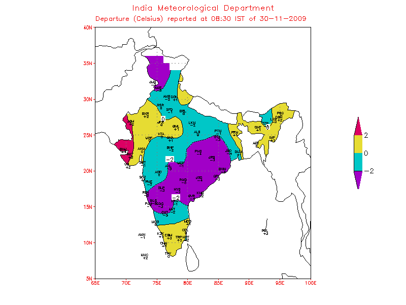
Because, surely the temperatures will rise in urban centres due to concretisation and congestion. We will notice temperatures are lower by 2/4c just a few kilometres outside our cities. Why, even in open spaces within the city, we will record temperatures lower than in a crowded area.

Hence, for the purpose of recording Global temperatures, still a vast majorities of the readings are from the major, and medium cities. Of-course there are rural readings as well, but vast rural patches, like farmlands and open regions go unrecorded, and they too are part of the earth.

Hence, modifying a bit, we could say we are in for "Urban Warming", to some extent, but definitely not "Rural Warming". And "Urban Warming" cannot create climate change !


Ok, lets observe the fact that is already upon us, rather than worry about the "islands" sinking in 2030 !

Water vapor is responsible for 95 percent of the greenhouse effect. CO2 contributes just 3.6 percent, with human activity responsible for only 3.2 percent of that. That is why some studies claim CO2 levels are largely irrelevant to global warming. Without the greenhouse effect to keep our world warm, the planet would have an average temperature of minus 18 degrees Celsius. Because we do have it, the temperature is a comfortable plus 15 degrees Celsius.

NASA Marshall Space Flight Center data shows 2008 ice nearly identical to 2002, 2005 and 2006.

One won't read it in the media. It doesn't suit the editors of most climate alarmist publications. But below is the picture that reveals the allegedly 'disappearing Arctic ice' defied countless theories growing last year by 30%. And the visual satellite proof had been put up in my blog article on GW Part II.

One of their biggest scaremongering predictions was that 'by the end of the century Bangladesh would be 'under the waves' .

New data shows that Bangladesh's landmass is increasing, contradicting forecasts that the nation will be under the waves by the end of the century, experts say.

Scientists from the Dhaka-based Center for Environment and Geographic Information Services (CEGIS) have studied 32 years of satellite images and say Bangladesh's landmass has increased by 20 square kilometres (eight square miles) annually.

I reproduce--"Maminul Haque Sarker, head of the department at the government-owned centre that looks at boundary changes, told AFP sediment which travelled down the big Himalayan rivers -- the Ganges and the Brahmaputra -- had caused the landmass to increase.

The rivers, which meet in the centre of Bangladesh, carry more than a billion tonnes of sediment every year and most of it comes to rest on the southern coastline of the country in the Bay of Bengal where new territory is forming, he said in an interview on Tuesday.

The United Nations Intergovernmental Panel on Climate Change (IPCC) has predicted that impoverished Bangladesh, criss-crossed by a network of more than 200 rivers, will lose 17 percent of its land by 2050 because of rising sea levels due to global warming".

Director of the US-based NASA Goddard Institute for Space Studies, professor James Hansen, paints an even grimmer picture, predicting the entire country could be under water by the end of the century.

Now the flip side:

Sarker said that while rising sea levels and river erosion were both claiming land in Bangladesh, many climate experts had failed to take into account new land being formed from the river sediment.

"Satellite images dating back to 1973 and old maps earlier than that show some 1,000 square kilometres of land have risen from the sea," Sarker said.

"A rise in sea level will offset this and slow the gains made by new territories, but there will still be an increase in land. We think that in the next 50 years we may get another 1,000 square kilometres of land."

We can go on and on with thi discussion. What with a record cold snap on both sides of the Atlantic !

More in the next part.

kapadias@gmail.com


Tuesday, December 22, 2009


Sub- Continent South of Himalayas still Warm

As we hear and read of severe cold waves and snow over Europe and the North-Eastern U.S. we see a larger part Central, Northern and Western regions of the Indian Sub-Continent yet to feel the real nip of Winter ( Barring the Northern regions states of the Himalayan region).


In the Northern most Hilly region, the presence of a W.D. (low-pressure system) and associated cloud cover have retained the temperatures below normal over Kashmir and H.P.
Kargil was -6c during the day and -14c as the minimum.


In the remainins areas south of the Himalayas,the days and nights are still high (IMD maps), and slightly above the normal marks , and the western coastal areas are almost in a heat wave !!


Here is the link to todays (22nd.) highs and lows in major cities of India (IMD).


Mumbai was unusually warm and uncomfortable (for this time ) with a high of 34c on 21st Dec.and the low at 23c.
The highest in Asia yesterday was 35c at Makkah.


I think for Mumbai, things might ease off a bit, with temperatures going below 30c in the day and 18c at night only after Friday.


This is totally attributed to the easterlies blowing along the west coast of India, and preventing the cooler Himalayan Hills Northerlies from creeping Southwards.


Also, the clear skies caused maximum temperatures to stay above normal over Gujarat, the west coast and parts of Maharashtra.


Minimum temperatures too were above normal over Gujarat, Madhya Pradesh, peninsular India and Rajasthan.


Latest satellite images continued to present clear skies over most parts of peninsular India, indicating an anti-cyclonic circulation with high pressure, thus ruling out any clouding.

kapadias@gmail.com

Sunday, December 20, 2009


Cold Snap in the Northern Hemisphere:


With a cold snap on both sides of the Atlantic, some very interesting lows have been recorded. Interesting and very low temperatures were seen today (Sunday, 20th.).

Lowest in the world: Verhojansk (Russia): -48c
Tosontsengel(Mongolia) : -39c

Lowest in N.America: Artic Village (Alaska) : -38c
Spence Bay : -38c

Lowest in Europe: Jungfraujoch : -29c
Moscow: -18c

Lowest in U.K. Topcliff (Yorkshire) : -13c

Lowest in India; Darbuk (Ladakh): -28c
 Leh -16c
 Keylong (H.P.) -11c

Map of the European lows today

.
Extreme snow depth in N.American Continent


.

Refer Mark's Blog for latest on the U.K.cold.
 
kapadias@gmail.com

Friday, December 18, 2009


Global Warming Discussion -III

All was smooth, no one was worried about sinking , or about the earth "giving way", until our "Green Bug" entered the scene. This creature who emerged, actually first struck around the 1970s. "Bugs" is the "know All" of climate, the expert on weather.

After devoting a decade in the 1970s to predicting that a new ice age was on the way, "Bugs", also known as "Greeny", discovered that they could scare a lot more people by claiming that the Earth was suddenly and dramatically warming instead.


It turned out to be a fabulous fund-raiser for one and all !

And what about the "Leaks" mentioned in my previous blog ?? Lets investigate and peep into some very interesting and "eye openeing write-ups, hitherto unpublished, BUT, hidden in the closets.


1. Canada Free Press:


"Obama’s White House has already trashed the leaked British emails as “irrelevant”. Nor are any enquiries likely to impact what Lord Monckton describes as the world’s “class politique”. Why? Because too many reputations, too many research grants, too much power-grubbing, is riding on the anthropogenic global warming horse. And there’s because there’s a deal of money to be made by it leading proponents, too. In early December, Paul Cheeser, special correspondent for the Heartland Institute, revealed that Michael Mann has received around $6 million for his various predictions, models and reconstructions.


"In short there are way too many vested interests to admit that the real science just does not prove their case. But then, as Climate-Gate reveals only too plainly, when it comes to unsound claims for AGW, we are often not dealing with real scientists pursuing empirical truth, nor, sadly, with men of high integrity".-- Unquote.


When you want to make a dramatic impact, computer model your predicitions. Who cares about facts, when so man people are gullible enough to buy into predictive fantasy?


2. From an article in "Human Events"- Quoting Ban-KIMoon, U.N. Chief.


“We have just four months. Four months to secure the future of our planet,” Ban pronounced to the Global Environment Forum -- We are facing “Droughts, floods, and other natural disasters” as well mass social unrest, violence and “incalculable” human suffering, warned Ban. All of which will result, Ban claimed, if the world fails to “seal a deal” on climate change in December.


" With that the UN General Secretary -- Greenpeace note -- jetted off to Norway to draw attention to the melting polar ice cap where, unfortunately, severe weather conditions led to a trip to the North Pole being put on ice. Non-plussed, Ban informed his Norwegian audience: “We may have a virtually ice-free Arctic in 30 years”. Ban did not seem to know that the Arctic sea-ice is half a million kilometres greater in extent than it was this time last year. And his hosts were clearly too polite to inform him that their ancestors were growing crops in Greenland over a millennia ago. Nor did Ban explain why he picked the Arctic rather than the world’s far larger greatly expanded ice mass of the Antarctic"--Unquote.


I am putting up Satelitte image of Artic Ice of 2 years enclosed to show this increase.


3. Climate Depot -By Marc Morano.


"More than 60 prominent German scientists have publicly declared their dissent from man-made global warming fears in an Open Letter to German Chancellor Angela Merkel. The more than 60 signers of the letter include several United Nations IPCC scientists.


"The scientists declared that global warming has become a “pseudo religion” and they noted that rising CO2 has “had no measurable effect” on temperatures. The German scientists, also wrote that the “UN IPCC has lost its scientific credibility.


The scientists, from many disciplines, including physicists, meteorology, chemistry, and geology, explain that “humans have had no measurable effect on global warming through CO2 emissions. Instead the temperature fluctuations have been within normal ranges and are due to natural cycles.”


“The IPCC had to have been aware of this fact, but completely ignored it during its studies of 160 years of temperature measurements and 150 years of determined CO2 levels. As a result the IPCC has lost its scientific credibility,” the scientists wrote.


“Indeed the atmosphere has not warmed since 1998 – more than 10 years, and the global temperature has even dropped significantly since 2003. Not one of the many extremely expensive climate models predicted this. According to the IPCC, it was supposed to have gotten steadily warmer, but just the opposite has occurred,” the scientists wrote.

“The belief of climate change, and that it is manmade, has become a pseudo-religion,” the scientists wrote. “The German media has sadly taken a leading position in refusing to publicize views that are critical of anthropogenic global warming,” they added.


“Do you not believe, Madam Chancellor, that science entails more than just confirming a hypothesis, but also involves testing to see if the opposite better explains reality? We strongly urge you to reconsider your position on this subject and to convene an impartial panel for the Potsdam Institute for Climate Impact Research, one that is free of ideology, and where controversial arguments can be openly debated. We the undersigned would very much like to offer support in this regard".---Unquote


This latest development comes on the heels of a series of inconvenient developments, making public opinion to turn against climate fear promotion.


4. UN IPCC chairman Rajenrda Pachauri speaking thus in his opening address:


"The recent incident of stealing the e-mails of scientists at the University of East Anglia shows that some would go to the extent of carrying out illegal acts, perhaps in an attempt to discredit the IPCC."


So, according to Mr Pachauri, let us not concern ourselves with the actual content of the emails and the 'thinking' behind them.


These reports ought to be an eye-opener for the wasted billions so far spent fighting a non-existent enemy.


One is left to wonder what the money will actually be for - given that sea level rises don't threaten anywhere, the world is already on a downward spiral in terms of temperatures and polar bears are not becoming extinct, and the Maldives are still above water. Could they be for low-energy lightbulbs ? perhaps !


But, again, I must ask a very serious question of our media. Why does it continue to print and discuss about current climate ‘warming’ when it is now widely acknowledged that there has been no ‘global warming’ for the last ten years, a cooling trend that many think may continue for at least another ten years? Why does the media not mention anything about the cooling ??

 How can you talk of the climate ‘warming’ when it is not there.


Its Getting Cooler ( But Don't Tell the Media).

kapadias@gmail.com

Wednesday, December 16, 2009


Canada Freezes

Edmonton, Canada, Froze ( don't know if that explains it) at an all time low of  -46.1c !!

Read more about it, with other lows in Canada, in Mark's Blog. He has given fantastic details and a superb report.

All at http://markvoganweather.blogspot.com/2009/12/50-below-zero-air-too-close-for-comfort.html

Tuesday, December 15, 2009

Global Warming--?? -II

When we talk about Global Warming or Heating, we actually mean a rise (or fall) in the temperature on the Earth. Now, how is this measured or calculated ? I am no expert, but I know roughly how this is done.


Computer Models do this stuff.


The goal of these climate models is to project how rising greenhouse-gas emissions affect the global temperature. The models are technological marvels. Using supercomputers, they divide the world into grids of roughly 4,000 cubic miles apiece.


It is complicated stuff. The models consist of a whole lot of complicated equations written to how players such as sunlight, clouds and rain influenced by powerful ocean currents and tiny specks of sea salt, alter the readings.


Added to the equations are such measurements as past temperatures, barometric pressure and sea salinity. Calculations about the influence of sunlight are fed in. Various projections of greenhouse-gas emissions are factored in. The computers then run the equations and make projections of global temperatures.


"The models are only as good as the information they are fed, and the success of the models depends on the accuracy of their assumptions.


The effects of clouds, for example, are unclear. Depending on their shape and altitude, clouds can either trap heat, warming the earth, or reflect it, cooling the planet, and greenhouse gases affect cloud formation -- and clouds in turn affect temperature".


Also, one big uncertainty is ocean temperature. Oceans trap huge amounts of heat, and the vastness of the oceans makes gathering temperature data costly and arduous.


Now, the flip side:


On a graph, the models' temperature projections ultimately point upward, signifying warming. But along the way, each line has dips -- temporary periods of cooling. The timing and depth of the drops differ from model to model.


Global climate models did not account for a drop in global temperatures since 2006, but climate scientists believe the lower temperatures are temporary.


Ok, a few years of cooling doesn't mean that people aren't heating up the planet over the long term. But the cooling wasn't predicted by all the computer models. That has led to one point of argument: The models are imperfect.


And humans controlling the Global Warming, as such ?? Its a no-no.


Its pathetic when they tell you to switch your light bulbs, turn down the themostat of your heating system by one degree, tell you to buy a “green” car, use “green” energy, windmills, solar energy, bio fuels.


What’s more serious, it claims they are going to control the temperature of the planet by 2 degree Fahrenheit!


The effort equals the emptying of the Pacific Ocean with a tea spoon.


It won’t influence our climate in any form whatsoever.

kapadias@gmail.com


Friday, December 11, 2009


"Cyclone Ward"


Another December cyclone from the Bay. Though not rare, it surely is the fag end of the North-East Monsoon season, for the South.


Thursdays depression over south-west Bay of Bengal has intensified into a cyclone, "Ward"., according to IMD. However, with a core pressure at 996 mb, JTWC still puts the prospects of a cyclone development at "good".


The upper level winds are conducive for further development with low vertical wind shear, and enhanced outflow, allowing the system to grow.


Satellite imagery shows sustained and deepening convection and organise around a consolidating low level circulation centre, though covered and obscured by high clouds.

The upper level environment is conducive for further development, though vertical wind shear is low.

Meanwhile, the western disturbance, mentioned in the previous blog, would affect western Himalayan region during the next 24 hours.


Now, this approaching W.D. could, in all probibilities, prevent the cyclone from crossing the coast of Eastern India. In fact the W.D., though feeble, might just make the system skirt the coast, maybe upto the A.P. coast, and then coild move north-eastwards. But we can still expect very heavy rains along the T.N. coast and coastal A.P.

Tuesday, December 08, 2009


"Global Warming"- Or whatever- Is it for Real ??

Recently, the U.N. climate conference in Copenhagen has commenced, when 192 nations will seek to reach a binding treaty to reduce emissions of carbon dioxide and other heat-trapping greenhouse gases worldwide.


Now, some doubt is cast, with the news that computer hackers have broken into a server at a well-respected climate change research center in Britain, consisting of more than a decade ofcorrespondence between leading British and U.S. scientists included in about 1,000 e-mails and 3,000 documents — stoking debate over whether some scientists have overstated the case for man-made climate change.


I quote a report from London- " In one leaked e-mail, the research center's director, Phil Jones, writes to colleagues about graphs showing climate statistics over the last millennium. He alludes to a technique used by a fellow scientist to "hide the decline" in recent global temperatures. Some evidence appears to show a halt in a rise of global temperatures from about 1960, but is contradicted by other evidence which appears to show a rise in temperatures is continuing.


Jones wrote that, in compiling new data, he had "just completed Mike's Nature trick of adding in the real temps to each series for the last 20 years (i.e., from 1981 onwards) and from 1961 for Keith's to hide the decline," according to a leaked e-mail, which the author confirmed was genuine."


Some climate change skeptics and bloggers claim the information shows scientists have overstated the case for global warming, and allege the documents contain proof that some researchers have attempted to manipulate data.


In the first place, the word refered should be carbon dioxide (CO2), not carbon, plus it is  inaccurate to claim that carbon is a pollutant. "A scheme that appears to be deliberately misnamed, just to confuse the public," Prof Carter said.


Prof Carter, who is an experienced geologist and environmental scientist from James Cook University in Queensland, said the reduction in global temperature would only amount to one thousandth of one degree Celsius by the year 2100, a "pretty poor return on the $270,000 these families will have paid by then".


The World, in its Copenhagen Meet, is now concentrating on a Carbon Pollution Reduction Scheme (CPRS). If it goes ahead as planned, a carbon price of $30/t will produce a direct cost of $3000 every year for a family of four, as per Professor Bob Carter, at Bunbury forum.


In fact, during the current period of increasing atmospheric CO2, the Green Revolution saw a massive increase in global food production, with somewhere between 5pc and 15pc of the increase being caused by higher CO2 levels. Although major El Nino events cause heat spikes, with one in 1998 causing global temperatures to rise by 0.2c, there has been no net change in global temperatures in the last 50 years, during a period when atmospheric CO2 increased by 20pc.


And why worry about rising sea levels? It is something natural. Around 20,000 years ago it was 8-10c colder than now, sea levels were 70m lower. It was possible to walk from Australia and through to Tasmania.


Doubling the CO2 in the atmosphere would increase wheat yields by 60 per cent, increase legume yields by 62pc and increase the yields of other cereals by 70pc. Some pollutant! ??


One cannot blame today's daily changes and extremes of weather on "Global Warming", of call it "GW." Climate is what you expect, but weather is what you get.


In fact, the earth has been cooling since 1998, with CO2 concentrations increasing by 5pc during the same time


Why Copenhagen will achieve nothing:
Guys, it’s like getting offered 10% of the stock in a fake business.

10% of nothing is still nothing.


You cannot solve a problem that does not exist.


You can, however, become a victim by accepting the transaction at face value.


By questioning current beliefs on global warming, I may be against the stream, But I do not feel any guilt of " popular incorrectness."


to be continued....

kapadias@gmail.com

Monday, December 07, 2009

No Winter for the plains of India yet.

Winter is yet to cast its grip over the sub continent plains this year . With nights actually near the normal, or even the above normal mark, the required normal coolness is yet to appear in almost all the regions south of the Himalayas. IMD's anomoly map shows the entire region in "normal" colours, with the central regions going upto 4c above normal. In fact, most of the northern plains are in the 10-15c range. (map).

                                                             
The lowest in the plains is 5c, at Amritsar.

In H.P. the lowest was -9c at Keylong. Srinagar was -2c today, and with recent temperatures in Leh at -13c, the Himalayan regions are having their normal share of biting frigid cold.

Now, this "above normal" trend has been persisting since last week. This variation map (below)  of the prevoius week shows it all.


However, the arrival of a W.D. will reverse the situation. A system, expected by the 11th, will bring precipitation to the entire region, and at least help the rain starved areas of Punjab, Rajasthan and U.P. On its moving away eastwards, temperatures are expected to drop substantially in the northern plains, bringing in the real feel of winter.

The W.D, now building up near the Caspian Sea, is expected to "double up" and en-route bring rains to Dubai on Wednessday.

A short note of my views on "climate change" will be blogged on Wednessday.

kapadias@gmail.com


Monday, November 30, 2009


This blog will now have the privilege of being directly available to U.K. weather enthusiasts, thanks to Mark Vogan from Scotland, expert in meteorology. With this "collaboration", we can interact better and share weather events from both sides. "Vagaries of the Weather" will also put up a direct link to Vogan's blog.


For European readers, the weather pattern in the Indian Sub-continent has basically 3 seasons: Winter, Summer and the Monsoon rainy season. Officially, the Monsoon season ends on 30th September, when Winter commences. The entire Indian region can be roughly divided into 3 zones, northern, central and southern. Winter season starts from the northernmost regions.

Summer starts in the Indian region from March, the heat shifting gradually northwards.

However, the northern and southern regions are the 2 areas which get winter rains. Both from completely different systems. We will discuss these as and when systems develop.


South:

IMD states that weak north-east monsoon conditions are likely to continue over south peninsular India during the next 36 hours

However, some international models predict the formation of a low-pressure area over southeast Bay of Bengal with a westward movement.

NGP/GFS model also predict upper air circulations showed near the southwest Bay and the system moving southwards, even below Sri Lanka.

Subsequently, a slight increase in rainfall activity thereafter, could be the commencement of a wet regime over the southern peninsula during the first week of December according to forecasts by NCEP.

With COLA showing an increament of rains along the Tamil NAdu coast from the week begining 7th. December, the southern peninsular surely is in for some revival of monsoon rains soon! I see, some heavy rain along the T.N. coast mainly on Tuesday.

North:

For the northern sub-continent, its been dry (due to no Western disturbances at present), and cooling down to some extent. The lowest of the temperatures in India, naturally has been in the extreme northern district of Ladakh, with Darbuk at -21c. In the northern state of Himachal Pradesh, the lowest was -5c recorded at Keylong. (Far better than -12c, a few days ago).

But overall, in the central and rest of the regions, the lows are almost near the normal levels.(IMD map).


A map of the day's highs show the clear demarkation of temperatures in the nort, Central and southern regions.


Mumbai: Clear weather throughout the week. Days will remain around the 31/32c mark, and the low, during the week,will move towards the 18-20c range from the current 21c.


kapadias@gmail.com

Friday, November 27, 2009


Heavy November Rains in U.K.

Though a bit late, putting up this information about the record rains in Scotland is a must.


The wettest November day on record in the U.K. has caused flooding problems across the south west of Scotland.


Heavy rain affected many parts of north-west Britain during 18, 19 and 20 November 2009, and led to widespread flooding.


The rain was particularly heavy and "monsoonish" (says Mark Vogan) in the mountainous terrain of Cumbria and southwest Scotland resulting in record rainfall totals.


In Cumbria, 372.4 mm of rain fell at Seathwaite and 361.4 mm of rain at Honister between 0800 on Wednesday 18 November and 0400 on Friday 20 November. This includes the 24-hour total at Seathwaite (ending 0045 on Friday 20 November) of 314.4 mm, which is a UK record for a single location in any given 24-hour period


Parts of Scotland were also badly affected, and flooding was also reported in Dumfries and Galloway in Scotland, where 30 roads closed in "treacherous" conditions.


"It's desperate. The town centre is completely flooded, the only people out there at the moment are the emergency services. The water is up to the waists of the firefighters." - A resident owner of a hotel.


About 1,200 homes in the Cockermouth area and 349 around Keswick lost power on Thursday night.


Further, there is excellent information in detail about this topic and rain records, and generally very good details of U.K. weather on Mark Vogan's blog.

kapadias@gmail.com

Monday, November 23, 2009

Pictorial Blog :


Today's Weather , 23rd. Nov.
Minimum Temperature Departure from normal
Maximum Temperature Today:
Today's Pressure Map:


Last week's Temperature Anolomy:

Last Week's Rainfall:
MJO Prediction:


Blue shows negative OLR anolomies, hence enhanced convection. Yellow shows positive and supressed convection.


Friday, November 20, 2009

North-East Monsoon Review:

About a month of the actual the northeast monsoon has generated excess rainfall in most of the southern peninsular states during the season so far . The best reciepient is North Interior Karnataka, with an excess upto +89%, and coastal Karnataka with a surplus of +72%. TamilNadu showed a surplus of +15%, though there are some regions in the north still deficient. (Map). So, with Kerala at +8%, it is overall a good season for the south as yet. Of-course with the Nilgiris getting much in excess of damaging rains.

The season has been normal or above normal over the southern peninsula.

But the central regions of Mah. and M.P. and more than their share of this "unseasonal" rain. Map shows all this region in excess.

Now, as per international forecasts, more rains are coming to the Tamil Nadu coast during November 19 to 26.

The south bay will host weather systems like lows/easterly waves for the southern peninsula during this time frame.

Hence Tamil Nadu coastal regions could expect heavy rains from the 21st.

Also, COLA sees some rain along the western coast (Karnataka coast) from 23rd. Some of this rain belt is seen creeping into southern Maharashtra on the 24th. November. Hence, we can expect some light rain in southern Maharashtra. Lets say Pune can recieve cloudy weather/light rain on 24th.

Mumbai: Weekend will be dry. No surprise after enough rains. In November, Mumbai Colaba has recieved 120mms (Record 164mms), and S,cruz has got 78 mms (Record 101 mms). With some reduction in humidity, one may feel a bit comfortable, though I expect the days to be high at 33c. Night will be pleasant at 22c.

Pune too was not too far from its record November rains. The city recieved 176 mms this month against the record of 209 mms. A drop in the night temperature is expected for Pune, low could nippy at 12/13c for the weekend. But increasing cloudiness after Monday will arrest the nip.

Wednesday, November 18, 2009

Two Very Interesting Weather Related Stories: (Reproduced from Earthweek).

Unusually early and heavy snowfall over Beijing attributed to China’s ongoing weather modification projects has caused Beijing residents to question whether it’s right to mess with mother nature.

The earliest snowfall to blanket Beijing in 22 years fell on November 1. It was followed 10 days later by another period of frozen precipitation, accompanied by freak thunder and lightning.

Artificial methods have been used for several years to mitigate drought effects across North China. They were also recently used to prevent rainfall during the 60th anniversary celebrations of the Communist revolution.

But such heavy and frequent snow so early in winter has snarled traffic and forced the capital's international airport to halt operations. The resulting inconvenience has triggered complaints from the public, according to the newspaper.

Xiao Gang, a professor in the Institute of Atmospheric Physics at the Chinese Academy of Sciences, told the paper: "We should not depend too much on artificial measures to get rain or snow, because there are too many uncertainties up in the sky."


Arctic Winter Refreeze Was Near October Record Low

Warm Siberian winds caused October 2009 to have the second-lowest ice extent for the month over the 1979 to 2009 period. Warm southerly winds during October warmed the Arctic so much that they prevented sea ice from reforming at a rate typical of the previous 30 years.

The U.S. National Snow and Ice Data Center reports that October had the second-lowest ice extent for the month over the period from 1979 to 2009.

The formation of polar ice normally accelerates during that month as the sun sinks lower in the southern sky each day and the day-long nights of winter return above the Arctic Circle.

But the growth rate slowed for a while early in the month as strong winds from the south blew over central Siberia, preventing the ice from forming along the coast there.

By month’s end, expansive areas of open water regions still existed in the northernmost North Atlantic and north of Alaska.

Monday, November 16, 2009

Arabian Sea active again ?

The low pressure area over Commorin area and neighbourhood now lies over Commorin-Lakshadweep area.
A trough in mid & upper tropospheric westerlies now runs roughly along Long. 72° E to the north of Lat. 20° N.
On Sunday, a vortex formation was observed in the south Konkan region ,and another in the Goa/Coastal Karnataka region. Both inland. (IMD Map)

As a result of the above, we have reports of heavy rainfall in the extreme south peninsular and all along the west coast. Some heavy, and unusual rain figures for the 24 hrs. ended 15th. are :Gingee (Villupuram dt) 18, Orathanadu (Thanjavur dt) and Kanyakumari 17 each (10.6 again on Monday), Adirampattinam 10.8, Thiruvanthapuram 10.4, Thanjavur 9.9, Kottayam 8.6,Panjim (Goa) 5.0, Kaveli 4.9, Cannur 4.3, Agumbe & Mumbai (Colaba) 3.9 each.
Also, some more complicated interactions like this upper air tropospheric trough interactiing with the induced low of the W.D. and bringing in moisture from the Arabian Sea has brought rain along the west coast and into Maharashtra in the last 2 days.
The prevailing systems will move away north-eastwards, and bring clearer and colder weather to the north-west and north by Monday, thereafter bringing low temperatures.
Mumbai( Colaba) got very heavy thundershowers in the early hours of Sunday, and recorded 39 mms in a 2 hour rain period. Pune got a heavy thunderstorm on Sunday afternoon with 37 mms and Mahableshwar recieved 60 mms on Sunday
Now, what about this new low ? International models predict the low could either move up to the Karnataka coast, or westward from Lakshadweep away from India’s coast. 2 obvious directions !!
One more day of cloudy and light rain conditions for Mumbai on Monday. Rainy conditions will clear from Tuesday onwards. ( for the time being??).

An easterly wave seems to be on stream to renew the rain periods for the south from 18th. resulting in very to heavy rains over Sri Lanka, southeast Tamil Nadu and south Kerala. ECMWF too predicts an easterly wave with another ‘low’ just east of Sri Lanka by 20th.


Thursday, November 12, 2009

Cold days in Central India

Phyan continued moving northward to north-northeastward over land and should now fizzle out within the next 12 due to further land interaction and strong vertical wind shear.

Vertical wind shear, is the sudden increase in wind speeds with height. This blows off the topmost region clouds of the storm head and kills the system.And also interaction with land cuts off the moisture needed to feed the cyclonic system.

Now, this has spread residual moisture that Cyclone Phyan has spread out over mainland, resulting in light rains and very cold days in central India and Rajasthan. Places were upto 14c below normal today.
Remaining moisture may create rain bearing clouds in the regions of interior Maharashtra, M.P. and west U.P. in the next 2 days. And precipitate some rain as well.

For the weekend:
North: Dry and day and nights getting colder. Nights 2/3 c below normal.
Central/West: Sparse rain and cloudy. Rain in pockets.
South: Spresd out rain in almost all the regions of the south. But not extreme heavy.
Mumbai: Weekend, partly cloudy. Coolish temperatures. Some rain on weekend, maybe towards Sunday.

Wednesday, November 11, 2009

Cyclone "Phyan"
Having moved at "super speed", much faster than a normal cyclone would, it has crossed the coast south of Mumbai, and now, at 5p.m. is at 19N and 73E. Core pressure is 989 mb and winds at 40 knts. That is East of Mumbai. The rainfall concentration is now to the East of Mumbai.

Mumbai: Rather than a hindrance, the rains were welcome in Mumbai, and surely to the lakes supplying water. A few heavy showers could still be expected in evening, tapering off late in the night. Rains to some extent, maybe light, till tomorrow afternoon at the most.

Heavy rains in the Nilgiris:

Ketti, in the Nilgiris, near Ooty, had an unusually heavy rainfall of 82 cms in the 24 hrs. ended Tuesday morning. Coonoor had a super 35 cms for 2 consecutive days on Monday and Tuesday, while Ooty recorded 18 cms. And a low temperature of 5c ! Kodaikanal recieved 15 cms also on 2 consecutive days from Monday. Wow ! No wonder the massive landslides there !


Cyclone "Phyan" update:
Latest position of "PHYAN" as on noon ,
Max wind speed at 55kts, core presuure at 982mb, and position at -172N-731E.
Could cross the coast south of Mumbai this afternoon, and start weakening.
CYCLONE "PHYAN"

TROPICAL CYCLONE (TC) 04A, "PHYAN" IS NOW LOCATED APPROXIMATELY 150 NM SOUTH OF
MUMBAI, INDIA, AND HAS TRACKED NORTHEASTWARD OVER
THE PAST SIX HOURS. THE FORECAST FOR CYCLONE CROSSING THE COAST HAS SHIFTED TO THE SOUTH, RESULTANT OF
RECENT NORTHEASTWARD MOVEMENT.

THE SYSTEM HAS WINDS HAVE INTENSIFIED TO 50 KNOTS, AND WITH CORE PRESSURE OF 985mb,"EYE" FORMATION IS BECOMING IMMINENT.
OVERALL FORECAST INDICATES FOR LANDFALL NEAR MUMBAI, AROUND 100KMS NORTH/SOUTH, AROUND AFTERNOON TODAY, THEN MOVING
NORTH-NORTHEASTWARD AND FURTHER INLAND.

MUMBAI IS GETTING MODERATE RAIN SINCE YESTERDAY. WITH THE DAY PROGRESSING ON WEDNESSDAY, THE RAINFALL WILL INCREASE, AND STORMY WAVES EXPECTED ON THE COASTLINE WEDNESSDAY EVENING. HEAVY RAINFALL OVER 100mms EXPECTED IN MUMBAI.

PUNE/NASIK ARE EXPECTED TO GET HEAVY RAINS ON WEDNESSDAY, AND REGIONS OF MADHYA MAHARASHTRA WILL RECIEVE VERY HEAVY RAINS.

COASTAL MAHARASHTRA AND SOUTH GUJARAT COAST WILL BEAR THE MAIN BRUNT ON WEDNESSDAY/THURSDAY.

next posting "soon"
kapadias@gmail.com

Tuesday, November 10, 2009

Cyclone 04A.
The US Joint Typhoon Warning Centre (JTWC) has upgraded the Arabian Sea weather system to a cyclone, 04A, onTuesday, with estimated wind speeds ranging upto 35 knots and 45 Knots in gusts.
At 70.9E and 14.1N, it is approximately 340 NM southwest of Mumbai. Expected track, north/north-east.
Posted on Tuesday @ 12 noon.
kapadias@gmail.com


Monday, November 09, 2009

Unseasonal Rains have commenced in Maharashtra.

Nasik district bore the brunt of a hailstorm on Monday, and several regions of Aurangabad, Kolhapur and solapur, and Marathwada have had rains.

The system in the Arabian Sea is now of depression dimesion.

However, some international models differ, and forecast the depression may move north along the west coast to take a westward turn off the north Konkan coast into the sea.

Some international forecast models indicate the Arabian Sea weather system may track north-northwest, presumably due to a western disturbance, now moving across Northern India, and its secondary low possibly dipping low into the Arabian Sea in a day or two.

The IMD outlook is in agreement with most international models This depression, is expected to cross in Gujarat during the next two days, the IMD said.

While COLA is of the view that the system may cross the Konkan coast and precipitate rain inland into Maharashtra and southern M.P..

In short, we have a depression moving up the west coast of india from the 9th. and precipitating rain along the Kerala/ Karnatakacoast on the 9th./10th., thence along Goa and south Konkan, and interior Maharashtra on the 10th/11th. and North Konkan will have moderate rains, with some heavy falls on the 10th/11th.

I personally feel the depression will fizzle out in the sea itself by the 12th. After some unseasoanal rains along its path as mentioned above. Let's watch its movement from day to day and see the changes.

Mumbai: Same forecast as per last blog holds good.
Stuffy weather with light showers on Tuesday, and some showers, with winds on Wednessday.Winds will change direction from easterlies to southerlies to westerlies, as per the depresiion movement. Maybe some thunder in the night. Day temperatures will be around 31c. Cloudiness decreasing from Thursday evening, as the depresion moves away from Mumbai.

Friday, November 06, 2009

Unseasonal Rains in Maharashtra?

The IMD confirms on Thursday that a cyclonic circulation has formed over the Comorin area. A trough from this system runs thru extreme south peninsula.

The latest from several models show that the low off Lanka coast would move north up the Indian coastline, and itensify a bit on November 8 and 9, and then merging into cooler waters off coastal Karnataka and getting stuck before weakening.

The system then may curve over land into Maharashtra around November 10th.COLA/ NCEP predict along similar lines.

As a result, Mumbai forecast for rain on Monday/Tuesday/Wednessday holds good. Rainfall upto 25mms could be expected on these 3 days in Mumbai.

But a little more is in store for the rest of Maharashtra. The interiors of the state can expect rains from Tuesday, and some places in Pune/Solapur and the other districts of madhya maharastra can get 40-50 mms in these 3 days.

Under the influence of the existing low, another low pressure is likely to form with a trough extending to southwest Bay of Bengal in the next two days.

Most international models predict good more rains over the peninsula over the next week, with likelyhood of continuing precipitation over south peninsular right until November 20.

Thursday, November 05, 2009

Low in South Arabian Sea

Streamline map from IMD today indicates the initial formation of a low in the south Arabian Sea.

Now, many models show this moving northwards into the Arabian Sea, but, stopping short at 15N, off Goa. Finally, as I mentioned, it may fizzle out due to the passing of an upper air W.D. in the northern plains of the sub-continent.
The CMC and ECMWF both models confirm the system upto off the Goa coast around the 9th.
Moderate rains are likely in all the regions of the southern peninsula due to the "pull" from the north-east by the system. Heavy rains can start in kerala on the weekend.
Approaching W.D. can precipitate rains in the northern plains and snow in the hills on the weekend. Hence initial increase in night temperatures, but to fall next week

Mumbai: Skies getting partly cloudy from Saturday. Rise in night temperatures from the present 23c to 25c. As of now, light rain may be possible on Monday.

Tuesday, November 03, 2009

Approaching W.D. may counter Arabian Sea system:

The trough of lower pressure running from the Arabian Sea thru peninsula into the southwest Bay has shifted into the Comorin area on Monday. ( Thai Map enclosed)
The FNMOC has also kept under watch thedevelopment in the southeast Arabian Sea around the Comorin area. At present, it is short of being officially being a low-pressure area. Its present wind speed is 15Knots/hr.

It is shown as 92B in the NRL site and this is forecasted to become a ‘low’ by the ECMWF, which will move northwards along the west coast of India, and, as per international forecasts, it will fizzle out somewhere around 15N, due to non support from the sea water temperatures.
I feel it may intensify a bit, creating cloudiness in the Arabian Sea, and, after the 4th. of November, bring some unseasonal rains along the coasts of Kerala, Karnataka and Goa. Rains along these regions may last a couple of days.
But I would wait and watch to forecast precipitation alomg the Konkan regions. Because, by this time, an active W.D. coming along would dominate this southerly system, and not allow it to "grow" further.
Also, another system within the same trough in the bay, would be required to share the available moisture along the trough line.
The north-east monsoon will till then continue to remain "feeble" and in a "low gear", in the T.N. and interior Karnataka areas.


An approaching W.D. is now keeping the temperatures high in the northern regions of the sub-continent.
Days in the western regions were very hot on Monday, with Chorr (Pakistan) at 38c, and Rajkot and Veraval also at 38c. Mumbai was at 36.6c ! ( IMD map shows the heat clearly).
With the W.D. we can expect a reasonably good drop in the temperatures,starting from the nortwestern areas, and more effectively in the night temperatures from this weekend. Also, rains could be expected in the plains of northern India and lower and middle hills from 4th. for a couple of days. And ofcourse snow in the upper hills.


Forecasted East rough  Let's look into the 3rd week of March ( 17th - 21st). Mumbai : Hot weather likely for Mumbai region this week, ty...