Wednesday, September 29, 2010


A low pressure, 92A, has formed over the southeast Arabian Sea, and on Wednesday night was at 12.3N and 68.3E, and core pressure at 1006mb.Winds are at 15kts.
Not much to read into as yet.
Most forecasts show 92A deepening to some extent, and IMD estimates it to become well marked. A deep shear tendency should help the low to become well marked, or maybe a depression.
Again, all forecasting models see the system moving west/northwest, away from the indian coast towards south Oman coastline.This is due to the anchored anticyclone north of Gujarat.
JTWC and Hurricane Zone have not put up any note of this system, not till the time of writing this blog.

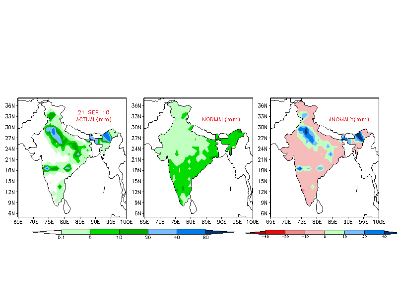
Meanwhile, as mentioned above, the anticyclone is now well engraved in the northern regions of India, and vagaries continues its widhrawal flow.
he map above shows increasingly drying up conditions over these areas dominated by the anti-cyclone circulation expanding to larger areas.

Monsoon has widhrawn from U.P./Bihar/Jharkhand/east M.P.and all of Gujarat except south Gujarat.The 200 hpa winds (above) roughly indicate the monsoon free regions indicated by vagaries.

The next 5-days forecast (above) outlooks indicate the humidity and moisture content in the atmosphere would drop in the regions of cenral India, Mah, Gujarat and shifting towards the east.
Likely now of further southward travel of the retreating monsoon. Another 2/3 days and it will be out from M.P./north Mah, including north Konkan and Mumbai and south Gujarat and Saurashtra (vagaries estimate).


And, ECMWF has estimated a low-pressure to form in the Bay off Tamil Nadu coast by October 6. Maybe, NEM advancing ???
It is expected to to cross T.N. coast near Chennai and adjoining South Coastal A. P. by the 7th./8th. Oct.

Tuesday, September 28, 2010


NASA images courtesy MODIS Rapid Response Team at NASA GSFC.


A comparitive image of 2010 with 2009. Shows the extent of flooding and swollen rivers of North India.
"The most obvious difference between 2009 and 2010 is the swollen Ganges River, which runs diagonally through the scene, past the city of Kanpur. In the image from 2009, this river is barely visible. East of Lucknow, the Ghaghara is also swollen. West-southwest of Kanpur, standing water has apparently accumulated on what was dry land a year earlier".

Sunday, September 26, 2010


With the anticyclone now well anchored over North-West India, the SWM is widhrawn from the region.

Northwesterly winds towards the north Rajasthan and are also prevailing over most parts of north India. This is indicative of sunny and drier days as moisture is wiped out by the arid northwesterly winds in the region

Vagaries would specify Gujarat (except South Gujarat),Rajasthan, Punjab, Haryana,J&K, H.P.and North M.P. as Monsoon free from today, 26th September.
Would expect the widhrawal to cover Utteranchal, west U.P, M.P. and Chattisgarh in the next 2/3 days.

Interior Mah has been receving thundershowers in the last 2 days. Pune and Aurangabad have been big beneficiaries . Today, Sunday, Pune got a decent thunderstorm in the afternoon.Thunder cells rolled over Mumbai on Sunday evening, with just some drizzles in some areas.
The forecasted vortex formation for this weekend is seen with heavy rainfall in South Konkan and Goa.
South Gujarat, Mah. and Karnataka would see some thundershowers in this week.

Friday, September 24, 2010


Look out: Record Breaking La Niña Occurring?

Direct Report from The Hockey Schtick:
From a discussion board at NOAA comes this graph showing the developing La Niña of 2010 might be a record breaker. La Niña causes multiple global climate disruptions including a drop in global temperatures and extreme weather events around the globe, which no doubt will still be conveniently blamed on mankind's evil ways. The last 2 times of record-contending La Ninas in 1954 and 1973 were during the global cooling scare.* (see vagaries' note below)

The most recent (July-August) MEI value shows a continued drop from earlier this year, reaching -1.81, and 2.35 standard deviations below April-May, both record-fast drops for this time of year. In fact, the three-month drop set a new all-time record for any time of year, beating a drop in 1998.

ZERO HEDGE reports:
The most recent MEI rank (2nd lowest) is clearly below the 10%-tile threshold for strong La Nina MEI rankings for this season. One has to go back to 1955 to find stronger La Nina conditions for this time of year in the MEI record, and back to September-October 1975 for lower MEI values at any time of year.
Conclusion:
We have one heck of big La Nina that has formed very quickly. We have not seen conditions like this in 55 years.

What does it mean for the Asian Weather:
La Nina brings warm water to the western Pacific. This will result in big storm after big storm hitting into China/Indonesia. So far there have been 11 typhoons to hit Asia this season. The most recent is Fanapi. It is about to make a mess of southern Taiwan. From there it is off to China. This powerful La Nina will continue for at least four more months. It is likely that it will end as quickly as it appeared. That transition will bring us violent storms. These in turn can send a whole lot of pulses, read systems, into the Bay, and result in strenghtening the NEM.
And the rest of the World:Look out for an extra cold winter and some cold water splashed on the claim "2010 is the hottest year ever."

Why is this La Nina cycle so strong? I have no clue. Nor do the people who study global weather. The strength of this ENSO cycle is no doubt related to that phenomenon.

*And a Final word on the so called "Global Warming"
(For new readers, vagaries has always been against the concept of so called "Global Warming". See archives of vagaries for a series of blogs in 4 parts explaining the facts against it).

Presto! Past global cooling 'adjusted' away! Deja Vu '72?: Dr. Hubert Lamb stated in 1972 that the global temp trend 'had been slowly dipping for the past 20
years'
'But a plot today of the 'same' HADCRU data shows an increasing trend from 1952-1972
'

Thursday, September 23, 2010

An overactive upper air circulation persisting over Northern regions over the last 4 days, has drenched the region and caused havoc and floods/avalanches in the hills.

As anticipated, now, the incoming anticyclone from the west is pushing into India, and will dominate the entire North/Northwest India by Saturday, 25th. September, pushing the monsoon away, which has overstayed its welcome by now.
Vagaries to announce monsoon widhrawal from these regions by Saturday.

Across the Western border in Pakistan, the days are getting hot, with Nawabshah(Sindh) on Wednesday at 42c.

Peninsular India would continue to receive end of season thunder showers in scattered patches during the weekend and into early next week (27th/28th.). Some concentration of heavier rains along the south T.N coast.

Forecasting models centre the rains around South Konkan/Goa on Sat/Sun due to a vortex formation off the coast. Some heavy thundershowers may move into south interior Mah and North Karnataka at the weekend.

Tuesday, September 21, 2010

The flood situation in north-west India is expected to ease in the next one/two days, before it finally starts getting better. The UAC, which was expected to fizzle out on Monday, has moved and is today located west of Delhi region is expected to move in a north-easterly direction, and weaken rapidly. The dates to watch out for in the Utteranchal/West U.P. region are between September 22 and 23, when rainfall will be heavy in that area. Delhi, Haryana, east Rajasthan, north Madhya Pradesh, west Uttar Pradesh can expect heavy to moderate spells during that time.

Two of the returning Kailash Mansarovar Yatra batches have been stranded and pilgrims had to face difficulties as heavy rains on the route blocked the way from both sides, Kumaon Mandal Vikas Nigam (KMVN) sources said."The batch had to stay at Chausaly village for two days as the motor road towards Haldwani as well as towards Almora got blocked,” said DK Sharma, Manager (Tourism), KMVN

Meanwhile, in H.P, rain continued to lash various parts of the state. Poanta received 74 mm, Renuka 70 mm, Nahan 50.2, Jubbal 46mm, Rohru 40 mm, Solan 37 mm and Manali 27 mm. The rain also led to a dip in the temperatures with Shimla recording 11.8°C, Kalpa 6.2°C and Keylong 6.6°C.

In Haryana, at least half a dozen villages were cut off as fresh floods washed away stretches of roads and inundated large tracts of cultivated land in a dozen villages.
Nabiabad, Sayeed Chapra, Japti Chapra, Nagli and Chandrao were cut off and the district administration had to provide boats to ferry the villagers to safety. Khukni near Chandrao had been marooned. Bhiwani, Haryana received the heaviest fall of 90 mms as on Tuesday.


Delhi falling in middle of all this action was in the midst of inclement weather. The maximum temperature as on Sunday was pleasant at 23.3c (10c below normal). To the delight of Delhiites, it was only 0.2c warmer than the minimum recorded at 23.1. But the coolest in the Capital was at the University recording station, with the day's high at 21.3c ! Dehra Dun was at a day's maximum of 20.4c (10c below normal) on Sunday.

The (good) news is that post-September
25, the monsoon seems to be withdrawing resulting in a drastic reduction of rainfall across India and northern India in particular.The forecasted COLA 850 hpa map shows the strong anticyclone (harbinger of post monsoon conditions) pushing the weakened UAC away to the east.
The water levels in north India’s rivers should start receding from then onwards. According the Japanese Meteorological Agency (JMA), rainfall will also reduce in the two weeks after September 25.

Vagaries could safely consider the monsoon widhrawal to commence from all Rajasthan, Delhi, Punjab and Utteranchal regions from the 24th.Will be confirmed on 24th.September.

Later this week, Rajasthan and Gujarat may witness a rise in day temperatures .
In the West, on Monday,Turbat and Nawabshah in Pakistan have climbed to 41c and 40c respectively. The highest in Asia though was Makkah at 44c.

It may still be a week, after the monsoon widhraws, before we see a fall in night temperatures in Rajasthan, Punjab and Haryana.


Sunday, September 19, 2010


Snowfall in Garhwal Himalayas nearly a month ahead of schedule

Nearly a month ahead of schedule, the higher reaches of Garhwal Himalayas today received snowfall, sending the mercury plummeting in Chamoli and Rudraprayag districts.

The hills around Badrinath and Kedarnath temples have received snowfall while lower areas received rainfall forcing the people to take out their woollens.

Usually, the Garhwal Himalayas experience snowfall during October.
Source:link


As anticipated in Vagaries, the first low (last week's), struck at Utteranchal exactly on Friday/Saturday, raining its might in the state ! With the system merging into the monsoon axis, moisture laden east/west winds became active, or rather overactive,in the region !

In Utteranchal, the rainfall amounts for Friday were: Phoolbagh 116 mms, Mukteswar 102 mms, Bareilly 52 mms, Dehra Dun & Tehri 45 mms each,
and for Saturday, the rainfall figures were very heavy at: Mukteswar 236 mms, Dehra Dun 149 mms, Rani khet and Nainital 120 mms each, mussoorie 90 mms, Tehri 85 mms, Kalpa 74 mms, Poanta Sahib 52 mms. (adjoining H.P.)

For Dehra Dun, the total rain from 1st. June till date is now 2967 mms, i.e. 1087 mms above the normal ! From 1st. Jan it has ra
ined 3080 mms, against an annual normal of 2260 mms !
And rainfall in adjoining West U.P:
Najibabad(Tehsil) 160 mms, Moradabad 120 mms,Deoband 110 mms,Orai 110 mms.

Resultantly, after 2 days of torrential downpours, Widespread reports of landslides and consequent roadblocks hav
e come in, along with reports of extremely heavy rainfall in the state.
According to one report from a local source, one "complete hillside has been washed away" near Naini Tal.

And, as per the tracking of the current low in Vagaries in the last blog, the system has moved into M.P, and heavy rains have lashed Northern M.P, with figures for Saturday's rainfall at: Gwalior 68 mms, Datia 57 mms, Khajurao 55 mms, Raipur 54 mms, Damoh 45 mms, Pendra 40 mms, Jabalpur & Umaria 39 mms each.

Earlier, while moving across the states of M.P. and Chattisgarh, the rains were copious, and good amounts of precipitation was measured on Friday.
Friday's rain in the region: Durg & Raipur 86 mms each,Sironcha 54 mms, Ahiri 45 mms, Jagdalpur 39 mms, Jabalpur 33 mms, Gwalior 30 mms.
The rainfall activity is concentrated in the regions as per the IMD map of 19th.

It is expected now, the system will fizzle out around the M.P./East Gujarat region, by Monday. This hastening up of its demise is due to stiff resistance in the west from the stabilising anti-cyclone , forming over Pakistan /west Rajasthan.


.

As per the current synoptic charts, the 200 hpa jet streams are establishing themselves in the 20N-25N regions, and with strong anti-cyclone situations on the pressure chart, the humidity levels are dropping in the Western Rajasthan and adjoining regions.

Hence, it could be concluded, that the Monsoon has further widhrawn from Central Rajasthan (except the eastern parts of the state), Kutch and entire Pakistan.

Friday, September 17, 2010


The MSL low in the bay off the Orissa coast now lies along the Orissa coast, and may have crossed inland today.
I mention "may" as the COLA/GFS map of Friday evening shows the low partly inland...But still at 1000 mb.

The clouding assiciated with the low is thick in the North A.P. region (as on Friday evening), so very likely the low is inland.
But the "feeding" to the low seems good, as seen from the cloud formations in the South quadrant.

I Estimate the low to move west-northwest, and track into M.P. by Sat/Sun, and still be around 1000mb.
Consequently, heavy precipitation in north A.P. and M.P. regions during the weekend. System mayfizzle out over South Gujarat/Rajasthan by Tuesday.

Eastern regions of Gujarat may get some rain on Mon/Tuesday.
Bharuch can expect some light to moderate showers on Monday and Tuesday.

Meanwhile, the existing UAC from the previous system, is now over West U.P, hence extremely heavy rains in the region were reported on Thursday/Friday.
This UAC may fizzle out by Sunday, but not before precipitating heavy rains in Utteranchal.

All parameters pertaining to monsoon widhrawal are "intact" over Pakistan and adjoining rajasthan.And, I see an anticyclone at 1008 mb developing over Pakistan by Monday, as forecasted by some models.
For all practical purposes, I would have removed the monsoon from Rajasthan/Punjab and Kutch. But being cautious, leading European and Japanese forecasting organizations suggest that rains are prolonged and may overstay.
I'll wait for the low, the new system, to finish its work, and then put up my views.
We should get a clear picture by Monday, when Vagaries will put up the further widhrawal position.

Wednesday, September 15, 2010

As discussed in our previous blogs, the Monsoon "reversal" schedule seems to have commenced, from where it should, Pakistan region and in India, the extreme west of Rajasthan.

"Vagaries" had anticipated the widhrawal to commence from the 15th. of September.

As on the 15th. the most important and obvious parameters of monsoon reversal are seen.
1. The 200 hpa jet streams. This has been explained earlier, and now is clearly seen as a westerly stream all over the Pakistan region, and somewhat into western Rajasthan. During Monsoons they are easterlies, as they are below the 25N line.


2. A well defined anti-cyclone in the areas pertaining to the widhrawal.And much less humidity (grey shading) in the regions where monsoon is retreating.


3. The OLR image
indiacates higher values ver the western region of India and neighbouring Pakistan.


"Vagaries" would consider the monsoon as over from Pakistan (save coastal sindh, adjoining India's Kutch region) and western most regions of Rajasthan from today, 15th.September.

The next areas, which would normally come in the widhrawal stage wuld be Kutch and Saurashtra, and rest of Rajasthan State. When ? Most probably around the begining of next week, say by the 20th.of September. But another appraisal of this second phase on Friday.

Regarding the current low as discussed on Tuesday, it seems what was predicted will hold good. The low being originally at 1002 mb, was thought to be too weak to carry on inland as a MSL low. As envisaged, should track inward as an UAC.
The path ? Thru North A.P./East Vidharbha on Thursday, and into M.P. and South U.P. on Friday.
But, the heavier rains will actually be precipitating once the UAC establishes itself over M.P. by around Friday, or a day later on Saturday.
Rains in Delhi and west U.P. on Friday/Saturday. And , if the W.D. predicted by IMD for Friday comes thru, the inter-action of the 2 systems will produce very heavy rains.
The regions of heavy rains on Saturday could well be Delhi or Utteranchal or H.P. Let's guess that once the W.D. arrives.

Tuesday, September 14, 2010

"Vagaries has become Interactive with its Readers"!


Pics clicked on Tuesday evening from my cell. Dark clouds over the Mumbai coast, with thunder cells.


My mailbox is receiving an absolute positive response from readers since the last few days, and they feel it would be a good idea to share views with all.
In fact, I have started receiving some exceptionally good weather pics.

And am putting up some, right away !

The first "slot" will be pics sent by Akshay Deoras from Nagpur. These are excellent pics from Akshay, himself a meteorologist.

In Akshay's words:
"The first one is a massive Vortex system that built up from clouds which appears like a tornado since Cape was very high with shears to shape it
It was taken at Leh and as you also had been there you might be able to notice the exact location."


"Second one is a photo of Rainshaft of a thunderstorm. It was taken from a Local Severe Weather Chase."


"Third one is water logging in my area in Nagpur after heavy rains on 4th Sept 10"


Now, in the map above, there are 2 vortices. 1 around the South Gujarat coastalregion, and 1 off the karnataka coast.
This enables me to forecast rains in the regions around the 2 vortice, as seen in the map.
Bharuch can expect some increase in rainfall intensity next 2 days.

Yesterday's rain was mainly concentrated around the low near N.Rajasthan/Haryana. This is now an UAC, (UAC Thai Map above), and moved into Utteranchal hills. Should fizzle out by tomorrow.
There has been constant light to medium rains in T.N. and adjoining A.P. yes
terday and last night, due to complex vortices formation at 700 mb levels.

An UAC had formed in the Bay off the A.P. coast on Monday, 13th. Today, it has moved inland as I see in the Thai map (below). At 1002 mb, I do not read much of it. Of-course some rains in A.P. and adjoining East Mah. can be expected, but I see it going back to its "base", i.e. to 850 hpa level, and become an UAC within 24 hrs. That's my reading, and the system may still hang at MSL for a day or two. We'll watch it.
Eitherway, as per estimates and model forecasts, it should in all likelyhood move North-West direction. Track will be thru North A.P/Orissa/M.P.


Rainfall pattern will be monitred as the system and moves, but A.P./ M.P./ North interior Mah.and later after the 17th,west U.P./Delhi and Haryana could well be the beneficiaries.

In the Thai map above,The sesonal low over Sindh, the western end of the axis, has now weakened to 1002 mb. Seeing these developments, I feel the SWM will widhraw from West Rajasthan by wednesday/Thursday, 15th or 16th.
Monsoon rains will also be done with from South Pakistan, Sindh regions from middle of next week, around the same dates, i.e.15th/16th. Sept.

Mumbai Weather:
Tuesday:

31c - 25c Partly cloudy day. Evening shower possible in some
areas with thunder.Rain amount 10 mms

Wednesday:
30c - 24c Partly cloudy day. Evening showers with thunder.Rain amount 10 mms


Thursday:
30c - 25c Cloudy day, with a few showers after mid-day.Rain amount 10-15 mms .

Friday:
30c -24c Cloudy to overcastday. Periods of regular rain showers, some heavy (in some areas) and of a bit longer duration. rain amount 20-25 mms.


Sunday, September 12, 2010

It would more like it to make our "vagaries" more interactive by direct participation from you readers. Would like it if you can post a 2-liner snippet, or a photograph of some weather event in your neighbourhood, or some interesting event you would like to share.
I would prefer some local weather event, like heavy rains/lightning/road flooding/storm/outdoor scenes. Personal feeds would be more informal and friendly, rather than pasting articles from elsewhere.

You could email me directly at: kapadias@gmail.com / rajesh26@twitter.com for reproducing on "vagaries".

We could also add a new dimension to "vagaries" by regularly putting up "Space News".
I would like readers to participate and contribute events in outer-space to "vagaries". This can be done by emailing the link to me and it will be put up giving credit to the sender. (Sender must in turn give credit to the source).
From the readers, I would like to have an honest feedback, if this addition is appreciated.

kapadias@gmail.com

Saturday, September 11, 2010

Hurricane Earl (lower left), Tropical Storm Fiona located to Earl's east, and Tropical Storm Danielle far in the Northern Atlantic. Credit: NASA/GOES Project

"There's lots of commotion in the ocean." That saying was never more true than the current situation in the busy Atlantic Ocean.
The GOES-13 satellite captured this image on Tuesday Aug. 31, and visible are three areas of tropical commotion. The large and powerful Hurricane Earl (lower left) is passing Puerto Rico, Tropical Storm Fiona located to Earl's east, and Tropical Storm Danielle far in the Northern A
tlantic.

Weather:
Very heavy rains in North Rajasthan and Haryana/Punjab today.
Reason ? Here is the Thai map with the explanation. The monsoon axis, shifts North, and the western end, a low at 998 mb sucks in and draws in all the moisture from the erstwhile system in the North Arabian Sea.The satellite image shows the clouds in that direction.
And rainfall along the axis, as always.(also seen in satellite image).
For west Rajasthan, I feel this could be the final bout of rains this monsoon.

I do not expect the moisture in these Northern regions to last beyond a day, with heavy rains in Delhi on Sunday.
But due to the monsoon axis being a bit North, some rains along the Delhi/U.P./Jh
arkhand belt c
ould continue till Monday.
From Tuesday, we can expect the axis to shift southwards along the South Rajasthan/M.P./Orissa line.


Weak rainfall will continue alng the west coast.
The states of Gujarat, M.P, interior Mah, interior Karnataka, A.P, and T.N. will have very
scaterred rains till Wednesday, 15th.

A request to re-read yesterday's blog on th forthcoming estimated low....
I expect a Bay low off the A.P. coast around the 15th. As of now, since the axis could fall in line of the low, the system should track into M.P.from the 17th.
More of this next week.

Mumbai Forecast:
Sunday: 31c - 26c Partly Cloudy spells. Hot day. A shower in some areas. Rainfall around 5 mms

Monday: 32c - 26c Some clouds. Hot day. An evening shower in some
parts. Rain will measure around 5/10 mms.

Tuesday: 32c - 26c. Some thick clouding in the morning, getting brighter later. Rainfall will be around 5 mms.

Friday, September 10, 2010

With the low moving thru Kutch, the desert regions and rest of Gujarat were (again) battered by very heavy rains.
No explanations needed.Here are the 24 hrs rain amounts in cms. for Gujarat:

Gujarat region :- Dholka – 36; Barwala, Umagaon-17
each; Dhandhuka, Ranpur, Daman – 15 each; Kamrej – 12; Navsari – 11; Amod, Hansot – 10 each
Dohad, Petlad, Tarapur, VV Nagar, Dediapada, Nandod, Pardi, Gandevi, Olpad – 9 each; Baroda,
Bodeli, Valsad, Vapi, Jalalpur, Bardoli, Khambhat, Mehmadabad – 8 each; Anand, Matar, Ankleshwar,
Silvassa, Mangrol, Palsana – 7 each; Valod, Rajpipla, Dharam
pur, Vagra – 6 each. 5cm and less
rainfall recorded at a number of places.

Saurashtra–Kutch :- Jamnagar-13; Vallabhipur – 12; Kutch-Mandvi-11; Limbdi, Botad, Porbandar,
Okha – 9 each; Bhavnagar, Gogha, Kutiana, Dhrol, Lalpur, Rajkot – 8 each; Ranavav-7; Keshod,
Dhrangandra, Umrala, Kalawad, Jasdan, Upleta – 6 each; Kodina
r, Veraval, Chotila, Kharaghoda,
Lakhtar, Sihor – 5 each; Babra, Lathi, Sutrapada, Halvad, Palitana, Dwarka, Jodia, Kalyanpur, Gondal,
Abdasa, Naliya – 4 each. 3 cm and less rainfall recorded at a number of places.

Since the low has merged with the seasonal low over Sindh, rains have spread
into the South Rajasthan. (Uni.of Wisconsin map).
In the sindh region of Pakistan, good rains are reported, with North Karachi getting 36 mms of rain yesterday.
On moving into drier areas, I expect the low to fizzle out within next 24 hrs. Hence subsequent decrease in rainfall in Gujarat/Karachi region from tomorrow,

SWM shifts into +ve Zone:
The overall all India statistics for the monsoon rain is now +1%. Shifting into the plus zone is good, but it is very important to see alongwith if there is any r
egion still in the deficit.
The map is clear and self explanatory.
The situation is particularly bad in Jharkhand where rainfall deficit is touching 50%.
It has been very obvious this year that the monsoon’s bounty has been generous to largely dry areas of west Rajasthan and Kutch/Saurashtra getting 54 and 106% more rains this year.
While The monsoon starters of Kerala and coastal Karnataka witnessed lesser rains this season.

Withdrawal signs:
The monsoon usually starts receding from Western Rajasthan from Sept 1. However this year, this region has been receiving rainfall upto 10th. of September. IMD has stated in its latest updates that it might be a bit late in the monsoon witdhrawing. NCEP is of similar opinion and expects a withdrawal from Northwest India only after 15th of September.

Current analysis show the 200 hpa jet streams having moved very marginally south of 30N. But, on the western side, in Pakistan, we see the jet streams westerlies below 30N, as on Friday. And, as discussed yesterday, the seasonal low in Sindh is becoming 1000 mb, and maybe going up to 1002 mb by Monday.
I would back on a witdhdrawal from Pakistan and Western Rajasthan from Monday or Tuesday.
Further witdhrawal, southwards will be monitored stage wise.

A low is forecasted to form in the bay around the 14th. If true, then as per the above developments, the low may just skirt off north/north-eastwards. But ,another factor to estimate the track, is to see and observe is the axis alighnment as on that date.
Too early to discuss these permutations today !

kapadias@gmail.com

Thursday, September 09, 2010


In a day of speedy movement, the hitherto sluggish low, has moved at super speed from M.P.yesterday thru North Mah. and Gujarat today, and now over Gujarat in the evening. The correspnding clouding and rain related to this system has moved thru N,Mah. and Gujarat, today, and shifted location to western Gujarat and adjoining Sindh coast. Today's rain (Thursday) is restricted only to this "catchment" region of the system.(NRL map).

That was fast. Even before I could pre-pone my forecast it has be-littled all estimates and moved away as if being chased out.

Expected to move away west into the sea by tomorrow, (making a bold attempt to forecast this low :), it should precipitate heavy showers along the Kutch and Sindh coast and Karachi.
In the rear of this system, it is expected that having sucked in much moisture, we may expect very little rain in the coming 3/4 day for the entire peninsula region and central regions of india.

The off shore trough along the west coast too is "tired" now, and not expected to be too active next 3/4 days. Albiet we can get just about 5-10 mms/day along
the
coastal cities.

However, the monsoon axis will be along the Rajasthan-Delhi-NorthM.P.-Jharkhand belt, and these regions would get some rain (not heavy).

"Widhrawal Symptoms":
In the next 2 days we see the monsoon anchor, the Sindh low, becoming 1000/1002 mb. This is normally at 994 mb in
full season, and has been at 998 mb since last week. IMD/GFS map.
We also see in some international models, the 200 hpa jet streams slipping a little below the 30N line, and becoming westerlies in Pakistan from the 11th./12th.
Initial signs of monsoon
moving out from the extreme west and Sindh region would be from early
next week. Say, after the current system,low, has finished its job in coastal Sindh.

Mumbai Forecast:
Friday:

29c - 25c.: Partly cloudy, with a few passing showers.

Saturday:
30c -26c: Sun and clouds. Few showers.


Sunday:
31c - 26c: More sunny than cloudy. light rain in some areas.


P.S.: This pertains to the clarification posting on vagaries dated 31st.August.
Vagaries had made a clarification in response to a reader's query about the lakes position.
Our reader had mentioned that TV9 channel had showed Bhatsa overflowing. It was clarified by this blog that the 2 lakes, Bhatsa and Upper Vaitarna have not overflowed, but water was released from the lake as a pre-cautionary measure.

Dear Reader, the same matter has appeared in tday's Times of India on page 4 under the heading "Bhatsa level lowered on fears of overflowing".
Unbelievable !
Current Low, at sea level hastily reaches Gujarat border with M.P. today afternoon. Resultant clouding seen over Gujarat and N.Konkan.

Seems will have to pre-pone the forecasts given in "vagaries" for Gujarat and Mumbai by 1 day. due to faster-than-expected speed of low after crossing into land.
And remember, this same low lingered over the Orissa coast for 5 days !
"Vagaries of the Weather" :)

Still, I would expect a couple of heavy showers in Mumbai on Thursday evening.
Mumbai Colaba and S'Cruz measured up 60 mms till Thursday morning.
Total for Colaba: 3123 mms. Shortfall for record: 360 mms.

Wednesday, September 08, 2010

Against "vagaries "estimate of 35 mms during Wednesday, the rainfall at the 2 met. stations, till Wednesday evening , were 20 mms at Colaba and 50 mms at S'Cruz.
And, as anticipated, the rain intensity has increased towards the night.
The initial forecast fr Thursday and friday is maintained:

Thursday: Overcast and cloudy with frequent rain showers. Rains decreasing after night. Rains expected (revised since previous estimate) to around 50-70 mms.

Friday: Skies will be partly cloudy, with heavy passing showers, of shorter durations.. Rainfall to the extent of around 25 mms.


But, against anticipation, the current sytem, the low, has intensified since our last report, and at 998 mb, lies n the border of Vidharbha/east M.P./Ch
attisgarh states.(Thai map).

Maybe, now, instead of an UAC as presumed, we may see the low itself move North-West and later fizzle out over South Rajasthan.

But not befre pouring heavy rains over Gujarat/S,Rajasthan and North interior Mah.on Thursday and Friday.I estimate rainfall in excess of 150 mms in some places of Saurashtra and castal cities of Gujarat.

Elsewhere, I see moderate rains along the monsoon axis, which runs from Rajasthan thru M.P. thru West Bengal.But less "incursions" of rains into the Northern region this time. (Read less rains for the hill states now).
Heavy rains lashing Mumbai..records on way to be broken ???

Mumbai Colaba total till Wednesday Morning: 3063 mms
Shortfall for all time record: 419 mms.

Will it happen ??

Tuesday, September 07, 2010


Since its arrival on the 3rd, this low from the Bay has lingered on in the Orissa region for the last 4 days, without any significant movement, and throwing all forecasts into the bin.
From 1002 mb yesteday, it has become marked at 1000 mb on Tuesday evening.
On T
uesday evening, it is stationary over Orissa (Thai map), and in this constant position, has precipitated very heavy rains in regions south/south west of the low in the last 2 days. Regular formation of thick clouds were seen in the Vidharbah/Chattisgarh and west M.P. areas due to this position hugging system ! Rains, in the these areas, were as much as 222 mms were recorded in Brahmapuri (Vidharbha) today, Jabalpur 106 mms yesterday, and Jalpaiguri 210 mms on Sunday.
Regions in Rajasthan were receiving very heavy rains, with flooding threats to the Kota area. The hill states of Utteranchall and H.P. have been getting good rainfall. Tehri recieved more than 125 mms yesterday, and Simla around 100 mms in the last 2 days. (IMD map of last 2 days).

It is time now for the system to move ! All forecasts aside, ( by the way, the low is now embedded in the monsoon axis), it is now supposed to move along the axis corridor (see IMD map), and travel north-west. Since it is now 1000 mb strength, I suppose it will survive till north M.P. region.

By the 9th. a pulse from the system will travel west towards Gujarat, and form an UAC, which will precipitate heavy rains in Gujarat and north interior Mah.

Later, due to the system's westward movement, southern coast of Sindh including Karachi can expect showers on Saturday/Sunday.

The coastal regions of South Gujarat and
North Mah. should get heavy rains on the 9th/10th.

Bharuch district can expect some heavy rains from Wednesday evening and Thursday.


Off shore trough will keep the rains active along the rest of the western coast till t
he 10th.

There was some misunderstanding in reading my last blog of 4th. A reader from Gujarat questioned if the monsoon was in its last week now.
The 200 hpa winds jet stream has turned complete westerly above the 30N areas. This is still the initial step of monsoon withdrawal.
In a normal time frame, from todays situation, the south-west monsoon can withdraw from west Rajasthan in a week's time. That is when you may see the jet streams in a westerly direction over the North-West regions.

Systems are generally guided by these jet streams for their tracking directions. In the post monsoon period, we will see the westerly jet streams covering the whole peninsula, north of 10N. And the winter systems from the North move westwards.

Mumbai: Contrary to our forecast, Mumbai had some heavy showers on Monday night, and a few showers on Tuesday, with the rain gauge reading 30 mms during Monday night and about 10 mms on Tuesday.

Wednesday:Cloudy day,with rains intensity increasing from evening into the night. Precipitation amount expected till Thursday morning, around 35-40 mms.

Thursday: Overcast and cloudy with frequent rain showers. Rains decreasing after night. Rains expected around 35-40 mms.


Friday: Skies will be partly cloudy, with heavy passing showers, of shorter durations.


Forecasted East rough  Let's look into the 3rd week of March ( 17th - 21st). Mumbai : Hot weather likely for Mumbai region this week, ty...