Saturday, September 30, 2023

South West Monsoon Rainfalls  (Seasonal) 2023

All India deficit at -5.6%. ( In spite of El Nino threat)


The Top Pan India is (of course) Mawsynram 8875 mms.

Maharashtra first 3 toppers:
1.Amboli 7837 mms, 
2.Tamhini 6715 mms 
3. Patgaon 6642 mms.

Besides that Mahabaleshwar 5780 mms, Matheran 5641 mms.

South West Monsoon 2023 total rainfall in Maharashtra & Goa across coast:

Dahanu: 2177mm

Boisar: 2588mm

Palghar: 3490mm

Virar: 2764mm

Vasai: 2954mm

Thane: 3398mm

Santacruz: 2978mm

Colaba: 2398mm

Alibag: 2231mm

Badlapur: 4428mm   (1)

Panvel: 3506mm

Pen: 4302mm    (2)

Roha: 3293mm

Murud: 2655mm

Shriwardhan: 2890mm

Mangaon: 3950mm   (5)

Mahad: 3806mm    (6)

Harnai: 2749mm

Poladpur: 3951mm   (4)

Dapoli: 4000mm    (3)

Guhagar: 3021mm

Chiplun: 3603mm

Ratnagiri: 2550mm

Pawas: 2454mm

Lanja: 3341mm

Devgad: 2751mm

Jaitapur: 2370mm

Malvan: 2618mm

Vengurla: 2758mm

Pernem: 3431mm

Sanquelim: 3250mm

Panaji: 3272mm

Marmugao: 2917mm

Quepem: 3721mm

Sanguem: 3561mm

Canacona: 3171mm


Data Credits: IMD & Agri Department

Compiled by: Vagarian Abhishek Apte

 As 3 Saturday Evening...moving into S.Kokan Coast as Depression 


Pune rain performance in Monsoon 2023

Pune Shivajinagar rain this monsoon season: 446.2mm, which is 26% below normal.

Most rainy month of the season: September.

Highest 24hrs rainfall was 37.9mm on 27 September

No. of rainy days in monsoon (1 June-30 September)

2023: 44 days

2022:48 days

2021:42 days

Monsoon rain (1 June-30 September) yearwise

2023:446.2mm

2022:817.4mm

2021:469.7mm

Data: IMD


Delhi rain performance Monsoon 2023

Delhi Safdarjung recorded 660.8mm rain this monsoon season, out of this 70% of rain occurred in just 7 days. 

For the 1st time in last 13years, both August and September simultaneously recorded less than 100mm rain. 

Below Graph shows daily rain variation in Delhi this season. Data IMD

Number of days with rain greater 100 mm = 2 days
Number of Rainy days in June = 8 days
Number of Rainy days in July = 10 days
Number of Rainy days in August = 3 days
Number of Rainy days in September = 5 days


Friday, September 29, 2023

Detailed Weather forecast from Friday 29th September to Tuesday 3rd October - Tracking the Monsoon withdrawal

Some much needed rainfall has occurred over interior and rainfall-deficit Maharashtra during the last 10 days, although the deficit will persist in some districts. 

Mumbai: Retreating monsoon thunderstorms are possible until 1st October, after which the chances of rainfall decrease. Only isolated thunder pop-ups likely around Ghats during 2nd-3rd October. 

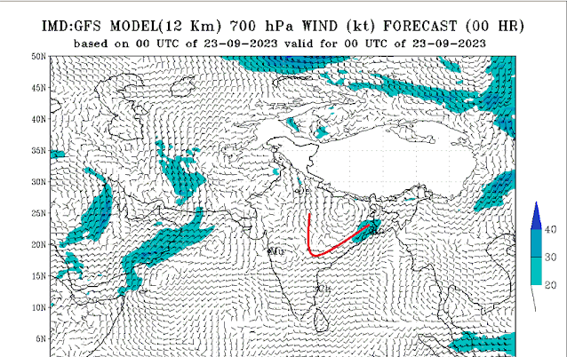
Dry air from north/northeast at 700 hP and 850 hPa will engulf most of north Konkan and interior Maharashtra after 3rd October. 

Monsoon may withdraw around 5th-7th October from Mumbai and north Konkan. 

October heat will set in with max temperatures rising to 32-34C for MMR. Nights can be around 24C, slightly cooler for Thane district. 

Pune: Chances of retreating Monsoon thunderstorms till 2nd October, after which isolated thundery activity may be confined to Ghats till around 3rd/4th October. 

Monsoon withdrawal may happen by 7th October. 

Daytime temperature may rise to 31-32C after the stoppage of thunderstorms. Night temperature may dip to around 19-21C, with rural areas/Ghats seeing a further dip.

Note: Although weather is likely to be mostly dry, surface winds for Mumbai and Konkan may still remain weak northwesterly, so moderate humidity may persist. The dry easterlies may start from the second week of October.


Due to persisting dense clouds/thunderclouds, a cyclonic circulation has formed over Arabian Sea off the south Konkan coast - moderate-heavy rain/thundershowers likely for south Konkan and Goa for next 2 days, with localized very heavy rain. It may become a low pressure area.
It won't be able to push in moisture till Pune/Mumbai, otherwise rain/thunderstorms would have persisted during the 1st week of October. 


Marathwada and Vidarbha: Some rain/thundery activity may continue till 2nd October for southern districts, and dry weather after that. 

Daytime temperature can rise to 33C after 2nd October.

Eastern parts of Vidarbha may see some rain till 3rd October. 

Gujarat: Rain/thunderstorms from the retreating Monsoon will persist till 30th September near Bharuch,Vadodara, Saurashtra, Surat, Valsad regions. Few places near Surat/Valsad and south Saurashtra can see localized thunder till 1st October. 
Monsoon likely to withdraw from entire Gujarat by around 3rd/4th October. 

Dry weather, and October heat with temperatures rising to 34C is possible after Monsoon's withdrawal. Some regions in Kutch may touch 36C. 

Parts of Kerala and coastal/Ghats of Karnataka can receive moderate-heavy rain over next 3 days.

A new low, BB-10 is developing over north Bay of Bengal. It will move west/northwest and bring moderate rain for West Bengal, Odisha Bihar, Jharkhand, north Chhattisgarh, eastern parts of Vidarbha and Madhya Pradesh, east and central Uttar Pradesh till about 3rd/4th October. Western areas of Uttar Pradesh may also see few isolated showers. 

Himalayan regions of central and eastern Nepal, Sikkim, Bhutan, and Arunachal Pradesh can receive heavy rain - avoid travel. 

Many parts of northeastern states of India can receive good rain in this period. 

Punjab, Haryana, Rajasthan, Delhi NCR: No rain is expected, Monsoon withdrawal may be announced in a day or two. 

Western Himalayan states and UTs may receive some rain/snow from a weak Western Disturbance from 30th September to 3rd October. 

Thursday, September 28, 2023

 Mumbai Rainfall Today..28th till 5.30 pm

TOP BMC RAINFALL AMOUNTS IN CITY AND SUBURBS IN millimeters

*24 HOURS (FROM 5.30am ON 28/9/23 TO 5.30PM ON 28/9/23)*


*SUBURBS*

H East Ward Office Santacruz East 45

L Ward Office Kurla West 41 

Bandra Fire Station 28

Vile Parle and Kurla Fire Station 37

Marol Fire Station 33

K East Ward Office Andheri East 32


*CITY*

F North Ward Office Kings Circle 19

Colaba Pumping Station 16

Rawali Camp 13

Malbar hill 8

Colaba Fire Station 7

VIRAR 10

VASAI 25MM

Wednesday, September 27, 2023


27th September..Fast Changing Scenarios:


Chart compiled by Vag. Gokul.

Fast Withdrawal indications:

Subtropical ridge at lower levels have started extending eastwards from the desert areas towards NW India at 25°N indicating the seasonal shift. As a result, .Bay system may not travel west into central India from east coast.

*BB 10 not coming inland is a big miss and may allow an early SWM withdrawal from North, Central and Peninsula India.

*Some more moisture inflow is needed into Maharashtra to sustain rains in October first week..

*Arabian Sea may not see any strong UAC off the coast to push southerlies...

*Retreating thundershowers also starting with NE flow directly...so few days of active ⛈️ thunder activity before dry weather in peninsula and Maharashtra. (If  there would be E/SE component in TS then may have persisted longer).

Forecast till 1st October:

*Monsoon withdrawal from Rajasthan, Punjab, Haryana, JK, HP  and Delhi by 28th September.

Dry weather in Northern, Central States. Eastern India will get some rains.

Most of Western Ghats, Madhya Maharashtra belt and parts of Marathwada and Vidarbha to receive thundershowers till 1st October.

Mumbai:

*Retreating Monsoon afternoon/evening  thunderstorms expected for Mumbai and Pune regions. These thunder activities may persist till 1st/2nd October.

*Some areas can get localized heavy rain with gusty winds.

*Due to fast developments in the High pressure spread, Mumbai Monsoon may withdraw a few days earlier than anticipated. Could be around 5th October for total withdrawal.

Inputs from Vag. Gokul and Vag. Shreyas.


 Pune district lashed with heavy thundershowers yesterday evening. Some rain figures below in mm:

Pune Region lashed by Thunderstorms on Tuesday night 

1. Bhatghar: 97

2. Temghar Dam: 76

3. Askhed: 72

4. Tathawade: 62

5. Kasarsai Dam: 60

6. Chinchwad: 55

7. Hirdoshi & Talegaon: 51

8. Alandi: 48

9. WadgaonSheri: 47

10. Pashan: 43

11. Shivajinagar AWS: 42

12. Dapodi: 37

13. Bibwewadi: 29

14. Katraj: 26


Compiled By: Vagarian Abhishek Apte

Credits: RTSFROS & IMD

Monday, September 25, 2023

Rare Red Auroras: See this rare phenomena on Space News Page 

Antarctica witnessed world’s most intense heatwave in 2022after temperatures soared 39C above normal...See World Weather News Page

25th September 

South West Monsoon withdrawal begins from SW Rajasthan as anticyclonic flows/associated ridge persists there .Water Vapour image indicates the Withdrawal 


Rains will decrease rapidly over NW India .

A low pressure system embedded in the Monsoon Trough near Vietnam will move west over Bay in the next few days and form a Low in the Bay by 29th. 


Sunday, September 24, 2023

Posted 24th Night 

Occasional showers next week till Ganesh Visarjan

Next week, 25th -29th, Mumbai can expect showers and thundershowers to continue.These late season waning rains will be heavy in particular areas of the city. Resulting in un- even figure distribution, with occasional sunny periods. 

Mumbai monsoon will continue till around 10th October. 

Mumbaikars have not to worry about rains deficiency. Colaba IMD Station has already received 423 mms and Santacruz IMD 387 mms till 24th September. 

So no worries for September rainfall ,which normally should be 383 mms.

With more rains expected this September,  Mumbai rains will be in excess for the month.

Water in lakes comfortable at 98%. One year's stock.


Posted 24th Night

Gujarat Special:

 Next week,  25th to 28th, Light to moderate rain/thundershowers can occur over many areas of Gujarat (Surat/Valsad, Bharuch, Vadodara, Ahmedabad and parts of Eastern Saurashtra). 

Rainfall may not be evenly distributed in all regions.

28th onwards, Rainfall restricted to South Gujarat. 

Kutch region to see mainly dry weather after Monday 25th September. 

Rainfall on 23rd

Excessive rainfall in Junagadh 


Bharuch District detailed rainfall 


Monsoon may withdraw from Kutch towards the end of the week, 29th/30th.

Saturday, September 23, 2023

Bumper rain in India in September despite of El Nino

Despite fear of El Nino, it is raining a lot in September in India. El Nino certainly on a vacation mode.

All India September rain is a whopping 15% above normal now (1-23 September)

Region-wise percentage distribution of rainfall this September till date:

Northwest India: -4% 

South India: +24%

Central India: +51%

East-Northeast India: -25% 

Friday, September 22, 2023

Nagpur Downpour....Cloudburst on 23rd between 2.30 am -3.30 am...98.5 mms at city AWS Railway station
24 hr Rainfall till 8.30am of 23-9-23
Nagpur city 176 mm, Sonegaon AP 117, Khapri 65

Upper Trough Southwards from BB-9 ( also seen in adjoining image put up yesterday) created heavy rainfall patches 

Mumbai Colaba 77 mms till 8.30. Saturday 23rd
Scruz 1.5 mm.
Uneven distribution is likely was mentioned on blog...as no proper streamlined westerly flow rains

Posted 22nd Afternoon:

* Low Pressure BB -9 now over Jharkhand.

* Monsoon Axis in Normal Position 


* Water Vapour showing significant reduction from extreme NW India, and the Jet Streams reversing to anti Monsoon seasonal directions estimated for 24th...


Indicative of  Monsoon Withdrawal commencing from West Rajasthan from 26th September..Normal Date 17th September

------------------------------------------------------------

*Mumbai: 

Fairly frequent rain showers with thunder this weekend, 23rd/24th.,some persistent rains in some areas, with thunder. Expect mist and reduced visibilities at times.

As on 22nd, the season's rainfall total is 2855 mms: {+632 mms} (Scruz), & 2163 mms{+162 mms}(Colaba).

With 8 days till month end, Mumbai Scruz has a chance of crossing the 3000 mms (120") mark this season. (IMD counts seasonal rains upto 30th September.)

This has been achieved 9 times since records began:

1) 1954: 3451.6 mms

2) 1958: 3759.7 mms

3) 1983: 3025 mms

4) 2005: 3289.2 mms

5) 2010:  3327.9 mms

6) 2011: 3154.8 mms

7) 2019: 3669.6 mms 

8) 2020: 3686.8 mms

9) 2021: 3163.5 mms

Figures Compiled by Vag. Abhijit Modak.

The Mumbai lakes and dams level reported at 6 am on 21st September 2023 is 1422269 ML (98 %).

Last year on 21st September 2022 was 1424647 ML (98 %).

In the year 2021 on 21st September 2021 was 1438850 ML (99 %).

Normally Monsoon withdrawal date for Mumbai is 8th October..As always maintained repeatedly, this year Mumbai  Monsoon will persist till at least 10th October.

Thursday, September 21, 2023

Current El Nino..2023.

Many queries are cropping up on the "El Nino" topic ...Firstly, what is El Nino?

Simply put..An over heating of a tongue of water off the South American Coast.

Caution: All El Nino years may not necessarily mean a weak Monsoon, as seen in the chart below 👇


ONI & El Nino: Characterized by a positive ONI greater than or equal to +0.5ºC.

 La Niña: characterized by a negative ONI less than or equal to -0.5ºC. 


By historical standards, to be classified as a full-fledged El Niño or La Niña episode, these thresholds must be exceeded for a period of at least 5 consecutive overlapping 3-month seasons.

El Niño Advisory ...How is it shaping up ?


*El Niño conditions are observed.

* Equatorial sea surface temperatures (SSTs) are above average across the central and eastern Pacific Ocean. The tropical Pacific atmospheric anomalies are consistent with El Niño. 

*El Niño is anticipated to continue through the Northern Hemisphere winter (with greater than a 95% chance through December 2023-February 2024).*

The Indian Summer Monsoon 2023 was partially affected by the current developing El Nino. 

The monsoon started off weak, with  June being -9%  July, impressed with +13% . August saw erratic activity, with -36% for the month.

So far this September, surplus is +9%,

All India Monsoon is at -7%.  Maybe a better picture will emerge by this month end...for the overall Monsoon Season. 


Wednesday, September 20, 2023

Region wise Monsoon Report till today 20th September:


The monsoon started off weak, with  June being -9%  July, impressed with +13% . August saw erratic activity, with -36% for the month.

So far this September, surplus is +9%,

All India Monsoon is at -7%.  Maybe a better picture will emerge by this month end...for the overall Monsoon Season. 

Now,  with multiple weather systems , BB-8, BB-9, UAC over Rajasthan, more showers across the country are expected this month.

The ongoing rainfall this month, is a blessing for the Summer crops, following the driest August in over a century. 

This year, the withdrawal date is delayed....Normally the Monsoon starts its reversal from Rajasthan on 17th September.

----------------------------------------------

Maharastra Monsoon upto 20th...👇

Mumbai: Next few days the current pattern will continue with occasional showers, some with thunder. Weekend forecast on Friday...

Interior Maharashtra   Many areas in Vidarbha, Marathwada and Madhya Maharashtra regions likely to get moderate rain/thundershowers over next 3 days. 
Rainfall may not be uniformly distributed
 Ch. Sambhajinagar can see moderate rain/thundershowers tomorrow 21st and Friday 22nd. 
25-45 mm total rainfall possible in these 2 days.


Tuesday, September 19, 2023

 19th September..evening 

*Low pressure BB 9, forms over NW Bay of Bengal.


*Rains to increase gradually over Odisha, Chattisgarh in the next 48-72 hrs. 


*BB 8, Cyclonic circulation continues to prevail over SW Rajasthan. Heavy rains to continue over parts of Kutch and Rajasthan. 

*Monsoon Trough remains active


Compiled by Vagarian Gokul

Monday, September 18, 2023

 Today's [ 18th] rain in ,Gujarat 


BB 8 continues in Gujarat...

Visavadar (junagadh) reported 185mm during last 4 hours ending 10am


And Kutch...😳


Sunday, September 17, 2023

Posted 17th Night:

BB-8 continues its Westward track pouring extremely heavy rains in Rajasthan, M.P. and Gujarat.👇

Ahmedabad,Bharuch and Vadodara heavy rains were pre warned in Vagaries "Latest Snippet " yesterday.
 

However, the "pull effect" Westerly winds towards the system from the Arabian Sea was weak (not enough gradient).Closely spaced isobars mean strong winds; widely spaced isobars mean lighter wind.
The Westerlies can strengthen a little bit as the location of the Low shifts towards Kutch


Hence the rainfall over North Konkan (Mumbai) was not as per our expectations.
.
Mumbai did not receive the expected amount of rains due to poor Westerlies. We expected around 40 mms cumulative this weekend, but averaged around 30 mms between North and South Suburbs.

Monday 18th, will get some regional heavy showers. From 19th -22nd ( Rest of the week), we can expect showers in irregular intervals, not steady, in parts of city. Sunny  periods in between.
This pattern of rains will continue through the week.

Pune: The coming week will be partly cloudy with light rains in parts of Pune.

Sambhajinagar: Light to moderate rains will continue for the next 4 days. There will be no danger of fields getting waterlogged. Slight increase from 22nd.
Rainfall this season till today : Phulambri 384 mms ( 78%), Waddod Bazar 358 mms ( 73%)
संभाजीनगर : पुढील 4 दिवस हलका ते मध्यम पाऊस सुरू राहणार आहे. शेतात पाणी साचण्याचा धोका राहणार नाही. 22 पासून वाढ होण्याची शक्यता. या हंगामात आजपर्यंतचा पाऊस : फुलंब्री 384 मिमी (78%), वडोद बाजार 358 मिमी (73%)

Bharuch: After getting good rains ,( Netrang 52 mms, Bharuch 35 mms), the rainfall intensity will decrease from the coming week...18th onwards.
ભરૂચ: સારા વરસાદ પછી, (નેત્રંગ 52 મીમી, ભરૂચ 35 મીમી), વરસાદની તીવ્રતા આગામી સપ્તાહ...18મીથી ઘટશે.

Magnificent site..Sardar Sarovar  Overflowing...see here

Saturday, September 16, 2023

Friday, September 15, 2023

Posted 15th Night

MumbaiWetter days, but 

NO Weekend ALERT 

The Low is moving West as anticipated. 

So, an increasingly wetter weekend for Mumbai. Frequent rain showers on Saturday, Sunday abd Monday. Cloudy and cooler.

Around 150 mms this weekend could be a cause of some inconvenience in vulnerable areas. 

Pune: May not get the full effect of the System. Lighter rains this weekend. 


Thursday, September 14, 2023


Chart compiled by Vag Gokul 👆

Posted 14th  Night

Another active phase of Monsoon begins for Maharashtra 🌧️⛈️.


Mumbai will see rains increasing from 16th September, with heavy rains likely from 16th to 19th September (Ganesh Chaturthi). The total combined rainfall in these 5 days can be 150-200 mm for Mumbai region. 

Places in Palghar and parts of Thane district can see heavier rain.

Pune: Monsoon feel to return with light rain expected during next 4-5 days. Some areas can get moderate showers. Overall, cumulative rainfall can be between 20-40 mm. 

Moderate-heavy rain in parts of north interior Maharashtra districts (mainly Nagpur, Amravati, Akola, Buldhana, Jalgaon, Dhule, Nandurbar, Nashik) over next 3-4 days. 

Ghats of Maharashtra to receive heavy rain during next 4-5 days as westerlies winds from the Arabian Sea strengthen.

Gujarat:

South and east regions of Gujarat (Surat/Valsad/Bharuch/Baroda) can get moderate to heavy rain over next 5 days. 

If the low BB-8 tracks till east Gujarat (which is possible), then rainfall can be very heavy in some areas (above 200 mm in 5 days).

Saurashtra to see moderate rain, with some heavy showers for Eastern parts.

Ahmedabad region to get moderate rain, mainly during 17th-19th September.

-------------------------

Medium range forecasts showing Arabian Sea may persist with westerly winds into last week of September while Bay may start showing reversal earlier

 13th Morning..heavy rains from BB 8 in Odisha 


The region in Mumbai which got rains on Thursday afternoon 

MUMBAI (BMC) RAINFALL AMOUNTS IN millimeters
*3 HOURS (FROM 3.30 PM TO 6.30PM ON 14/9/23)* 

Vile Parle Fire Stn 62
S Ward Office (Bhandup) 52
Vikhroli Fire Station 50
SWM Santacruz Workshop 59
Kurla Fire Station 47
Virar 15mm
Vasai 22mm

Tuesday, September 12, 2023

Posted 12th Evening:

New Low...BB-8 developing in Bay....

Mumbai: The Monsoon is playing " Come & Go" with Mumbai. 

*June with low rainfall,  

* A drenched July

*A long dry spell in August, causing concern and worry..and then a wet spell, bringing hope and smiles.  

 *September: A wet beginning and a dry spell, and now, another dry, hot spell ...

But...this Monsoon, it will continue with its unpredictable games.

Another wet spell is expected over Mumbai from 16th ~20th..bringing good rains, and  we may see all the lakes overflowing. 

The Mumbai lakes and dams level reported at 6 am on 12th September 2023 is 97 % of the total. 

The quantum and intensity is still unsure, but will be able to get some inclination as the Low crosses the coast on 13th.( Maybe in excess of 100 ~150 mms between 16th ~20th.But we can ascertain that later).

As said earlier in Vagaries, a good spell in September should not be a reason to worry for Mumbai  !

-------------------------

Interior Maharashtra is in for good bountiful rains. 

From 16th, for the next 3/4 days, Vidharbh, Marathwada, and Madhya Maharshtra will receive the much required rainfall for the standing crops. 

Sambhajinagar District will receive good rains from 16th..with cumulative at least 70 -80 mms next 4 days.

Marathwada Dams and Reservoirs:👇

Jayakwadi at 32.42% of its full capacity, compared to 97.24% at the same time last year. The dam is the primary source of water for irrigation, drinking and industrial use in eight districts of the Marathwada region.

Majalgaon Dam - Beed. At 12.69% of its full capacity.

Lower Manar Dam - Nanded. At 55.21% of its full capacity

--------------------------

Rainfall may even creep into Gujarat region (Bharuch) and parts of Eastern Saurashtra from 18th.


Friday, September 08, 2023


Outlook for Saturday 9th Sunday 10th

Mumbai: Passing showers. Shorter periods.Rain intensity lower than last 2 days. Today and tomorrow combined may see 40-60 mm average. Few places could get a little heavy rain.


Thursday, September 07, 2023

 TOP BMC IN CITY AND SUBURBS RAINFALL AMOUNTS IN millimeters

*12 HOURS (FROM 5AM TO 5PM ON 7/9/23)* 

*City*

Dadar Fire Station 80

Haji Ali Pumping station 71

Vagaries (Willingdon) Club 70

Frosberry Reserviour 57

D Ward Office (Grant Road) 65

Municipal Head Office 61

Colaba IMD 43 ( 9 hrs)


*Eastern Suburbs*

M East Ward Office (Deonar) 163

Marol Fire Station 98

Scruz IMD 94 (9 hrs)

S Ward Office (Bhandup) and

Deonar (Vagaries Pvt) 90

Vikhroli Fire Station 84

Chembur Fire Station 80


*Western Suburbs*

Malwani Fire Stn 128

Chincholi Fire Station 99

Goregaon 99

R Central Office (Borivali Stn) 90

K West Ward Office (Andheri W) 88

 Vasai 12 hr rainfall 117mm

Virar 12 hr rainfall 118mm

Forecast update from 7th -10th September - Monsoon turns active!

Increase in rain across Maharashtra & Mumbai from Janmashtami as mentioned earlier!


Mumbai: Rains increasing Mumbai region. Some moderate-heavy rains expected during next 3-4 days (cumulative 4 days total upto 200 mm average in MMR region, some places can see higher amounts). 

Pune: Light to moderate rain/showers likely. Around 30-40 mm likely over next 3-4 days. Some places may receive higher rain. 

North Madhya Maharashtra districts of Dhule, Nandurbar, Jalgaon, parts of Nashik district can see some moderate to heavy rain (above 100 mm in 3 days for some areas). 

Marathwada: Overall, moderate rain likely in the districts of Marathwada (up to 30-50 mm average in 3-4 days). Northern districts (some areas in Ch. Sambhajinagar and Jalna) may see some localized heavy rain (60-80 mm total in 3-4 days). 

Vidarbha: Moderate rain with heavy in few places mainly in northern districts of Nagpur, Bhandara, Amravati, Akola, Buldhana (rainfall can vary between 60-100 mm total in next 3-4 days)


Gujarat: Moderate rain likely in Navsari-Bharuch stretch across Surat,Valsad regions. Baroda region can also see moderate-heavy  rain upto 60-100 mm by Sunday 10th September. 
Ahmedabad region and Saurashtra may only get light rain. 

West Madhya Pradesh and eastern Gujarat border regions can receive heavy rainfall of 80-120 mm total by Sunday 10th September. 


Wednesday, September 06, 2023

Posted 6th September

The rainfall from BB-7 as on 6th September 


After the BB-7, the low pressure , the retreating process  of the monsoon will commence from extreme NW India.

Thereafter, weather systems, if any, will not be perusing into parts of  Central, Western and Northern India. 

The normal withdrawal date of monsoon from the western parts by the end of the life cycle of this monsoon low. will be coinciding.

Normally SWM starts withdrawing from extreme NW India from 17th September. 

This year Mumbai withdrawal of Monsoon can be expected around 10th October.

Kutch by 18th September....Gujarat around 1st October.

Monday, September 04, 2023


Posted 4th August..

Monsoon turning active - much needed rains expected for most of the country in the coming days!

{ Mumbai: 
*Rains to increase from around Friday 8th September in Mumbai region.
*Moderate rain, occasional heavy showers likely over the upcoming weekend of 9th-10th September. Some rumbles of thunder possible.

Mumbai Lakes & Water Storage 

The Mumbai lakes and dams level reported at 6 am on 04th September 2023 is 1312578 ML (91 %) of the total.

(About 9 months Stock). If on Getting > 350-400 mms in remaining days of Monsoon, it should end the season on full storage. Monsoon expected to persist in Mumbai till 10th October. 

Last year on 04th September 2022 was 1417217 ML (98 %) of the total.

In the year 2021 on 04th September 2021 was 1316898 ML (91 %) of the total.}

Pune: Light rain likely from 8th September onwards, bringing back the Monsoon feel. Some showers can be moderate intensity. Days can remain pleasant below 30C. Overall 10-15 mm cumulative rainfall is possible from 7th-9th in Pune region.

Maharashtra forecast for upcoming week: 

Some rain/thundershowers likely to continue in south Madhya Maharashtra and southern districts of Marathwada during Monday 4th and Tuesday 5th September. 

Rainfall will increase from Thursday 7th September as low BB-7 moves into Maharashtra. 

BB-7 forecast by IMD GFS
Kokan and Goa: Rainfall increasing from 8th September, moderate rain likely over the weekend, with some places getting heavy showers. 

North Madhya Maharashtra districts like Nashik/Jalgaon/Dhule can receive moderate rain with heavy in some areas during 7th-9th September.

Vidarbha: Vidarbha districts can see some moderate rain with heavy at times from 6th to 9th September. Average total rainfall in Vidarbha region can be around 60-80 mm in these 3 days. Very beneficial for crops. 

Marathwada: Moderate rain with heavy at a few places is expected from 7th-9th September. Many districts can get up to 50-80 mm of rain in 3 days. Very good for standing crops. 
Ch.Sambhajinagar - Moderate rain is likely from 7th-9th September. Cumulative rain in these 3 days can be 50-70 mm.

More details on Maharashtra by Wednesday 6th September. 

Rest of India 

North Interior Karnataka to get moderate-heavy rain/thundershowers during 4th-5th September. 
Rainfall to increase in Odisha, Chhattisgarh, Telangana and Madhya Pradesh as BB-7 starts tracking west. 

Kerala: Heavy rain in southern parts of the state for 4th-5th as offshore trough develops with strong westerly winds. Northern parts of the state will see rain increasing from 5th September. Rainy week ahead for the entire state.

Coastal Karnataka: Rainfall to increase from 5th/6th September. Moderate-heavy rain is likely. Southern parts of the coast and Ghats can get heavy rain. 

Gujarat forecast also by Wednesday 6th September

Posted 26th April 2024... Currently, no indications of any Severe Heat Waves or highly above normal temperatures this season... And currentl...