Monsoon Watch - 3...10th May 2024...Arrival Date & Quantum Estimate
This year, I have observed a varying and fluctuating mode in the basic parameters. A little unusual (from my last 56 years of basic Monsoon development studies).
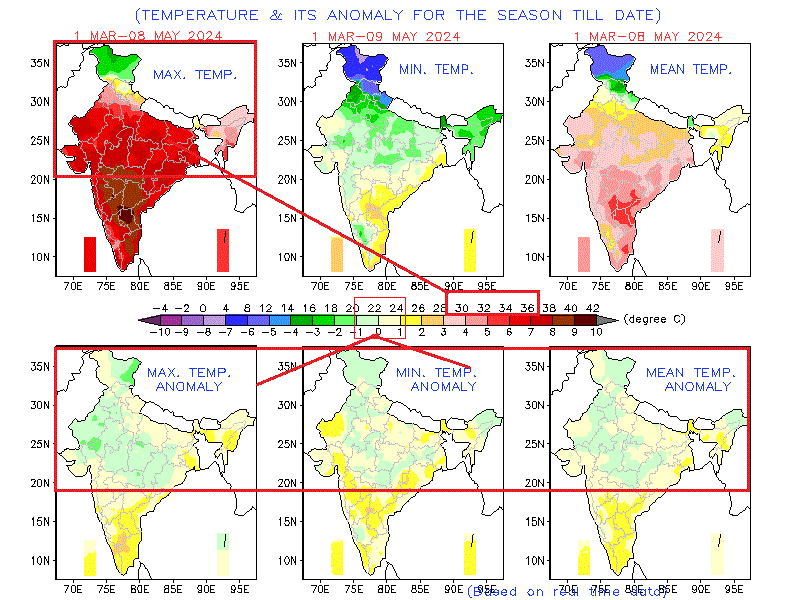
1. The Seasonal low is still steady at 1002/1004 hpa at the core. Should be getting lower gradually, but variations and cooler (than normal) climes in North and NW India in April/First half of May and persisting WDs (with snow in Kashmir) kept this from occurring.

Showing the fluctuating trends, Will suddenly drop to 998 hpa around 23rd/24th May.
2. Heat wave...Except in the Southern Regions, no real effect of Heat Wave in North and North West.
3. Equatorial Cross Winds...Bay region & Arabian Sea
.png)
.png)
6.ONI:
The most recent ONI value (February – April 2024) is 1.1ºC.
{El Niño: characterized by a positive ONI greater than or equal to +0.5ºC.
La Niña: characterized by a negative ONI less than or equal to -0.5ºC.
By historical standards, to be classified as a full-fledged El Niño or La Niña episode, these thresholds must be exceeded for a period of at least 5 consecutive overlapping 3-month seasons.
CPC considers El Niño or La Niña conditions to occur when the monthly Niño3.4 OISST departures meet or exceed +/- 0.5ºC along with consistent atmospheric features. These anomalies must also be forecasted to persist for 3 consecutive months}
Understanding the the above criteria, we estimate:
Note:
Arrival Date*:
With a moderate summer (initially) in heartland India due to a series of WDs also preventing the "uppermost winds" from seasonal setting, no Low Pressure formations in Bay,( for the Bay branch) and a late season fading El Nino, we estimate
The arrival Date of the Indian South West Monsoon over the Bay Islands will be delayed by a few days to 18th/20th May ( normal date 15th May).
However, the West Coast Branch of the Monsoon, could be arriving at Kerala around normal date of 1st June.
Quantum*:
India being a big Country, the Spatial distribution of the rains will be varying a lot.
Southern Peninsula & West Coast may be Normal,
Gujarat & Central India slightly above Normal,
NW India and North normal.
Slightly below Normal in the East.
The much talked about La Nina factor is expected, but only in the later stages of the Monsoon, approximately in August/September. Hence, what we may see is initially normal or slightly lagging rains, but better precipitation in the second half of the season.
Data from 1951 to 2023 shows India experienced above-normal monsoon rainfall on 9 occasions when La Nina followed El Nino event
IMD has estimated this years Monsoon quantum at around +106%+- 5% of the normal.
===================================
Monsoon Watch is reflecting Vagaries' views..Monsoon Watch should not be used/depended upon commercially or otherwise. Monsoon Watch Series may differ from official and other models.


No comments:
Post a Comment