Co Authors: GSB, Shreyas Dhavale, Pradeep John, Dr. Vineet Singh, Gokul

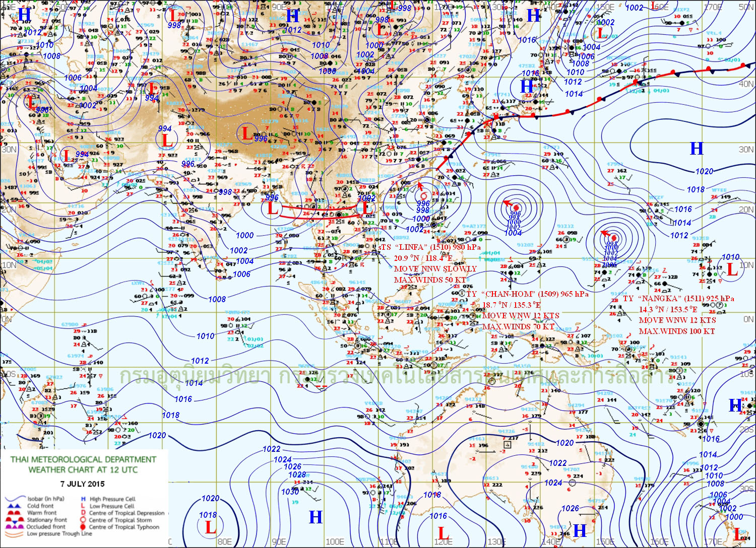
Wednesday, July 08, 2015

Posted Thursday Night:
Mumbai: Passing showers in parts of city...otherwise partly sunny. Around 5-10 mms of rain expected.
Pune will be partly cloudy with light rains in some parts.
Kolkata sees decrease in rains from Friday.


Map shows rainfall occurred on Thursday. With Monsoon Axis and BB-2.


BB-2 to track NW into East U.P. 
Heavy rains lkely in East U.P. and Bihar...potential local flooding.
Kolkata 66 mms overnight as on Thursday morning and 29 mms in 12 hrs on Thursday.
40 mms in Jabalpur and 24 mms in Goa in 12 hrs Thursday till 8.30 pm IST
Weekend report on friday Night

--------------------------------------------------------------------------------
Posted Wednesday Night:
A brief report tonite..Next posting for the week end weather will be in detail...

BB-2 forms as a Low in the North Bay of Bengal, of the West Bengal coast...Low at around 998 mb, is embedded in the Monsoon trough.

Monsoon trough runs from Pak Punjab thru Southern Indian Punjab thru Southern region of U.P. and then thru BB 2 into Northern Thailand and Laos.
BB-2 now is expected to cross the Bengal/Odisha coast and move NW, into East U.P. regions...and if continuing, may crash into Nepal Himalayas...causing continuation of "break monsoon" conditions for the Peninsula.

Next 2 days, Thursday and Friday, good precipitation expected in North Odisha, Northern Chattisgarh, W.Bengal, Bihar, Jharkhand, East M.P. and Central U.P.
All along axis, from Punjab, Haryana and Delhi thru rest of U.P. we expect good rains on 9th and 10th. Western end of axis, The Punjabs, get heavy rainfall in places.

Mumbai, the wait continues... estimate for Wednesday and Thursday will be partly cloudy, with some very isolated passing shower in some areas. Around 3-5 mms per day where it rains.
Delhi NCR wakes up again to a rainy day on Friday. Rains and thunder showers on Friday will measure around 25 mms average.
Kolkata: Brace up again for another thunder showers on Thursday, expect around 30 mms again....but prepare for a decrease in rains post Friday...
Good rains in East M.P. and Shahdol gets showers on Thursday and Friday. Monsoon conditions and accumulated rains next 2 days will be around 60 mms.
Meanwhile Goa gets steady rainfall next 2 days, maybe getting around 25-30 mms per day. Coastal Karnataka too gets good showers .

Gujrat (Pakistan) will get moderate rains both days, about 8-10 mms per day.

Sindh , including Karachi, region will be hot.( Light rains were seen in parts of SE Sindh on Wednesday).Some thunder showers in few places in SE Sindh on Thursday.

Next Update for Saturday Sunday on Friday Night...Please put in your request for specific city forecast..will try to give it.

Tuesday, July 07, 2015

Posted Tuesday Night:

True to forecast, Tuesday rains in Delhi NCR, Pak Punjab and Kolkata... Barielly received 54 mms as on 7th Morning.

Delhi NCR had rains on Tuesday ...with the rains amounts in cms on Tuesday as follows:
Delhi(Palam) ­5, Delhi(Aya Nagar)­4;  Delhi(Safdarjang) -3, Delhi(Ridge) -1.( Vagaries had estimated average 30 mms).

Parts of West of U.P, Bengal, H.P. Odisha and Uttarakhand got rains on 7th......


..


Major amounts...in cms.( Tuesday Daytime)..
Canning  ­8; Shimla, Kolkata and Balasore ­5
Mukteshwar,Satna, Digha and Jamshedpur ­3 each; Sundernagar,
Varanasi, Sultanpur, Narnaul, Ambikapur, Bhagalpur and Purulia­  2 each and Dehradun, Pantnagar, Dharmshala,
Gorakhpur, , Damoh, Rewa,Sidhi, Purnea, and Contai ­1 each
Kolkata and Balasore  5,

In Pakistan, the entire North (Punjab) region got very heavy rains Tuesday. Islamabad was leashed by heavy showers, with rain amounts in mms as shown>>

Islamabad (Golra= 156, Bokra=117, Saidpur=97,Z.P=71) See pics of Islamabad today in Vagaries Pakistan

Lahore PBO=63, Okara=62, Multan=59, Toba Tek Singh=48, Faisalabad=45, D.G khan=42, Risalpur=40, Bahawalnagar, Malamjaba=38, Murree=35, Bahawalpur City=34, Joharabad=33, Rawalakot=32, Kot Addu=29, Sahiwal, Layyah=24.


A Low, BB-2, can form on Wednesday in North Bay, though some charts are showing it as a Low on Tuesday evening..


Monday, July 06, 2015

Very hot desert Nights ....
Minimum temperatures of Monday 6th July in Oman ..
Al Amirat 38.2c, Muscat Seeb A.P.  37.8c,  Qalhat  37.6c, Suwaiq 36.1c.

Max on 5th July in Suwaiq 48.4c, Rustaq 47.1c, Muscat A.P. was 46.6c, 

Kuwait on 4th July:
Mitribah                                    Max 50.6c                  
Kuwait International airport      Max 50.3c         
Sulaibiya                                  Max 50.0c                     
Jahra                                        Max 50.6c

Kuwait Max Monday 5th July:
1 Mitribah (Kuwait)                                  49.1 °C
2 Kuwait Internationalairport (Kuwait)     48.8 °C   Minimum 35.5c....
3 Sulaibiya (Kuwait)                                 48.4 °C   Minimum 36.0c....
4 Jahra (Kuwait)                                      48.3 °C                              
5 Abdaly (Kuwait)                                     48.2 °C

Hottest in U.A.E. on Sunday 5th:
Fujairah 48.3c ( Min 31.2c), Abu Dhabi A.P. 46.5c ( Min 32.1c), Dubai A.P. 44.5c

Max in Saudi Arabia on 5th July:
1 Al Ahsa (Saudi Arabia)               47.4 °C
2 Al Qaysumah (Saudi Arabia)       46.3 °C
3 Wadi Al Dawasser Airport (Saudi Arabia) 46.0 °C

Sunday, July 05, 2015

Posted Sunday Night: 

Mumbai: Monday 6th/Tuesday 7th/Wednesday 8th: Partly sunny to cloudy skies. A couple of passing showers in some areas will bring much needed relief. But, rain amount may not exceed 5-7 mms per day. stuffy nights continue.
Interior regions of Maharashtra (Madhya Mah, Marathwada and West Vid) will remain practically dry without meaningful rainfall till next 4 days.

Synopsis:
Currently Hot and very hot days in the entire region...5th July...In Pakistan Moen jo Daro 47c and Larkana 46c....and Sri Gangannagar at 40.7c and 40.6c at Palam (Delhi). in India

The Monsoon axis is stubbornly fixed in the North, and the fresh WD ( JL-1) is preparing to proceed, come what may !

Time-series representation of the Summer Asian Monsoon OLR Index (SAMOI-N) indicating the meridional shift of the active convection area to the North
The OLR index (SAMOI-N) indicates the meridional shift of the active convection area associated with the Asian summer monsoon. SAMOI-N is defined as the difference between the reversed-sign area-averaged OLR anomalies over the area from northern India to northeast of the Philippines (shown by the area enclosed by the solid green line on the bottom) normalized by the standard deviation and those over the area from the central North Indian Ocean to southeast of the Philippines (shown by the area enclosed by the dashed green line on the bottom). Positive and negative SAMOI-N values indicate northward and southward shift of the active convection area, respectively, compared to the normal (i.e, the 1981 - 2010 average). The thick and thin green lines indicate seven-day running mean and daily mean values, respectively.

Monday 6th: As mentioned on 1st July, the Inter Action of WD ( JL-1) with the Monsoon axis starts from Monday 6th July. Northern Indian States of Punjab, Haryana, H.P. and Utterakhand get good precipitation on Monday 6th July. 
As the day proceeds, rains become heavier by afternoon /evening in Indian Punjab, adjoining Haryana, West U.P. and Uttarakhand. Spill over into North Rajasthan possible. U.P. regions East of Delhi (Barielly) will be receiving heavy falls. Adjoining East M.P. can get showers also as the entire axis line is prone to rainfall.
Delhi NCR starts getting showers from Monday evening.

Tuesday 7th: Monsoon entering Northern Pakistan.
More concentration of heavy rains on Tuesday (more likely as the day progresses) in Pak Punjab. All regions in North Pakistan get heavy showers. 
Gujrat (Pakistan) gets showers on Tuesday, amounting to around 15-20 mms on Tuesday. 
Heavy falls in Nepal. Heavy rains also possible in Sikkim, leading to overflowing of local rivers downstream.
Rainfall in Indian NW regions may be a little less compared to Monday. 

Delhi NCR will be cloudy with showers interspersed in the day. Around 30 mms Tuesday day and Night.

Wednesday 8th: The entire stretch from Pak Punjab thru Indian Punjab, Haryana, U.P, Uttarakhand and North Bengal get moderate rains. 
Delhi NCR may get less rains also, but the intensity will be more on Thursday again.

 From an already formed UAC,a Low ( BB-2) forms in the North Bay of Bengal on the 7th. 
May concentrate in WML and maybe depression (992 mb), before crossing Odisha coast around 10th. But strength and Track depends on WD trough behaviour. 

If JL-1 can bring down the Monsoon axis to the South near Rajasthan, then this BB-2 can possibly track West wards. If the persisting WD trough extends Eastwards, the BB-2 may head North. Vagaries is unsure of the track today.

West Coast trough remains weak next 4 days. Slight movements continue (seasonal). A "spurt" ...
1). In off Karnataka/Goa region will see increased rains in Goa on 7th and 8th. Maybe around 40 mms/day...and 
2.) in the Northern end may bring some light rain relief to Saurashtra for a day on Tuesday/Wednesday.
Strong SW winds will continue in Saurashtra and Coastal South Gujarat next 3 days.
But most of Sindh (including Karachi) will remain practically dry and hot.temperatures may shoot to 46/47c next 2/3 days.

Chennai will continue to be very hot, around 40c next 2 days, with no meaningful rains till Thursday at least
Kolkata: Oh Calcutta ! And it goes on..Thunder showers again on Monday and Tuesday...around 15-20 mms average.

Friday, July 03, 2015

Heat Wave in Western Europe..Some Hot Spots on 4th July....See International Page

SWM Toppers is back, Top 20 Rainfall stations in India from 01.06.15 to 30.06.15

Its Mawsynaram and Cherrapunji all the way, none had the chance to catch them. Agumbe has got only 1323 mm and Amboli around 1250 mm is not in the list. The surprise is 2 stations from Tamil Nadu has made into the list it is not Chinnakallar or Devala. Its Parsons Valley and Avalanche from Nilgiris district.

in mm (min 1400 mm)
  1. Mawsynaram, Meghalaya - 4781
  2. Cherrapunji, Meghalaya - 4355
  3. Parsons Valley, Tamil Nadu - 2166
  4. Shiragaon, Maharashtra - 2076
  5. Lamaj, Maharashtra - 2057
  6. Talacauvery, Karnataka - 2033
  7. Naladi, Karanataka - 1910
  8. Hosanagar, Karnataka - 1892
  9. Kottigehara, Karnataka - 1826
  10. Bhagamandala, Karnataka - 1820
  11. Amgaon, Karnataka - 1738
  12. Patherpunj, Maharashtra - 1684
  13. Avalanche, Tamil Nadu - 1663
  14. Tapola, Maharashtra - 1596
  15. Yadur, Karnataka - 1481
  16. Sangave, Maharashtra - 1472
  17. Mulshi, Maharashtra - 1470
  18. Mahabaleshwar, Maharashtra - 1443
  19. Kuttiyadi, Kerala - 1401
  20. Hulikal, Karnataka - 1400

This data is only for Vagaries, Kea Weather and Tamil Nadu Weatherman. I kindly request you to put source of this blog, in case you are trying to copy and paste the above in any other blog or website. Compiled by Pradeep for Vagaries.
---------------   ------------------------------      ----------------------------          -------------------------------
Posted Friday Night:
The Monsoon Progress Map is now removed from the right side, and the Latest Monsoon Surplus/Deficit % is put up (All India)
All India is +7% till date.

Seasonal Rainfall (in mm) from 1 June to 3 July, 2015
Region Actual Normal % Departure from Long Period Average
All India                           +7%
East & Northeast India      -4%
Northwest India               +17%
Central India                    +11%
South Peninsula                 +9%

Mumbai Lakes Storage as on 3rd July 2015 in Mcum:
Bhatsa  326, Vaitarna  89, Modak 64,Tansa 29,Tulsi 5 , Vihar 8, Middle Vaitarna 129.
Total Storage 650...33% taken as wastage, leakages, evaporation etc, Mumbai has actual  433.  And supply at 3.7 Mcum, city has  117 days of Water supply. 
Source WRD (Mah Govt) .

All Major and Minor reservoirs of Marathwada have a total live storage of only 7% as on date. 
Jayakwadi has only 1% storage, and Lower Terna, Majalgaon and Manjra reservoirs 0% !  

As the reasons were explained, rains were seen in the Eastern States of Odisha and W.Bengal, and NE last 3 days. And weak monsoons elsehwere.( Monsoon will be weak for a couple of days now in East also).

Monsoon remains weak in the Peninsula next week also. But as mentioned in the 1st July Post, Point no. 4), a WD will bring rains to Punjab (India and Pak), and to Kashmir, H.P. and Utterakhand. Nepal will benefit from the inter action of WD and Monsoon axis. All this from 7th July.
Point no. 5 of 1st July post holds valid, and S.W. Monsoon may move into Rest of Sindh and Pakistan from 7th July.

Article for Lokmat Times (4th July) on Aurangabad and Akola Regions on Current Weather Page.or see direct at Lokmat Times Site...Page 3

Wednesday, July 01, 2015

U.K's Hottest July day ever...and Western Europe Heat wave ...see International Page
New Delhi: Palam touches 40.3c and Gurgaon 40.0c on Thursday...S'Jung 38.9c.----------------------------------------------------------------------
Posted Wednesday Night:...1st July

How is the South West Monsoon going to behave in July ?


1. MJO: the current phase of very weak MJO in our seas is prevalent, and with a slight "blip" in the Northern region seen thru OLR images, we see the Northern Bay showing signs of of a UAC formation soon. UAC may effect Eastern States of India and the NE States with precipitation in first week of July.


Rains increasing in Kolkata from Sunday 5th.


But the weak MJO phase ( Though gradually moving out of the very weak phase) in the Southern seas continues  and without any Eastward propagation for the next 10-12 days.

Long Term forecasts show the MJO "improving", that is first getting "Neutral" by around 14th July, and then gradually strengthening after 17th July.

As a result, we have a strong MJO wave in the Western pacific. We may even see a typhoon form in the Western Pacific next week.


2.El Nino: This event has strengthened in the last 15 days. SOI is at -9.0. and the Central and eastern tropical Pacific Ocean sea surface temperature indices are more than 1 °C above average for the sixth consecutive week.


3. The Monsoon axis remains North of its normal position till the 8th at least.Rains expected in Eastern U.P, Bihar and Sikkim and Himalayan W.Bengal next week.


4. A WD moves into the Northern Sub Continent around 6th July. This would merge with the Western end of the Monsoon axis and bring good precipitation to Northern Pakistan and Northern India.


5. Next 8-10 days, Precipitation remains lower than normal in the Peninsula, Western Region, Central Region, NW region of India. Also in Central and Southern Pakistan rains will be below normal. Monsoon may move into remaining Sindh and Pakistan after 7th/8th July.


Monsoon remains weak in the Sub Continent (barring Eastern states of Odisha/Bengal and NE India. Barring extreme North Pakistan) in the first 15 days of July. Strengthening in the second half will see the rains recovering in the regions.


For All India, i would expects a 10% shortfall overall for July only. The current +ve figure of +16% would therefore fall.


Next 5 days in....

New Delhi: As the next 2 days get hot, maybe around 40c, we will see an increase in showers by Sunday and Monday.

Mumbai remains hot and cloudy, around the 33c-27c range. With no major rains developing till Sunday. Around 3 - 5 mms per day.


Pune remains in the 30-23c range till Monday, with light drizzles in some parts.


Aurangabad till Monday, remains dry and hot at around 34c, with minimum at 23c. Light drizzles in some parts.


INDIA - STATE CAPITALS / U.T.- JUNE 2015 RAINS (CMS)


1.MUMBAI @ 111 CMS ..
..


 18th Evening Pre Withdrawal Thundershowers in full force