Co Authors: GSB, Shreyas Dhavale, Pradeep John, Dr. Vineet Singh, Gokul

Thursday, November 30, 2023

 30th November 

Possibility of a potential cyclone in the South Bay  remains. Various models are indicating its possible formation around December  2/3 rd 2023.

A well-marked low-pressure (BB 14) area persists over the southeast Bay of Bengal, expected to strengthen in the next 24 hours with a northwest track.


Easterly winds have resulted in a trough extending from Indonesia to Sri Lanka. The embedded Well Marked Low will get enriched moisture.

This could mark the fourth tropical storm in the Bay this year. 


As different models differ on the final track which is uncertain,Despite differing model predictions, Vagaries estimate a possible track to North T.N. / South A.P. Coast. 

 Hence heavy to very heavy rains could be  expected over Tamil Nadu and Coastal Andhra Pradesh. 

Wednesday, November 29, 2023

GEOMAGNETIC STORM WATCH


Solar storm to hit Earth on November 30, will disrupt mobile communication.


NASA and weather experts are issuing
a warning about an upcoming solar storm projected to strike Earth on November 30

This relatively minor storm is anticipated to disrupt radio and GPS.

NASA and weather experts are issuing
 a warning about an upcoming solar storm projected to strike Earth on November 30

This relatively minor storm is anticipated to disrupt radio and GPS

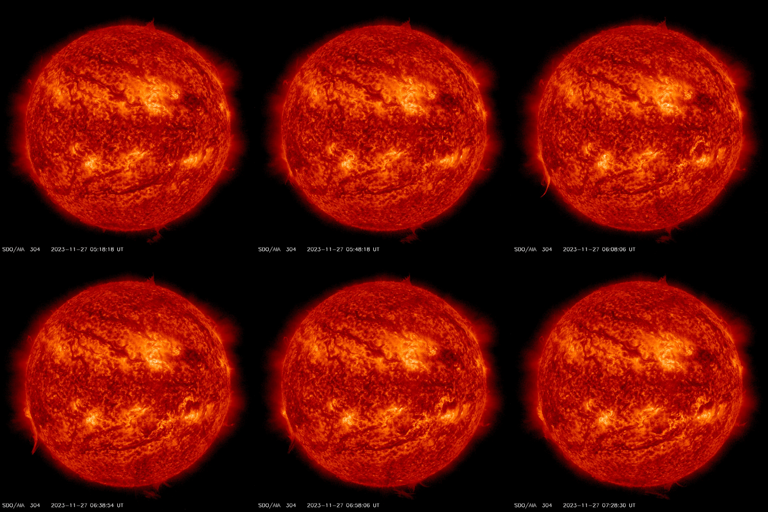
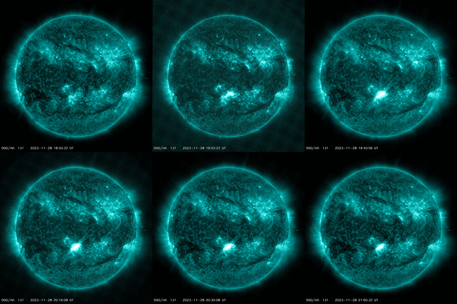
 Three and perhaps four CMEs are heading for Earth following a series of explosions on the sun this week. 

Estimated time of arrival: Nov. 30th and Dec. 1st. The biggest of the CMEs, launched on Nov. 28th, could sweep up some of the earlier, lesser ones, forming a Cannibal CME.


Monday, November 27, 2023

28th November 

Light rains 🌧 may continue in Pune and Sambhajinagar next 2/3 days.

Rainfall from yesterday's weather interactions

❖ Significant Rainfall Amount:

Mumbai Lakes (mm) Vaitarna 37, Tansa 47, Vihar 0, Tulsi 9, Upper Vaitarna 33, Batsa 56, Mid Vaitarna 31

➢ Madhya Maharashtra: (cms) Taloda (dist Nandurbar) 15, Jamner (dist Jalgaon) 9, Yaval (dist 

Jalgaon) 8, Nandurbar (dist Nandurbar) 7, Shahada (dist Nandurbar) 7, Shirpur (dist Dhule) 

7;

➢ Gujarat Region: (cms) Sagbara (dist Narmada) 14, Navasari_aws (dist Navsari) 13, Umerpada 

(dist Surat)12, Mandvi (dist Surat) 12, Kukarmunda (dist Tapi) 11, Kamrej (dist Surat) 10, 

Narmada_kvk Aws (dist Narmada) 10, Surat City (dist Surat) 9, Surat_kvk Aws (dist Surat) 

9, Netrang (dist Bharuch) 9, Nadiad (dist Kheda) 8, Nizer (dist Tapi) 7, Palsana (dist Surat) 

7, Ankleshwer (dist Bharuch) 7, Sankheda (dist Chhota Udepur) 7, Olpad (dist Surat) 7, 

Modasa (dist Aravalli) 7;

➢ Saurashtra & Kutch: cms :

Chuda (dist Surendranagar) 11;

➢ West Madhya Pradesh: Rama (dist Jhabua) 11, Niwali (dist Barwani) 11, Sendhwa(med) 

(dist Barwani) 11, Pansemal (dist Barwani) 10, Rajpur (dist Barwani) 10, Chachariyapati 

(dist Barwani) 9, Ranapur (dist Jhabua) 9, Badwani (dist Barwani) 9, Khargone-aws (dist 

Khargone) 8, Jhabua-aws (dist Jhabua) 8, Udaigarh (dist Alirajpur) 8, Warla (dist Barwani) 

8, Maheshwar (dist Khargone) 8, Kukshi (dist Dhar) 7, Pati (dist Barwani) 7, Kathiwada (dist 

Alirajpur) 7, Alirajpur (dist Alirajpur) 7, Bhagwanpura (dist Khargone) 7, Anjad (dist 

Barwani) 7, Jhirnya (dist Khargone) 7, Bhikangaon (dist Khargone) 7, Bhabhra (dist 

Alirajpur) 7, Sondwa (dist Alirajpur) 7, Gogawan (dist Khargone) 7;

➢ Marathwada:cms

 Purna (dist Parbhani) 9, Manvat (dist Parbhani) 8, Parbhani - Imd Obsy (dist 

Parbhani) 8, Jafrabad (dist Jalna) 7, Gangapur (dist Chh. Sambhajinagar) 7, Pathri (dist Parbhani) 7, Selu (dist Parbhani) 7;


Sunday, November 26, 2023

26th Evening:

Scenario 1:

In a rare turn of events, heavy thunderstorms occurred in Gujarat, Mumbai, and M.P....

The reason :

1.A Western Disturbance trough  dropping Southwards ( Due to sharp temperature gradient in the upper most atmosphere).👇


2. A severe confluence of 850 winds around East Gujarat region.👇


3. An Upper air trough from Maldives to (off) Maharashtra coast (Unseasonal), with an embedded Circulation in it.👇


4. Confluence of East-West Winds due to the "Line of Discontinuity, causing thunderstorms 👇


The inter action of these systems and their corresponding East/West winds resulted in the heavy rainfall in the regions

Scenario 2 ..the other side

The Low developing in the Bay( 27th) could develop , and may turn into a potential cyclone next week,,after 30th...to be watched and tracked.

26th November...The expected 

Pre dawn Thunderstorm lashes Mumbai 

TOP FIVE BMC RAINFALL AMOUNTS

Borivali Fire Station: 14.47 mm

Malwani Fire Stn    : 14.8 mm

Kandivali Fire Station: 13.71 mm

Andheri Fire Stn     : 12.7 mm

Bandra Fire Station: 11.94 mm

Colaba 9 mm

Scruz 5 mm

Continuous lightning flashes....reaching 19 flashes /minute.

Lightning flashes at around 19 /minute 😲

Continuous lightning flashes dangerous video by Vag. Salil..


Thursday, November 23, 2023

Unseasonal rains Special:
For Maharashtra and Gujarat - (continuing from the previous post)...

Mumbai: 
Unsesonal Rains in Mumbai may dampen the events and functions planned in open.
Hence adequate planning is advisable for outdoor events/activities. 

Total rainfall from 24th - 27th November may be between 30-60 mm. 

Heaviest rainfall for Mumbai/Navi Mumbai/Thane/Palghar regions (around 30 mm) is possible from Sunday evening to Monday evening and can be accompanied by thunder. 

Pune: Rainfall total from 24th - 27th November could be around 20-40 mm in Pune and PCMC regions. 
Planning for outdoor events should be done.

Ch. Sambhajinagar: Unseasonal Rains expected on 25th to 27th. Around 15 mms cumulative. 
Beneficial for standing Chana and Wheat.

Nashik: Hail may damage the Grapes in Nashik.

Rainfall from 26th will begin off the Maharashtra and Gujarat coast and spread eastwards into interior regions and also into Madhya Pradesh. 

Places in north Konkan, north Madhya Maharashtra (Nashik, Dhule, Nandurbar, Ahmednagar,Jalgaon), Marathwada (Ch. Sambhajinagar, Jalna) and Vidarbha (Buldhana, Akola, Amravati, Washim, Wardha, Nagpur) may receive hails during 26th-27th. 

Bharuch: Rainfall total from 25th - 27th November can be around 30-60 mm. Rain likely to be accompanied by thunder. 

Some places in Gujarat may receive hail.

Initial rains from tomorrow could be triggered by a typical Line of wind discontinuity or wind convergence feature (moisture laden southeasterlies meeting the moist Sea breeze from Arabian Sea).

Forecasted winds on 25th November.


But Sunday onwards, the Western Disturbance due to dipping Jet stream can lead to thundershowers with chance of hailstorms in some areas. 


Rainfall and cloud movement during 26th-27th likely to be from west to east or southwest to northeast associated with the movement of the trough in upper-level westerlies.                                        
   
 
Forecasted trough in the Jet Stream at 200/250 hPa by 26th November.

700 hPa winds forecasted for 26th November - good moisture inflow.

Akvan

 17th November  Current Intensity Analysis   UW - CIMSS ADVANCED DVORAK TECHNIQUE ...