Special Monsoon Watch :
An Upper Level trough is spotted in the South East Arabian Sea around Maldives/Lakhadweep Region.
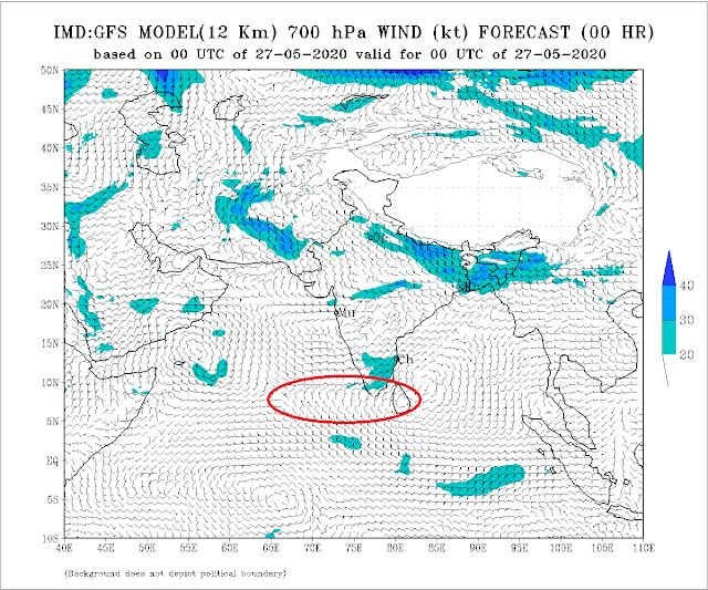 This could now evolve into a UAC and surface level low as explained yesterday, into a system.
Now, this Low ,AS-1 , is to be watched. Today, we have favourable Arabian Sea SST (30/31c) to strengthen the system. As explained, we have sufficiently warm waters in the Central Arabian Seas to help evolve good Cumulus clouds by reacting with the cooler water currents from the Somalia Currents.
AS-1 will form around 1st June. Then, the track and intensification is to be watched. Good track along a supportive Vortex in the off shore trough will help in Monsoon strengthening. but, a NW track , which will take place by High Ridge and WD resistance, will suck the moisture and currents away.
(Another completely separate system can form in the 55E region off South Oman coast by 31st)
But, as of today, the formation of the low is encouraging the Monsoon winds in the region.
 Good pre monsoon showers are recorded in Sri Lanka last 24 hrs.
Kukulaganaga 260 mms, Canawarella 60 mms, Badaragama 59 mms, Mellawa 57 mms, Moraliya-Oya 51 mms, Yatiyanthota 40 mms.
Rainfall expected to enhance as per Sri Lanka Met Dept.
----------------------------------------------------------------------------------
Reply to Query: Reliable Data can be obtained from Vagaries:
Vagarian Abhijit gives the Rainfall in Cherrapunji last 7 days
May 21st :94 mms, 22nd :213 mms, 23rd: 328 mms, 24th: 322mms, 25th:242 mms, 26th 195 mms, 27th: 244 mms = 1638 mms
An Upper Level trough is spotted in the South East Arabian Sea around Maldives/Lakhadweep Region.
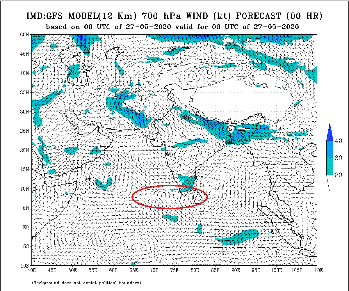
Now, this Low ,AS-1 , is to be watched. Today, we have favourable Arabian Sea SST (30/31c) to strengthen the system. As explained, we have sufficiently warm waters in the Central Arabian Seas to help evolve good Cumulus clouds by reacting with the cooler water currents from the Somalia Currents.
AS-1 will form around 1st June. Then, the track and intensification is to be watched. Good track along a supportive Vortex in the off shore trough will help in Monsoon strengthening. but, a NW track , which will take place by High Ridge and WD resistance, will suck the moisture and currents away.
(Another completely separate system can form in the 55E region off South Oman coast by 31st)
But, as of today, the formation of the low is encouraging the Monsoon winds in the region.

Kukulaganaga 260 mms, Canawarella 60 mms, Badaragama 59 mms, Mellawa 57 mms, Moraliya-Oya 51 mms, Yatiyanthota 40 mms.
Rainfall expected to enhance as per Sri Lanka Met Dept.
----------------------------------------------------------------------------------
Reply to Query: Reliable Data can be obtained from Vagaries:
Vagarian Abhijit gives the Rainfall in Cherrapunji last 7 days
May 21st :94 mms, 22nd :213 mms, 23rd: 328 mms, 24th: 322mms, 25th:242 mms, 26th 195 mms, 27th: 244 mms = 1638 mms


2 comments:
Great analysis as usual boss (y)
Thanks a lot..Yes source for reliable data is here.I agree.
Post a Comment