Tuesday, March 27, 2018

FLIP FLOP IN TEMPERATURES AT NORTH KONKAN..27 March 2018 (evening)

😊 In the state , Coastal North Konkan (Dahanu) was the coolest during the day (fine and breezy 29.6 c ) on 22nd March 2018  ..
😵Coastal North Konkan (Mumbai SCZ) was one of the hottest during the day (hot and very dry 41 c ) on 25th March 2018..
😨 Interior North Konkan (Karjat) jumped from 36 c to 45 c ..

→After the heat wave , coastal Konkan (Mumbai SCZ) has settled to a humid , breezy tropical weather at 33 c / 24 c today .. Expected to continue in the same vein during the week..

The Flip Flops during the past 5 days at Coastal (Mumbai SCZ ) and Interior Konkan (Karjat) - 

Monday, March 26, 2018

Mumbai being coastal station sees reduction in temp as sea breeze tried to peep in earlier today compare to yesterday. 

While Interior N. Konkan got roasted in heatwave with further rise in temp today and also witnessed highest temperature of 2018 till now !

Bhira town in Raigad Dist at base of Tamhini ghat was hottest place in India as recorded max of 45 today!! It is also a first 45 C mark temp of India for 2018.

Below Map will give the idea of how the temp behaved in N.Konkan today.


Map by Vagarian Tejas & Data input by Vagarian Abhijit


Sunday, March 25, 2018

Mumbai & Veraval both shared title of hottest place in India today at 41C!
Map by Vagarian Tejas & Data by Vagarian Abhijit

Mumbai SCZ records max temp of 41.0°C today which is hottest March day in last 6 yrs ! 
As previously record was of 41.3C in March 2011. 
Also it is a extreme heatwave as temperature was above normal by 8°C for this time of year!! And today max temp saw sharp rise of 7.8°C in just 24 hrs from yesterday's max of 33.2C!

Santacruz highest all time record for March is 41.7C on 28 March 1956

While Colaba at south tip of Mumbai saw max temp of 38°C today ! Which is also above normal temp by 6c & saw sharp rise by 6.5c in just 24 hrs from yesterday's max of 31.5C !


Friday, March 23, 2018

23 Mar 2018(morning)..Westerly winds effect ..
PARTS OF MAHARASHTRA COOL DOWN..


😊 HAPPY WORLD METEOROLOGICAL DAY 😊

→NORTH KONKAN coast was mild and breezy during the day
..Dahanu reported lowest max temp in the state @ 29.6 c 

..Mumbai reported wind gusts upto 40 kmph with max temp of 31 c (hum : 40%)

→WESTERN MAHARASHTRA was cool during the mornings
..Pune min temp @ 12 c 


→WESTERN GHATS were cold during the morning after a fine sunny day (30-32 c) , with reports of frost at Mahabaleshwar (Lingmala)
..Private AWS(unofficial) reported a chilly 3.3 c min temp at Mahabaleshwar today morning  .. Bopardi(lee area) reported a chilly 7.6 c ..Gaganbawda reported a cold 9 c .. Amboli reported a cold 10.6 c ..


😞Temperatures are expected to rise during next week throughout the state and the country heralding summer


Max / min temp in c (past 24 hrs ):
Delhi 31 /18  , Kolkata 35 /26 , Chennai AP 38 / 25 (humid)
Bengaluru 34 / 22 , Hyderabad 38 /21 


Kurnool 40 /26 , Manali 10 / 01 

Friday, March 16, 2018

Vidarbha Region in Maharashtra sees massive drop in maximum temperature due to cloudy skies condition triggered by remnant of Arabian sea system . 

Check image below for better viewing of max temp for today and 24 hrs change in 2nd column & departure in 3rd column were we can see departure are in huge negative  !


Source: IMD


Bangalore is getting lashed by Thunderstorm Rains from evening onward as LWD pattern is established with moisture incursion happening from fizzling low of Arabian sea ! Bangalore city has recorded 30 mms rainfall till 8.30pm with temp dropping to 20.6c.

Thursday, March 15, 2018

Posted Thursday Night 15th:

1. BB-1 has started weakening, and earlier than expected, it is downgraded to A Well Marked Low.
Tracking NW and weakening fast.
System will fizzle out in the Arabian Sea 
Mumbai was overcast on Thursday, with the high below 30c as expected...28.0c at Colaba and 28.4c at Sruz. Thursday afternoon and evening saw light rains in parts of Mumbai.
Friday will be cloudy and skies in Mumbai clearing by afternoon.
Pune will be cloudy on Friday.

Interior Maharashtra will get no rains from system after Friday evening.

Wednesday, March 14, 2018

Posted Wednesday 14th Night:

BB-1, Depression, at 8.4N and 72E. West off Kerala Coast...estimated core pressure 1006 mb. Tracking N/NW next 24 hrs. Weakening will start from Friday.
Rains expected along Kerala Coast. Coastal Karnataka  and N.I.K and commencing in Konkan and Madhya Maharashtra.
Mumbai will get light rains on Thursday evening and on Friday. Cooler day on Thursday with the day temperature below 30c. Pune will have a cloudy cool overcast day on Friday ...day around 25/26c.
164 mms rain in 12 hrs Wednesday in Minicoy, 27 mms in AminiDivi,. 3 mms in Mangalore.
Last 12 hrs accumulated rains map..


See Tamil Nadu Rain amounts Below....

First 200 mm rainfall of the year in India recorded in Thoothukudi as it breaks its all time heaviest 24hrs rainfall ever with 200 mm in just few hours beating the one day rainfall record set on 3rd December 1955, with 188 mm rainfall

Thanks to the Depression near Comorin - Lakshwadeep Sea, the first 200 mm rainfall of India in 2018 has been recorded. The rainfall recorded in Tamil Nadu in mm ending 8.30 am on 14.03.2018 are as follows. (min 20 mm) Thoothukudi District ------------------ Thoothukudi - 200 Kayalpattinam - 142 Srivaikuntam - 95 Tiruchendur - 82 Vaippar - 56 Keelaarsaradi - 54 Ottapidaram - 52 Ettayapuram - 49 Kayathar - 48 Kadambur - 45 Maniyachi - 40 Vilathikulam - 40 Surangudi - 38 Satankulam - 36 Vedanatham - 32 Tirunelveli District ----------------- Papanasam Dam - 190 Lower Papanasam - 146 Ramanadhi Dam - 130 Gadana Dam - 110 Servalar Dam - 102 Shencottah - 101 Gundar - 98 Kallidaikuruchi - 72 Thenkasi - 86 Manimuthar Dam - 68 Ambasamuduram - 67 Valliyoor - 67 Ayikudi - 64 Nanguneri - 60 Karupandhi Dam - 55 Kalakadu - 54 Kodumudi - 50 Adavinayanar - 50 Kadayanallur - 50 Cheranmahadevi - 46 Palyamkottai - 45 Keelapavoor - 42 Nambiyaru - 38 Tirunelveli - 31 Melaneelithanallur - 27 Sankarankoil - 25 Other district such as Dindigul, Kanyakumari, Virudhunagar others too got rains ------------------------------------ Lower Kodayar, Kanyakumari - 50 Kamatchipuram, Dindigul - 42 Mylaudy, Kanyakumari - 35 Kodaikanal Boat Club, Dindigul - 33 Kodaikanal, Dindigul - 31 Suralode, Kanyakumari - 32 Pillavakkal, Virudhunagar - 30 Kanyakumari, Kanyakumari - 29 Thuckalay, Kanyakumari - 27 Srivilliputtur, Virudhunagar - 25 Thiruppathisaram, Kanyakumari - 23 Upper Kodayar, Kanyakumari - 23 Kottaram, Kanyakumari - 22 Kuzhithurai, Kanyakumari - 22 Perunchani, Kanyakumari - 22 Kundha Bridge, Nilgiris - 21 Nagercoil, Kanyakumari - 20 Manjalar, Theni - 20 Mulanur, Tiruppur - 20 S.Pudur, Sivaganga - 20 Dharapuram, Tiruppur - 20 Aravakuruchi, Karur - 20

Sunday, March 11, 2018

Posted Tuesday Night:
BB-1 is now a Depression, at 6.5N and 75E....This could be well the first Depression in the Arabian Sea in March in many many years...See Vagaries blog of 21/22 March 2008 for similar conditions.
BB-1 likely to move N/NW.
Rains Likely in Coastal Karnataka, Goa by Thursday and in Pune by Friday.

Posted Monday Night:
1. Favourable MJO conditions in the Bay regions and a trough from the UAC towards the Bay Islands, prompted and hastened the formation of BB-1 at this time of the year. An Anti Cyclone in the Bay coincided with the Southerly location.
2, The anti Cyclone in the Arabian Sea, if it moves West, can make the BB-1 system track along/off the West Coast of India, off the coast till around 15N. This track is now a 25% probability.
3. Latest Location: Estimated at approximately 4.2N and 78.6E.

Konkan/Mumbai/Coastal Karnatak/Goa: Cloudy from Wednesday with light rains Thursday/Friday.
-----------------------------------------------------------------------------

Posted Sunday 11th March  Night:

BB-1 (the first system from Bay of 2018) has formed , and is now currently at 2N and 80E, South of Sri Lanka and India Southern tip.
System is a Well Marked Low, and will intensify upto Depression level by 14th March. BB-1 will track W/NW for 2 days and then NW . In its path, it will cross the Lakshdweep Islands. 
Very gusty winds and rough seas are predicted from Tuesday night over the Islands and off the Kerala Coast.Heavy rains also likely along Kerala coast and Lakshdweep Islands on 14th/15th March.
Due to existing Anti cyclone, 90% chance of the system fizzling out in the Mid Arabian Sea by 16th March.

On 15th March, Western Disturbance M-2 moves and brings heavy  rains in Kashmir, H.P. and moderate rainfall in the Punjab, Haryana, Delhi and West U.P.
Moderate rains in parst of NCR on 15th March, but getting hot before that.

Rains are likely along the West Coast of India on 15th March. Isolated light to medium rains likely in Madhya Maharashtra also.

Mumbai: Monday 12th and Tuesday 13th will be hot and sunny, around 36/37c...Wednesday will be partly cloudy and some light rains expected on Thursday 15th/ Friday 16th.
Entire Konkan coast and Goa likely to heat up to touch 40c at places on Monday and Tuesday. Light rains likely on 15th/16th....Light rains likely on 15th in Aurangabad.

A Line of Wind Discontinuity is likely to form along the Verical line thru the Southern Peninsula from the 16th. Pre Monsoon Thunder Showers likely from 19th /20th in Southern Peninsula. 

2nd week April will see good pre Monsoon Thunder Showers in the Interiors of Maharashtra and Interior Karnataka.

Saturday, March 03, 2018

Day Time Temperatures of 3rd March: India (from IMD)


And British Isle of 2nd March


For Information:....
Global climate trend since Nov. 16, 1978: +0.13 C per decade

February temperatures (preliminary)
Global composite temp.: +0.20 C (about 0.36 degrees Fahrenheit) above 30-year average for February.
Northern Hemisphere: +0.24 C (about 0.43 degrees Fahrenheit) above 30-year average for February.
Southern Hemisphere: +0.15 C (about 0.27 degrees Fahrenheit) above 30-year average for February.
Tropics: +0.03 C (about 0.05 degrees Fahrenheit) above 30-year average for February.

January temperatures (revised):
Global Composite: +0.26 C above 30-year average
Northern Hemisphere: +0.46 C above 30-year average
Southern Hemisphere: +0.06 C above 30-year average
Tropics: – 0.26 C below 30-year average
(All temperature anomalies are based on a 30-year average (1981-2010) for the month reported.)
Notes on data released March 2, 2018:

Compared to seasonal norms, the coldest spot on the globe in February was in northern Manitoba, Canada, near the Caribou River Park Reserve. Temperatures there were 5.95 C (about 10.71 degrees Fahrenheit) cooler than seasonal norms.

Compared to seasonal norms, the warmest place on Earth in February was northwest of Wrangel Island, in the East Siberian Sea. Tropospheric temperatures there averaged 6.89 C (about 12.40 degrees Fahrenheit) warmer than seasonal norms.


Thursday, March 01, 2018

Posted 1st March Night:

Officially the Summer Starts for Maharashtra and Mumbai (Peninsula Regions) from 1st March, yes, the season of hot days and humid nights.....But
We have seen a heat wave in the last few days of February, in fact, throughout the month of February, it has been above normal and warmer than usual in Mumbai and the Konkan region, including Coastal Gujarat.
But, as mentioned, the season changes from 1st March....and what's in store for Mumbai ? 
See below these February charts....


Now , there will be a fall in day and night temperatures from Friday. Weekend temperatures for Mumbai will be 2/3c lower and nights also lower by 2/3c....range should be 32/33-19/20c. 
North winds commence from Friday as M-1 moves in the North.
All the regions in Konkan and coastal Gujarat will see relief from Heat Wave.

Reason...


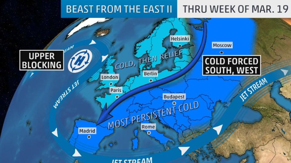
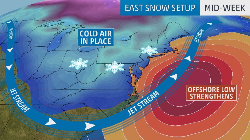
And ...Cold Spell in Europe...


Posted 6th Night: Mumbai:  7th - 12th October: Partly sunny in the day till late afternoon.  Thunder clouds forming from late afternoon in t...