Sunday, December 28, 2014

Maharashtra City Max, Min  and Rainfall . Max of 1st Jan and rain during day of 1st Jan

POONA                                        24.4(-4.6) 14.5( 4.0) 
LOHGAON                                  24.4(-5.6) 15.2( 3.2) 

 JALGAON                                   21.2(-8.0) 10.2(-1.4)          008.0
 KOLHAPUR                                23.8(-6.1) 17.8( 3.3)          000.2
 MAHABLESHWAR                     17.7(-8.1) 11.7(-1.3)
 MALEGAON                               21.0(-8.4) 16.4( 6.0) 
 NASIK                                        23.4(-5.1) 11.8( 2.1)           000.6
 SANGLI                                      24.7(-6.3) 17.7( 4.6)           008.0
 SATARA                                     23.0(-5.5) 15.2( 2.6) 
 SOLAPUR                                  30.3( 0.0) 18.6( 3.3) 

BOMBAY                                    26.0(-4.5) 19.6( 0.1)
Scz                                             27.3(-3.8) 15.8(-1.3) ALIBAG                                   26.1(-3.0) 17.5( 0.2) 

AKOLA                                     20.7(-7.9) 17.7( 4.5)              010.0
AMRAOTI                                29.2( 0.5) 16.4( 2.3)               005.0
BULDHANA                             18.5(-7.8) 16.3( 2.4) 

Chikhaldhara in Vidarbha measured 78 mms till 8.30 am Thursday.

Parts of Baroda got drizzles last night. Bharuch is experaincing showers at 6.30 pm IST on Thursday.
Bhopal saw a high of 14.2c on New year's Day...
Gwalior saw a high of only 13c and Bhopal 15.5c on the last day of 2014

Mumbai Weather Summary...2014 (From Rohit Aroskar)...See Mumbai Page and Rohit's Page

Posted Thursday 1st Morning...Vagaries' Forecasted....
New Year Eve Rainfall in Marathwada and Western Vidharbh...
31st Rainfall in Maharashtra...
As anticipated, the Marathwada region and Western Vidharbh got the rains and hail in some areas.
In West Vidharbh, Akola recorded a heavy 39.9 mms of rain, Buldana 23 mms and Yeotmal 15 mms on 31st. In Marathwada, Nanded saw 17 mms and Parabhani and Aurangabad 4 mms.


In Aurangabad, the rain started after the celebrations were over, around 1.30 am on 1st January, saving the New Year.
Nasik and Nagpur got traces of rain. Celebrations from being a damper.

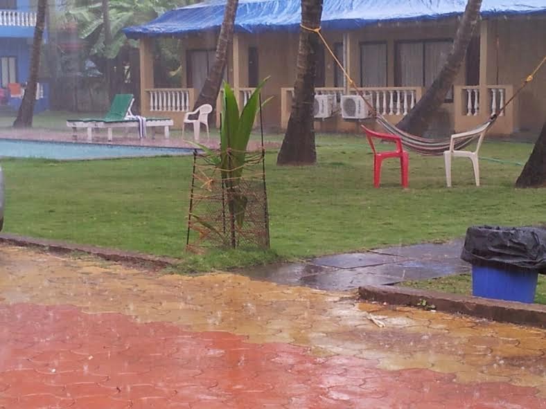
Some  regions of Goa too got showers. Vagarian RK Chaudhary informs of rain on 31st and sent this pic.


More later as we get more figures...


 ---------------------------------------------------------------------------------------------------------

Tuesday Night drizzles in Aurangabad...Mumbai gets partly cloudy. Predicted rains ( as given below in Monday post) on schedule in Marathwada and Madhya Maharashtra. Extending to West Vidharbh. Mumbai will get cloudy.

Mahableshwar Wednesday Morning Pic sent by Shiraz

BB-15 has tracked NE to 14N 86E...and likely to track NE and weaken due to resistance.Rains along Odisha coast and West Bengal coast.Decreasing from 1st.

Chennai rains decrease. Getting average 55-60 mms in 2 days as expected.


**** In the New Year, Vagaries is planning a well attended meeting. It is (almost) compulsory to attend this meeting. .
The Meeting is on 10th January, 5 pm,  and the venue is in South Mumbai. 
Please confirm on blog (comments) as early as possible, as I would like to see maximum attendance. All Vagarians from any place in India or abroad are welcome...
All must confirm .(as yes) by 4th January latest..****


--------------------------------------------------------------------------------------------------------------------------


Rainfall of Chennai during Monday 29th Daytime:
=======================
in mm
Minjur - 96 Puzhal Agro - 91 Ennore - 85 Puzhal - 65 Madhavaram - 64 Tharamani - 64
Nungambakkam - 54 Anna Univ - 42 Mylapore - 40  Sathyabama Univ - 37 Poonamalle - 36 Avadi - 35 Kolapakkam - 33 Meenambakkam - 29 (From Pradeep)

Posted Sunday 28th Night:

BB-15 !The sysytem now as a Low at 7.7N and 84E, is around 1006 mb. Seeing the behaviour of the upper level winds, I expect this system to deepen stage wise to depression and track towards the TN coast. BB-15 is then expected, after tracking along the coast, to weaken after Monday and fizzle out around 15N in the Bay.

29th December ; Heavy to Moderate Rainfall is expected : Along the North TN Coast. ( Chennai: Around 40-45 mms 29th Morning- 31st Morning). 
Light rains in Central TN.
30th : Heavy to Moderate Rains in Coastal AP. Moderate Rains in Coastal Odisha, TN and Kerala. Drizzles in Bangalore.

New Year EVE: 31st December: Heavy Rains in Coastal AP/Odisha. Vizag: Around 40 mms 30th morning-1st Morning). Coastal West Bengal gets heavy showers in many parts. Kolkata will gat a wet New Year Eve with showers in the evening. 
Moderate Rains in Interior Odisha and Parts of South Chattisgarh (Raipur: Upto 5 mms)).
Light showers in Aurangabad  , Ahmednagar, Jalna and Western Vidarbha (Akola). (Rains in Central India due to an inland trough ). Drizzles in Bangalore.

Very Cilly Night with around freezing temperatures in Punjab/Haryana, parts of NCR and Rajasthan.  

Mumbai will be pleasant and windy in the evening. Low at Santa Cruz around 16c and 19/20c at Colaba. Partly cloudy next few days after the 1st.
Goa will be partly cloudy with light showers in the night or 1st morning.
Pakistan Northern plains and Sindh to face very cold temperatures from 31st for 2/3 days. Around freezing in Sindh plains and Punjab.

New Year: 1st January 2015: Heavy Rainfall in Coastal West Bengal and adjoining Odisha. Kolkata gets showers in the day. Around 10-15 mms on 31st and 1st

Moderate to light showers and hails in Marathwada (Aurangabad : Around 20 mms in 2 days. Very cold day)), West Vidarbha (Akola), North Maharashtra (Hails) (Pune/ Nasik), Interior Karnataka (Belgaum) ( Bangalore: Showers on 1st around 15 mms in some parts), Hyderabad, Parts of South Gujarat Coast (Surat: Upto 3 mms), Baroda).
Cold Wave in all of Northern regions continue and intensify from 2nd January. Gujarat and Kutch get cold from 1st January.

As we had forecasted, the 200 hpa jet streams have taken the plunge, and dipped Southwards. Though earlier than forecasted by 1/2 days. 
Cold Conditions in NW India and Pak Punjab: The forecasted  freezing conditions prevailed over this region from 28th Morning itself. 

Some Low temperatures as on 28th Morning. List (prepared by Rohit Aroskar):
Panchmarhi dropped to -0.5c


In Pakistan, Islamabad dipped to 0c, Lahore to 2.7c.

Friday, December 26, 2014

Posted Friday Night: BB-15 

A Low has formed in the Southern Bay estimated at around 5.5N and 84.4E. In the 700 hpa trough now, expected to deepen from the current status and embed another Low (BB-15) in the 500 hpa trough by Sunday. 
Upper Jet Streams indicate a core around the TN coast. Meanwhile, in the Pakistan/NW India region, the 200 hpa jet streams are expected to get a Southward dip due to rushing in of Northern cool winds pushing in. 
Resultantly:
1a). The core in the jet streams of the Sub Tropical Ridge situated off the TN Coast will "move" Eastwards. The core, or the clockwise winds at 200 hpa, will circulate clockwise off the TN/AP coast. 
2b). The dipping of the jet streams Southwards, will take a "plunge" upto Sindh/Gujarat regions. 

Hence, due to 1a): The Low, BB-15, will strengthen, but will as a depression at around 998 mb, just miss and skirt along the TN coast and AP coast. Rainfall will be more concentrated in the waters. Chennai and TN coast will get rainfall from 30th. 
BB-15 will skirt the coast and move N/NE along the track.
Odisha can expect showers on Tuesday 30th.

2b): Will bring colder conditions in Northern Pakistan, Sindh, NW India and Rajasthan and Gujarat. All this from 30th December. Around freezing night temperatures from 30th in North Rajasthan, Punjab and Haryana. Similarly, very cold temperatures in Pak Punjab and Sindh.

Meanwhile, Saturday and Sunday will see rains in Southern TN . 

For Mumbai, Partly cloudy Saturday. The current pleasant nights will continue, and Weekend will see day around 32c, but a pleasant night with low around 15/16c. 
Pune will have a cool climate with partly cloudy Saturday and day at 26c. Lows around 9c.

Delhi. Days will be foggy, at around 17c. Sunday night will see a drop to 5c.
Chennai, rains increasing from Tuesday 30th.
Thunder showers expected in Thiruvananthpuram this weekend. Kochi will however be cloudy.

Tuesday, December 23, 2014

DEEP FREEZE

A must see for ALL..on Space News Page
 Fantastically Colorful Clouds Spotted in Arctic Stratosphere
POLAR STRATOSPHERIC CLOUDS:  Once seen they are never forgotten.

 (No photoshop and tampering done in any pic put up by Vagaries)

---------------------------------------------------------------------------------------------------------------------------------
Posted Tuesday 23rd Night: Night temperatures are expected to remain around 4-6c in most parts of the NCR  for the next 2 nights. 
Would expect a cold wave with temps at least 3-5c below the normal in Haryana, NCR and West UP next 2 nights. 
A slight let up in fog and rise in day temps for NCR to around 17/19c.

Mumbai minimum would be around the 13-15c mark next 2 nights. Fall expected again from 27th night in Mumbai.
Days would be around 31c next 2 days. 
Pune low at night would be around 10c.
A cold spell is expected in Saurashtra and Kutch from Wednesday 24th night for 2 nights thereafter.

A Low will form in South Bay on Wednesday. Will deepen and approach Chennai as a depression. Rains expected in Chennai on Sunday and Monday. As per current indications and the wind streams, system will weaken fast as it moves Northwards along the East Coast.

---------------------------------------------------------------------------------
From Arpit:
Maximum temperatures below 10c !!!
18 December
AMRITSAR: 8.4c

19 December
AMRITSAR: 8.7c

20 December
AMRITSAR: 8.7c
FEROZPUR: 8.7c
CHANDIGARH: 9.0c
AMBALA: 9.7c

21 December
SRIGANGANAGAR: 8.5c
PATIALA: 9.0c
KURUKSHETRA: 9.1c
PATHANKOT: 9.2c
SIRSA: 9.3c
KAPURTHALA: 9.4c
AMBALA: 9.6c

-----------------------------------------------------------------------------------------
Graphic from Rohit Aroskar

Thursday, December 18, 2014

CRAZY WEATHER - The heavy snowfall of Moscow...Crazy Temperatures of Yakutsk and Heavy Snow in Japan....See International Page

Very Low Temperatures in Delhi NCR on Monday morning (22nd) as expected
Hindon 1.9c, Najafgar 2.4c, Mungeshpur 3.0c, Narela 3.2c...Lodhi Road 4.1c and Safarjung 4.2c !!

Mumbai Santa Cruz was 15.2c and Colaba 20.0c.

Delhi NCR, After Low Day temps of 15c (S'Jung), Ridge 13.5c, Delhi Uni. 12.5c and Faridabad at 12.5c from yesterday's 17.8c, ....now  heading for very low temperatures Monday 22nd Morning...1/2c..

Super Super View of Noctilucent Clouds over South Pole...Space News Page

Satellite Image of Haze in the Kashmir Valley...How does it form ?...Current Weather Page

Very Low Temperatures in the Plains as on Saturday 20th December Morning....
Phulbani (Odisha): 1.4c* ( To be rechecked)
Khajuraho: 2.4c and Nazibabad: 3.0c.

In Pakistan: Islamabad 1.0c
Lahore Ap 3.5c

Early Snowfall in Towns of Uttarakhand.....

An intense cold wave gripped higher areas of Uttarakhand on 19th December after snowfall in the state. 
Four to five feet snowfall was recorded in the higher reaches, which were Badrinath, Kedarnath, Auli, Mandal valley, Munsiyari, Pokhri, Pithoargarh, and Gopeshwar.
Rare snowfall was witnessed at Phatta and Gopeshwar city (1300 mtrs ASL) after nearly a gap of a few years. There were reports of heavy snowfall in Bageshwar (1000 mtrs ASL) and Garud nearly after many years. The higher areas which of Kapkot, Champawat and Almora also received the season’s first snowfall.

-----------------------------------------------------------------------------------
Some General and Interesting International Weather Data...of Friday, 19th December 2014:...

Coldest in India: Leh  -15c.
Coldest in Pakistan: Kalat -5c
Coldest in Nepal: Jumla  -4c...Kathmandu was between 20.5c and 2c today.

Coldest in Asia: Ust Nera (Russia)  -51c
Coldest in North America: Stafansson I  -38c
Antartica Station Vostok recorded -40c. Indian station Maitri recorded a low of -3.2c.

Minimum wind Chill: Spence Bay Ap  -48.2c

Highest Pressure: 1084 mb at Claks Point , U.S.
Lowest Pressure: 974 mb  Mount Pleasant AP, South Georgia.

Hottest in Asia and India: Honavar  35.0c....
Hottest in Nepal : Simara AP  30c
Hottest in Pakistan: Gawadar 28c...

Additional Information : During the past 3 hrs prior to 10.00 pm IST, reports gathered showed 84 major Stations reporting very heavy rains, 31 stations reporting rains and 33 Stations reporting Thunder Storms throughout the World.

---------------------------------------------------------------------------------------------------
Low Day temperatures in Pak Punjab on Thursday 18th December:
Sialkot 9.2c
Sargodha  8.5c
Faisalabad 9.7c
Gujrat (Pak)  10.0c...This city recorded 1.8c as the minimum.

----------------------------------------------------------------------------------


Cold Day in Punjab as Amritsar day time temp dropped to 8.4c.....but higher as compared to the 2012 day-cold spell...see here for reference

3rd day of rains from the trough of low, TN rainfall ending 8.30 am on 19.12.2014

The trough of low at mean sea level over Comorin area and neighbourhood now lies over Comorin - Maldives area and adjoining southeast Arabian Sea.

in mm (min 15 mm)

Upper Kodayar - 75
Lalapet - 60
Kattumannarkoil - 50
Vedaranyam - 42
Venbavur - 33
Vadakadu - 32 
Papanasam Dam - 32
Palandurai - 28
Veppanthatai - 28
Tondi - 27
Sendurai - 27
Lakkur - 26
Andimadam - 26
Kolli Dam - 25
Chettikulam - 24 
Kamudhi - 23 
Mangalur - 23
Sivaganga - 22
Samayapuram - 20 
Kodavasal - 20 
Tozhudur - 19
Viralimalai - 19
Perambalur - 18
Srimushnam - 18
Avudayarkoil - 18
Lower Papanasam Dam - 17
Ramanathapuram - 17
Servalar - 16
Muthupet - 16
Kodaikanal - 16 
Uppiliyapuram - 16
Budalur - 16
Viralimalai - 15
Palani - 15
Kadavur - 15
Papansam T - 15
Natham - 15
M.Mathur - 15


Widespread rains from Trough of low for second day in coastal TN, ending 8.30 am on 18.12.2014

The trough of low at mean sea level over southwest Bay of Bengal and neighbourhood now lies over  Comorin area and neighbourhood.

in mm (min 20 mm)

Muthupet -  115
Adirampatnam - 85
Anaikaranchatram - 76
Bhuvangiri - 75
Kamudhi - 73
Peravurani - 72
Manamelkudi - 70 
K.M.Koil - 66
Tiruvarur - 66
Madukkur - 63
Lalapet - 62
Chidambaram - 60
Komaratchi - 60
Pandavaiyar Head - 58
Needamangalam - 57
Kodaikanal - 56
Lower Anaicut - 55
Kodavasal - 52
Vedaranyam - 51 
Andimadam - 51
Manjalar - 49
Ayyampettai - 48
Thiruthuraipoondi - 47
Neyvassal - 47
Mannargudi - 46
Pattukottai - 44
Parangipettai - 44
Thanjavur - 43 
Vallam - 43
Upper Kodayar - 42
T Palur - 42
Manamelkudi - 41
Karaikudi - 40
Devakottai - 40
Cuddalore - 36
Thirumarugal - 36
Vettikadu - 36
Sirkali - 34
Valangaiman - 34
Rameswaram - 33 
Kannangudi - 33
Annamalai Nagar - 33
Sethiathope - 32
Thiruvidaimaruthur - 32
Thuvakudi IMTI - 32
Kulasekkarapattinam - 32
Thiruppanandal - 31
Jayamkondam - 31
Karungulam - 31
Kothavachari - 31
Nagapattinam  - 30
Papanasam Thanjavur - 30 
Srimushnam - 30
Alangudi - 30
Bogalur - 29
Viralimalai - 29
Thiruvonam - 28
Tiruchendur - 28
Kumbakonam - 28 
Kallal - 27
Karaikal - 26
Kayalpattinam - 26
Orthanad - 26
Arimalam - 26
Sendurai - 25
Gandarvakottai - 25
Mudukulatur - 24
Pondicherry - 24
Tiruppullani - 24
Ramnad  Nicra - 23
Papanasam Dam - 23
Mayiladuthurai - 23 
Thirumanur - 22
Vanmahadevi - 22
Tirupathur Sivagangai - 22 
Pamban - 21
Pudukottai - 21
Tiruvaiyaru - 21
Annagramam - 21
Arantangi - 20
Aduthurai - 20
Satankulam - 20
Kadavur - 20
Thiruvarankulam - 20
Trichy Junction - 20
Gingee - 20
Tirumayam - 20
Budalur - 20
Chettykulam - 20
Tiruvadanai - 20
Ramanathapuram - 20
Neyveli - 20

Wednesday, December 17, 2014

After a cold day on Wednesday in Northern India, we see the day temperatures rising slightly on Tuesday. Amritsar saw a high of 13c on Wednesday. Expected low for Amritsar on Thursday is expected to touch freezing point.

Rainfall increasing in Chennai from 22nd and getting warmer in Central India this weekend. 
Mumbai with East winds will see the thermometer touching 32c again ....
Islamabad touched 1.5c and Gujrat (Pakistan) dipped to 2.5c on Wednesday morning, while the coldest night this season was a marginal lower at 2.4c...Wednesday morning Karachi was a cool 10.5c.

The weekend forecast will be put up on Thursday night.


Day Temperatures were below normal in Interior Mah on Wednesday 17th December....

 POONA                       24.9(-3.9)   11.4( 0.5) 
 LOHGAON                 25.1(-3.9)    12.5( 0.5) 
 AHMEDNAGAR        26.6(-3.0)    10.0(-1.3) 
 JALGAON                  24.2(-6.1)    09.0(-2.9) 
 KOLHAPUR              27.8(-1.9)   17.5( 2.7) 
 MAHABLESHWAR   22.5(-2.7)   11.7(-1.9) 
 MALEGAON             23.0(-7.1)   09.0(-2.4) 
 NASIK                       22.4(-6.4)   06.6(-3.8) 
 SANGLI                     27.6(-3.0)    17.1( 3.8) 
 SATARA                    24.3(-4.3)   12.7( 0.0) 
 SOLAPUR                 28.5(-1.8)   14.1(-1.1) 
OSMANABAD           24.1(-5.5)  10.8(-2.6) 
 AURANGABAD       24.8(-3.5)  10.6(-0.4)  

Chennai had traces of rains, a few light spells in some parts.
Lowest in Delhi NCR was Lodhi Road at 7.2c.Gurgaon low was 7.9c and SafdarJung at 9.0c.

Cuddalore district gets very heavy rain, TN rainfall ending 8.30 am on 17.12.2014

The trough of low at mean sea level over southeast and adjoining southwest Bay of Bengal now lies over southwest Bay of Bengal and neighbourhood

in mm (min 15 mm)

Parangipettai - 155
Kollidam - 76
Chidambaram - 69
Komaratchi - 55
Kumbakonam - 48
Annamalai Nagar - 44
K.M.Koil - 42
Aduthurai - 42  
Thiruvattur - 41
Mylaudy - 41
Mayiladuthurai - 40
Upper Kodayar - 33
Kottaram - 32
T.Palur - 31
Papanasam Dam - 30 
Thiruppanandal - 30
Thanjavur Taluk Office - 29
Sirkali - 28
Adyamadai - 28
Manjalar - 28
Bhuvanagiri - 28
Thiagadurgam -  28
Kothavachari - 27
Lower Anaicut - 27
Ayyampettai - 26
Vanmahadevi - 26
Papanasam Tanjore - 25 
Cuddalore - 25
Kammapuram - 25
Nallur - 25
Suralode - 24
Lower Papnasam Dam - 24
Thiruvidaimaruthur - 24
Vedaranayam - 24
Karuthancode - 23
Nanguneri - 23 
Tirukoilur - 23
Kalrayanhills - 23
Kandamangalam - 23
Vanur - 22
Veppur - 22
Boothapandy - 22
Lalapet - 20
Panruti - 19
M.Mathur - 19
Valangaiman - 18
Vallam - 18
Sembanarkoil - 18
Andimadam - 17
Sankarapuram - 17
Coonoor - 17
Kattumaylur - 17
Veppanthattai - 17
Anaikadangu - 17
Sathanur Dam - 16
Sethiathope - 16
Srivaikuntam - 16
Coonoor PTO - 16 
Karumkulam - 16
Aralvoimoizhi - 16
Thiruvonam - 16
Maddukkur - 15
Eraniel - 15
Alangudi - 15
Tirumayam - 15
Kunnandarkoil - 15
Srimushnam - 15
Pattukottai - 15
Adiramapattinam - 15


Vagaries Rainman

Monday, December 15, 2014

As Easterly Winds take over in the day from Tuesday, day temperatures expected to rise to 32/33c in Mumbai.Night temperatures expected to rise also.
Dry Weather expected in the Sub Continent, as the systems move away.
Light rains expected in parts of Chennai.
Next few Nights, the North will get cold nights.Delhi NCR may see the lows dipping to around 7/8c.

Pictures taken while flying over Matheran, Asia's only Auto mobile free Hill Station near Mumbai..see Mumbai Page

Papanasam records 400 mm from this easterlies spell, TN rainfall ending 8.30 am on 15.12.2014

The trough at mean sea level from southeast Arabian Sea to southwest Madhya Pradesh now runs from southeast Arabian Sea to north Madhya Maharashtra.  

in mm (min 5 mm)

Papanasam Dam - 66
Lower Papanasam - 50
Ambasamudram - 27
Servalar - 25
Kannadiyan - 24
Ottapadiram - 23 
Pandavaiyar Head - 23
Erode - 20
Needamangalam - 20
Sholayar Dam - 18
Parsons Valley - 17
Sathanur Dam - 15
Palayamkottai - 15
Mettur - 13
Ponnamaravathi - 13
Gudalur Bazar - 12 
Kovilpatti - 12
Palladam - 12
Erumaipatti - 12
Arantangi - 10
Kayathar - 9
Nallur - 9
Tiruppatur (S) - 9
Lalgudi - 8
Dindigul - 8
Kodaikanal - 7
Veppanthattai - 7
Tirunelveli - 6
Manimutharu - 6
Alangulam - 6
Paramathi - 6
Upper Kodayar - 6
Tattayyangarpettai - 5
Eravangalar - 5
Polur - 5
Uttukkuli - 5
Kangayam - 5
Manachanallur - 5

2nd day of heavy rains from WD in Himachal, ending 8.30 am on 15.12.2014

Western Disturbance (W.D.) as an upper air cyclonic circulation over Jammu & Kashmir and adjoining north Pakistan now lies over Jammu & Kashmir and neighbourhood extending upto 5.8 km above mean sea level with a trough aloft runs roughly along long. 74.0°E and to the north of lat. 25.0°N

in mm (min 15 mm)

Arki - 90
Nahan - 63
Gohar - 51
Sundernagar - 48
Rajgarh - 44
Mandi - 42
Jogindernagar - 39
Bhoranj - 38
Hamirpur - 38
Baldwara - 38
Sarahan - 37
Sunnibajji - 37
Kasaol - 37
Pandoh - 36
Kahu - 35
Kasauli - 33
Solan - 33
Kothipura - 30
Palampur - 28
Malraun - 25
Kandaghat - 21
Dharmashala - 18
Barsar - 17
Bajura - 15
Bhuntar - 15
Bhandal - 15
Majhouli - 15


Moderate Rains in Uttrakhand, ending 8.30 am on 15.12.2014

Western Disturbance (W.D.) as an upper air cyclonic circulation over Jammu & Kashmir and adjoining north Pakistan now lies over Jammu & Kashmir and neighbourhood extending upto 5.8 km above mean sea level with a trough aloft runs roughly along long. 74.0°E and to the north of lat. 25.0°N

in mm (min 10 mm)

Kasaya - 83
Mukteshwar - 73
Chamoli - 60
Pithoragarh - 49
Champawat - 45
Bharsar - 40
Almora - 20
Matela - 20
Josimath - 18
Jakholi - 17
Uttarkashi - 16
Haridwar - 10 


Kurudamannil records surprise heavy rains, Kerala rainfall ending 8.30 am on 15.12.2014

The trough at mean sea level from southeast Arabian Sea to southwest Madhya Pradesh now runs from southeast Arabian Sea to north Madhya Maharashtra.  

in mm (min 10 mm)

Kurudamannil - 111
Chengannur - 46
Mavelikkara - 39
Kollam -  36    
Mananthavady - 35
Ambalavayal - 31
Vythiri - 29 
Idamalayar - 17
Haripad - 15
Kuppady - 11
Kanjirappally - 10
Kozha - 10
Thariode - 10
 

Sunday, December 14, 2014

Easterlies give rains to TN for 5th day, ending 8.30 am on 14.12.2014

The trough at mean sea level from southeast Arabian Sea and adjoining Lakshadweep area to southeast Rajasthan now extends from southeast Arabian Sea to southwest Madhya  Pradesh across interior Maharashtra.

Lake areas of Chennai got good rains. Poondi got good inflows. Papnasam Dam gets around 350 mm from this system.

in mm (min 15 mm)

Thirukoilur - 89
Kelambakkam - 70 
Poondi -  70 
Hindustan University - 63
Thiruvalangadu - 60 
Kallakudi - 55
Kunnathur - 54
Polur - 53
Thiagadurgam - 52
Sankarapuram - 50
Kattankulathur - 49 
Papanasam - 46
Vandavasi - 47
T Palur - 47
Cheyyur - 46 
Manimutharu - 45
Nallur - 45
Keelpennathur - 41
Arakonnam - 39
Peranamallur - 39
Tiruvannamalai - 37
Kallakurichi - 37
Chinna Salem - 37
Thandarampattu -36
Madavaram - 36 
Sathanur Dam - 35
kattukuppam - 35
Kalasapakkam - 34
Gingee - 32
Chetpet -  32
Kadambathur - 31
Chidambaram - 30 
Kumbakonam - 30 
Tiruttani - 29
Arimalam - 29
Chinnakalar - 29
Poonamallee - 28 
Sholingur - 28
Nemili - 28
Thurinjapuram - 27
R.K.Pet - 26 
Eravangalar - 25
Kayalpattinam - 25
Thanjavur PTO - 25
Vellore - 24
Villivakkam - 23
Sriperumbudur - 23
Sethiathope - 22
Sholayar Dam - 20
Manalar - 20 
Thanjavur - 20
Arcot - 20
Alathur -20
Kalrayanhills - 19
Srimushnam - 19 
Pallipattu - 19
Pudukottai - 18
Kaveripakkam - 18
Valparai pto - 18
Pullambadi - 18
lluppur - 17
Tambaram - 17
Kaniyambadi - 17 
Ayyampettai - 17
Jawadhu Hills - 17
Ottapadiram - 16
Manjalaru - 16
Tiruvidaimarudur - 15
Ariyalur - 15
Vallam - 15
Puzhal - 15

Punjab gets its WD rains of the season, ending 8.30 am on 14.12.2014

Western Disturbance (W.D.) as an upper air cyclonic circulation over Jammu & Kashmir and adjoining north Pakistan and extending upto 3.1 km above mean sea level with a trough aloft runs roughly along Long. 72.0° E and to the north of 25.0°N Lat.persists.

in mm (min 15 mm)

Hosiyarpur - 79
Dayalpura - 75
Chandigarh - 74
Badi Kaoran - 56
Nabha - 55
Jlanadhar - 53
Balachar - 41
Ambala - 40
Saleran - 30
Fatehgarh Sahib - 30
Aur-Phambra Road - 32
Adampur - 24
Ludhiana - 23
Nawanshahar - 20
Gurdaspur - 19
Jagraon - 19
Mahurana - 18
Patiala - 17
Samana - 15

1st WD of the season pounds Himachal Pradesh, ending 8.30 am on 14.12.2014

Western Disturbance (W.D.) as an upper air cyclonic circulation over Jammu & Kashmir and adjoining north Pakistan and extending upto 3.1 km above mean sea level with a trough aloft runs roughly along Long. 72.0° E and to the north of 25.0°N Lat.persists.

in mm (min 30 mm)

Kandaghat - 88
Kasauli - 83
Nahan - 70
Banjar - 70
Sarahan - 68
Una - 60
Sundernagar - 60
Bangana - 60
Shimla CPRI - 58
Bhuntar - 56
Nauni - 55
Shimla - 54
Mandi - 52
Kothipura - 51
Barsar - 50
Kasol - 49
Chelsea - 41
Chamba - 41
Bharwara - 41
Udaipur - 41
Solan - 40
Malrun - 40
Dharamsala - 35
Kangra - 32
Majhouli - 31

Unseasonal Rain in Maharashtra for 3rd day, ending 8.30 am on 14.12.2014

The trough at mean sea level from southeast Arabian Sea and adjoining Lakshadweep area to southeast Rajasthan now extends from southeast Arabian Sea to southwest Madhya  Pradesh across interior Maharashtra.

in mm (min 15 mm)

Sakali - 55
Kingaon - 54
Mundgaon - 49
Wadgaon - 46
Sonwad - 35
Gorgawale - 33
Paratwada - 30
Bhuvasal - 30
Hated - 30
Chopda - 30
Pimpri - 30
Savada - 28
Kadgaon - 27
Patas - 24
Jalgaon - 23
Anjangaon - 22
Asoda - 21
Bhokar - 21
Erandol - 20
Shelapur - 19
Takalibhan - 18
Kedgaon - 18
Warwand - 18
Chapaner - 17
Anturli - 16
Dundage - 16
Ainpur - 15
Bamnod - 15
Hasanabad - 15


Unseasonal Rain Continues in Karnataka for 4th day, ending 8.30 am on 14.12.2014

The trough at mean sea level from southeast Arabian Sea and adjoining Lakshadweep area to southeast Rajasthan now extends from southeast Arabian Sea to southwest Madhya  Pradesh across interior Maharashtra.

in mm (min 20 mm)

Bandal - 103
Kadra - 53
Ulvi - 51
Heggadadevanakote - 47
Chikkakereyuru - 46
Barur - 44
Banavasi - 42
Dharma  - 40
Narayanpur - 38
Bharamasagar - 38
Naraganahalli - 36
Pandavapura - 36
Bankawadi - 31
Bidrahalli - 30
Sunkasal - 30
Halli
Yekkambi - 30
Hunsur - 30
Arebail - 28
Sirsi - 24
Hulikal - 22
Irsavado - 22
Eswaragere - 22
Tattihalla - 21
Karur - 20
Kodasally - 20
Kollur - 20
Yelkundele - 20
Bilichodu - 20
Badangod - 20
Vajrahalli - 20
Siddapur - 20
Taraka - 20
Kuppe - 20
Tanigebylu - 20
Siddapura - 20
Gersoppa - 20
Akheti - 20

South AP gets rain for 5th day, ending 8.30 am on 14.12.2014

The trough at mean sea level from southeast Arabian Sea and adjoining Lakshadweep area to southeast Rajasthan now extends from southeast Arabian Sea to southwest Madhya  Pradesh across interior Maharashtra.

in mm (min 20 mm)

Vampalle - 95
Mungalapalem - 73
Thirupathi Aero - 69
Karani - 65
Rayal Cheruvu - 61
Karakam Badi - 54
Suratpalle - 44
Pitchatur - 44
Vijayapuram - 40
ReniKunta - 36
Perumallapalli - 36
Gangudupalle - 35
Vedurukuppam - 30
Sri Bommaraju Puram - 30
Agarala - 29
Tirupathi - 26
Chinnagottigallu - 25
Sindurajapuram - 25
Kondakamarla - 25
Venkatarama Agraharam - 23
Penumuru - 22
Kalikiri - 20
Puthalapattu - 20
Pileru - 20
Kondakindapalle - 20
Puthanavaripalle - 20
Tirumalla - 20

Saturday, December 13, 2014

Cloudburst in Arakonnam, Tamil Nadu gets rains for 4th straight day, ending 8.30 am on 13.12.2014

The trough in the lower level easterlies from Lakshadweep area to north Gujarat now seen as a trough at mean sea level from southeast Arabian Sea and adjoining Lakshadweep area to southeast Rajasthan across east central Arabian Sea and Gujarat Region.

Dry region vellore district has got very heavy rains.

in mm (min 15 mm)

Arakonnam - 116
Kodanad - 78
Kodaikanal - 56
Sathanur Dam - 55
Tozhudur - 54
Kelservazhi - 54
Cheyyar - 54
Tiruttani - 50
Krishnagiri - 50
Vembakkam - 48
Mangalur - 44
Ayikudi  41
Uthangarai - 39 
Lower Anicut - 39
KV Kuppam - 39
T Palur - 38
Mettupalayam - 38
Thali - 38 
Tiruchendur - 36
Madhavaram - 36
Manalar - 35
Kulasekkarapattinam - 35
Tuticorin - 33
Lalapet - 32
Eravangalar - 32
Kallakurichi - 31
Satankulam - 31
Alangayam - 29
Jayamkondam - 29 
Kumbakonam - 29
Tiruvarur - 28
Thiagadurgam - 28
Hogenekal - 27
Kaniyambadi - 27
Paiyur - 26
Kelamangalam - 26
Kuppandham - 26
Andimadam - 26
R.K.Pet - 26
Lakkur - 25
Hindustan University - 24
Radhapuram - 24 
Papanasam Dam - 23
Virudachalam - 23
Sethiathope - 22
Jawadhu Hills - 22
Tirumayam - 22
Satyabama University - 22
Thirukoilur - 22 
Tiruvannamalai - 21
Karupandhi - 21
Keelpennathur - 21
Sholayar Dam - 20 
Harur - 20
Penucondapuram - 20
Needamangalam - 20
Sendurai - 19
Kalrayanhills - 19
Kothagiri - 19
Denkanikottai - 19 
Thenkasi - 18 
Thirumanur - 18 
Devala - 18
Bargur - 18
Pillur - 18
Coonoor - 18
Thoothukudi Port - 18 
Kottar - 18
Karamadai - 18
Rajapalayam - 17 
Ennore - 17
Gudiyatham - 17
Hosur - 17
Sankarapuram - 17
Mahabalipuram - 17
Kodaikanal Boat Club - 16
Kelambakkam - 16
Mayiladuthurai - 16 
Puzhal - 16
Bhuvanagiri - 16
Coonoor PTO - 16
Ponnamaravathi - 16
Nambiyaru - 15
Kunnandarkoil - 15
Adavinyanru - 15
Karimangalam - 15
Periyanaickenpalayam - 15
Shoolagiri - 15
Sembanarkoil - 15
Polundurai - 15
Nagercoil - 15
Kolli Dam - 15
Thanjavur - 15
Vallam - 15
Thiruchuzhi - 15
Tirupattur - 15
Bhoothapandy - 15
Pochampalli - 15

Hailstorm and heavy rains due to LWD in Maharashtra, ending 8.30 am on 13.12.2014

The trough in the lower level easterlies from Lakshadweep area to north Gujarat now seen as a trough at mean sea level from southeast Arabian Sea and adjoining Lakshadweep area to southeast Rajasthan across east central Arabian Sea and Gujarat Region.

in mm (min 20 mm)

Pune Chinchwad - 120
Visapur - 86
Mhasla - 85
Wagdari - 82
Gorgawale - 74
Jalgaon - 66
Bhira - 66
Pimpalgaon - 66
Alibag - 63
Harnai - 63
Dattawad - 61
Ainpur - 60
Bhokar - 58
Manerajuri - 57
Pune - 53
Chikalthana - 53
Asoda - 52
Marwad - 52
Pune Cagmo - 52
Pune Shivaji Nagar - 52
Vita - 51
Mehunbare - 48
Nevari - 47
Tasgaon - 43
Maindargi - 41
Pune Magarpatta - 38
Mangaon - 34
Dhule - 34
Pen - 34
Bamnod - 32
Muktainagar - 31
Pune NDA - 30
Mumbai Colaba - 30
Deopur - 30
Savada - 30
Takalibhan - 30
Borale - 30
Savalaj - 30
Bhokardan - 30
Malegaon - 29
Shendi - 27
Nijampur - 25
Talegaon - 25
Nighoj - 25
Karajagi - 25
Soygaon - 25
Kopergaon - 25
Dhule Khede - 24
Kasbevani - 23
Hasanabad - 23
Phulambri - 23
Shibalapur - 22
Kopargaon - 22
Malkapur - 22
Narangwadi - 22
Mahalgaon - 22
Bharadi - 22
Aland - 22
Niphad - 21
Warkheda - 21
Suregaon - 21
Akkalkot - 21
Rawande - 20
Vinchur - 20
Shirol - 20
Dindori - 20
Hated - 20
Dhad - 20
Kannad - 20

LWD caused by Easterlies give super rains to Karnataka, ending 8.30 am on 13.12.2014

The trough in the lower level easterlies from Lakshadweep area to north Gujarat now seen as a trough at mean sea level from southeast Arabian Sea and adjoining Lakshadweep area to southeast Rajasthan across east central Arabian Sea and Gujarat Region.

Karnataka is one lucky state it gets rains in winter, summer, SWM and NEM

in mm (min mm)

Chigateri - 193
Ittigi - 167
Belur - 101
Hadagali - 101
Bannur - 82
Walmi - 80
Siddapur - 77
Rantur - 73
Bellatti - 71
Kirwatti - 67
Dummawad - 66
Mugavalli - 58
Morab - 58
Byahatti - 58
Belwadi - 55
Khanapur - 54
Iyyanahalli - 52
Khanapur - 52
Indabettu - 50
Gersoppa - 50
Haliyal - 50
Badami - 49
Chikanandi - 48
Maradi Shivapur - 48
Harapanahalli - 48
Gokak - 46
Kakhandaki - 46
Athani - 45
Joldal - 40
Lakshmeswar - 40
Kittur - 40
Sandur - 40
Hiroli - 40
Ayyanhalli - 40
Chandragutti - 40
Amasebail - 40
Chikkabommanal - 40

Friday, December 12, 2014

Karanataka gets unseasonal rain for 2nd day, ending 8.30 am 0n 12.12.2014

The trough in the easterlies from Comorin area to southwest Madhya Pradesh now runs from Lakshadweep area to north Gujarat across east-central Arabian Sea and extends upto 2.1  kms a.s.l.

in mm (min 20 mm)

Doddabathi - 103
Yeradona - 79
Emmiganur - 75
Haralahalli - 69
Hallur - 68
Govinakovi - 65
Harihara - 58
Kondajji - 51
Tyagali - 38
Sampakanda - 37
Malebennur - 37
Tamba - 32
Jalihal - 31
Sasvehalli - 30
Kampli - 30
Channgiri - 30
Tammenahalli - 29
Itkal - 29
Sindhanur - 29
Siddapura - 28
Kuppelur - 27
Gurmatkal - 27
Gangavathi - 27
Karur - 26
Gurumittkal - 25
Banavasi - 23
Honnali - 23
Kurikuppa - 23
Gorebal - 22
Holalur - 22
Salgunda - 20
Shimoga - 20

AP gets rains for 3rd consecutive day, ending 8.30 am 0n 12.12.2014

The trough in the easterlies from Comorin area to southwest Madhya Pradesh now runs from Lakshadweep area to north Gujarat across east-central Arabian Sea and extends upto 2.1  kms a.s.l.

in mm (min 20 mm)

Ellutla - 115
Somasila - 84
Mangapatnam - 73
Torrivemula - 69
Ongole - 68
Bommavaram - 56
Kothapatnam - 55
Suruvepalle - 46
Reddi Cherla - 42
Pantapalem Epuru - 38
Marlupalli - 37
Letapalle - 33
Talamanchi_Patnam - 31
Chinnachepalle - 27
Throvagunta - 27
Chinthavaram - 26
Narpala - 25
Vontimitta - 25
Dhodium - 25
Gooty - 24
Ananthasagaram - 24
Mukthinutala Padu - 23
RsKodur - 23
Jaladanki - 22
Kondapuram - 22
Taticherla - 20
Ayyapareddypalem - 20
Yakasiri - 20
Lingampalle - 20
Karedu - 20
Tadimarri - 20
Vijayapuram - 20
Seetharampuram - 20
Darsigunta Peta - 20

TN gets rains for 3rd day, ending 8.30 am 0n 12.12.2014

The trough in the easterlies from Comorin area to southwest Madhya Pradesh now runs from Lakshadweep area to north Gujarat across east-central Arabian Sea and extends upto 2.1  kms a.s.l.

in mm (min 10 mm)

Papanasam - 53
Nanguneri - 44
Lower Papnasam - 41
Manimutharu - 34
Tiruchendur - 24
Ambasamudram - 23
Chennai AP - 22
Servalar - 21
Parangipettai - 20
Puzhal - 20
Kolapakkam - 17
Taramani - 17
Poonamalle - 14
Thiagadurgam - 14
West Arani - 14
Cuddalore - 14
Anna University - 14
Annagramam - 14
Cheranmahadevi - 13
Madhavaram - 13
Chennai - 12
Manapparai - 12
Chembarabakkam - 12
Mayiladuthurai - 12
Nallur - 12
Coonoor - 11
Thoothukudi Port - 11
Hindustan University - 11
Tozhudur - 11
Tamaraipakkam - 10
Jawadhu Hills - 10
Bhuvanagiri - 10
Kunnathur - 10
Avadi - 10
Virudhachalam - 10
Neyveli - 10
Panruti - 10
Gudalur Bazar - 10
Periyanaickenpalayam - 10

Papanasam Dam's record 2014 continues, TN rainfall ending 8.30 am on 11.12.2014

The trough of low at mean sea level over southwest Bay of Bengal off Sri Lanka - Tamil Nadu coasts persists. Papanasam Dam recorded over 400 mm in May this year. It had an excess Pre-monsoon, on par SWM and now an excess NEM. It has got rains all around the year.

Ningiris has been getting heavy rains, for 2nd day Coonoor has got very heavy rains. Due to some server problem, IMD Chennai has not updated their Daily Weather Report. Hence, this should be an useful one.

The water level in various dams was (in feet): Papanasam 142.15 (maximum level is 143), Servalar 147.96 (156), Manimuthar 105.75 (118), Gadana 82.50 (85), Ramanadhi 79.25 (84), Karuppanadhi 61.52 (72), Gundar 36.10 (36.10), Vadakku Pachchaiyar 42.25 (67), Nambiyar 22.96 (25), Kodumudiyar 40 (57) and Adavinainar 94 (142).

in mm (min 10 mm)

Servalar - 205
Papanasam Dam - 157
Mukurthy - 120
Coonoor - 93
Tiruchendur - 78
Kannadiyan Anicut - 77
Avinasi - 73
Lower Papanasam - 72
Kadambur - 69
Palaymkottai - 61
Manimutharu - 60
Alankulam - 54
Pehumpahallah - 53
Ayikudi - 51
Uthagarai - 50
Mettur - 43
Thenkasi - 43
Pillur - 39
Redhills - 37
Tirunelveli - 36
Chennai AP - 35
Karukulam - 33
Vallam - 33
Ambasamuduram - 33
Ariyalur - 33
Vettaikadu - 32
Kelambakkam - 32
Lower Kodayar - 31
Tamaraipakkam - 31
Keelsaradi - 31
Cholavaram - 30
Tiruppur - 30
Taramani - 29
Perundaurai - 29
Ennore - 27
Krishnagiri - 27
Ottapadiram - 26
Cheranmahadevi - 26
Ramnadhi - 25
Thirukattupalli - 24
Kundha Bridge - 23
Virudhachalam - 23
Kulasekarapattinam - 21
Sencottah - 21
Adavinayar - 20
Karupandhi - 20
Manalar - 20
Ervangalar - 20
Avalanche - 20
Puzhal - 20
Surangudi - 19
Nanguneri - 19
Gundar - 18
Kadanadhi - 18
Mullankivillai - 18
Emerland - 18
Madhavaram - 18
Bhavani - 18
Sandyanallah - 17
Dharapuram - 16
Guindy - 16
Mylady - 14
Chennai - 14
Kolapakkam - 14
Upper Bhavani - 14
Bodi - 13
Erode - 13
Upper Kodayar - 12
Chettykulam - 12
Uthukottai - 12
Sholayar Dam - 12
Peruruvani - 12
Villathikulam - 12
Kodimudiyaru - 12
Thiruparappu - 12
Lower Glenmorgan - 12
Periyar - 12
Kalugumalai - 11
Veerakeralamputhur - 10
Sankarankovil - 10
Thalvadi - 10
Chembarabakkam - 10
Bhavanisagar - 10
Chittar I - 10
Periyakulam - 10
Penncondapuram -10
Nagercoil - 10
Moyar - 10
Senthurai - 10
Korattur Anicut - 10
Pattukottai - 10
Budalur - 10
Gobichettypalayam -10
Kadamparai - 10
Pykara - 10
Glenmorgan - 10
Parsons Valley - 10
Adirampattinam - 10
Poondi Lake - 10

South AP gets heavy rain for 2nd day, ending 8.30 am on 11.12.2014

The trough of low at mean sea level over southwest Bay of Bengal off Sri Lanka - Tamil Nadu coasts persists.

in mm (min 40 mm)

Sriharikota - 133
Butchireddypalem - 97
Kovur - 92
Ithampadu - 76
Kasumur - 67
Kaligir- 67
Chinthavaram- 65
Gouravaram - 61
Nellore - 58
Vinjamur - 56
Ayyapareddypalem - 53
Jaladanki - 52
Ashnapuram - 50
Vidyanagar - 50
Kavali - 49
Sangam - 49
Indukurapet - 47
Katepalli Madhavanagar - 46
Chouta Bheemavaram - 46
Pantapalem Epuru - 44
Kondagunta - 41
Dagadarthi - 40
Gottigundala - 40
Dubagunta - 40
Tada - 40
Ojili - 40
Chillakur - 40
Kondapuram - 40

Kerala gets heavy rain after a long break, Rainfall ending 8.30 am on 11.12.2014

The trough in the lower level easterlies from Comorin area to southwest Madhya Pradesh across Lakshadweep, coastal Karnataka and interior Maharashtra persists.

in mm (min 20 mm)

Neyantikkara - 99
Piravom - 91
Velayani - 85
Perumkadavilla - 68
Perumbavur - 66
Trivandrum AP - 57
Trivandrum - 53
Kochi CIAL - 50
Madupattey - 45
Peermade - 44
Taliparamba - 42
Pambla - 39
Munnar - 35
Cheruthazham - 32
Neeriyamangalam - 30
Thodapuzha - 30
Kannur - 29
Mattanur - 25
Manjeri - 25
Nilambur - 24
Peringamala - 24
Vythri - 23
Chengannur - 22
Irukkur - 22
Hosdurg - 22
Mavelikkara - 21
Chalkudy - 20
Kuppady - 20
Kottayam - 20
Sengulam - 20
Vaikom - 20
Idukki - 20
Thariode - 20
Idamalayar - 20

Easterlies extend into Karnataka, Unseasonal Rainfall ending 8.30 am on 11.12.2014

The trough in the lower level easterlies from Comorin area to southwest Madhya Pradesh across Lakshadweep, coastal Karnataka and interior Maharashtra persists.

in mm (min 30 mm)

Amruthur - 93
Nalkeri - 92
Rae - 87
Koila - 75
Annuru - 74
Kodambadi  - 68
Huliyurdurga - 60
Sunkathonnur - 58
Srimangala - 57
Kuruchu - 46
Bailur - 45
Kenchamman Hoskota - 42
Hosanagar - 42
Kalavara - 42
Bindiganavole - 40
Dudda - 39
Sunkasale - 37
Sasalu - 37
Basaralu - 36
Sangabettu - 35
Pandavapura - 35
Keragodu - 34
Varana - 34
Kowdle - 32
Srirangapatna - 32
Puttur - 31
Chintamani - 31
Sukravarsanthe - 30
Bantwal - 30
Hulukunte - 30
Belthangady - 30
Kundapur - 30
Agalakote - 30
Hulimangalahosakote - 30
Haunsbhavi - 30
Nuggehalli - 30
Mysore - 30
Lingarajachatra - 30
Melkote - 30
Mani - 30    
Honakere - 30

Thursday, December 11, 2014


Nilgiris and Tirunelvei gets a beating as Rains lash TN after a break, ending 8.30 am on 10.12.2014

The trough of low at mean sea level over southwest Bay of Bengal off Sri Lanka coast now lies over southwest Bay of Bengal off Sri Lanka - Tamil Nadu coasts.

The trough in the lower level easterlies from southeast Arabian Sea to southwest Madhya Pradesh now extends from Comorin area to southwest Madhya Pradesh across Lakshadweep, coastal Karnataka and interior Maharashtra.

Pillur dam records over 100 mm and entire nilgiris gets widespread rain. Chennai too got its 1st spell after a long break. As usual the record season for Tirunelveli and Papanasam continues.


in mm (min 5 mm)

Pillur - 136
Coonoor - 70
Coonoor PTO - 69
Papanasam Dam - 64
Lower Papanasam Dam - 50
Servlar - 43
Madavaram - 42
Kothagiri - 30
Sivagiri - 26
Ambasamudram - 26
Manalar - 25
Mahabalipuram - 22
Pegumbahallah - 19
Hindustan University - 18
Sivaganga - 18
Periyanaickenpalayam - 18
Arantangi - 17 
Tirunelveli - 17
Palayamkottai - 16
Ketti - 15
Chennai Marina DGP office - 14
Manimutharu - 14 
Kundha Bridge - 12 
Red Hills - 11
Chennai City - 11
Kancheepuram - 11
Kuzhithurai - 11
Ayikudi - 10
Mettupalayam - 10
Erode - 10
Panchapatti - 10 
Eravangalar - 10
Parsons Valley - 10
Porthimund - 10
Vilupuram - 10
Manamadurai - 9 
Sendurai - 9
Illayangudi - 9 
Cholavaram - 9
Mannargudi - 9
Jayamkondam - 8
Ariyalur - 8 
Ooty - 8
Thiruchendur - 8
Thanjavur - 8
Cuddalore  8
Avalanche - 8
Manapparai - 7
Emerland - 7
Ulunderpet - 7
Sandyanallah - 6
Mukurthy - 6
Perambalur - 6
Chennai AP - 5
Lower Kodayar - 5
Upper Bhavani - 5
Valparai - 5

Much Need rains for Nellore, ending 8.30 am on 10.12.2014

The trough of low at mean sea level over southwest Bay of Bengal off Sri Lanka coast now lies over southwest Bay of Bengal off Sri Lanka - Tamil Nadu coasts.

in mm (min 5 mm)

Nellore - 131
Nellore AWS - 110
Sullurpuet - 95
Tada - 47
Sri Harikota - 24
Venkatagiri - 23

Sunday, December 07, 2014

Monday, December 01, 2014

Author's Views:                                        

The Comment below this Article, the One from Muhammad Waqas from Pakistan, is a must "to read" and is an observation from a weatherman in the true Vagarian Spirit. Such comments will go a long way in strengthening relations across International Borders, as the reader has rightly realised and observed that Weather knows no boundaries. 
I truly appreciate and thank Waqas for the insight and maintaining Vagaries as a bonding between the Global Weathermen.

I will be travelling for the next 12 days. Vagaries will be updated efficiently by the other Authors as Usual.


--------------------------------------------------------------------------------------------------------------------------
Posted Monday Night: (1st December)

Since around mid November, the 200 level Sub Tropical Ridge has positioned itself along the West -East line from East Coast of India to Myanmar. With the core off the AP coast. As a result, we have seen the jet streams at that level rotating clockwise  over the Sub Continent region, establishing a "High" and a resultant dry and above normal weather in most areas.
Even at the lower levels at 500 and 700 hpa, the high pressure  has stabilised, and the strong jet streams have prevented the formation of any major WDs.

Dry winds and low low dew points have prevented the formation of the usual fog in the North.

Also as a result, the upper level air temperatures at 850 and 700 levels have been proportionately higher...around 16c at 850 hps...That's high !

Absolute dry weather next few days till Thursday (at least) over the entire Sub Continent region. Do not see major fog forming in the Northern plains soon.

Tuesday 2nd, Wednesday 3rd  and Thursday 4th:

Mumbai:  Few clouds and days around 34/35c. Nights around 19/20c at SCruz. ( Mumbai and Badlapur Pics on Mumbai Page)

Pune: Days around 29c with almost clear skies on Wednesday and Thursday. Tuesday morning low will be 13c, gradually reducing to 11c on Wednesday.

Delhi NCR: Dry and low humidity ( < 45%) will prevent major fogging. Though days will drop slightly to 27c. Nights around 11c. 

Chennai: The city did not receive the expected amount of rains last weekend. Only 2 or 3 mms was measured. Now, as with the rest of the region, weather will be dry.

Badlapur max & min temp presentation in graph for Nov 2014...by Abhijit Modak on Mumbai Page

Forecasted East rough  Let's look into the 3rd week of March ( 17th - 21st). Mumbai : Hot weather likely for Mumbai region this week, ty...