Pune Scene on Thursday evening..cr.Vag Gokul
And this shot👇 by Proff. R. Kelkar Ex Director General, IMD from Pune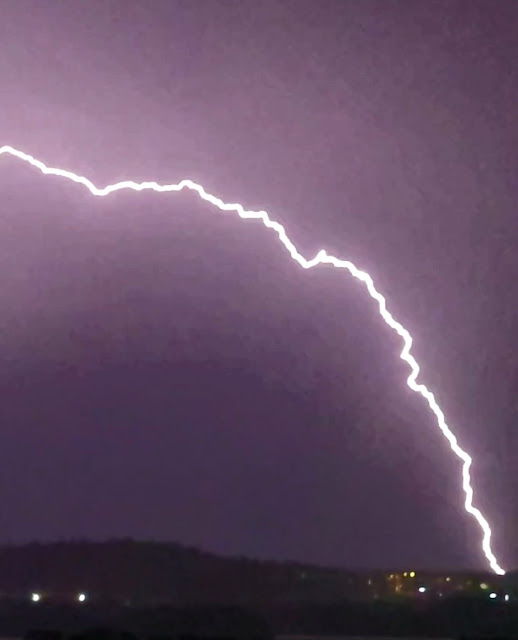

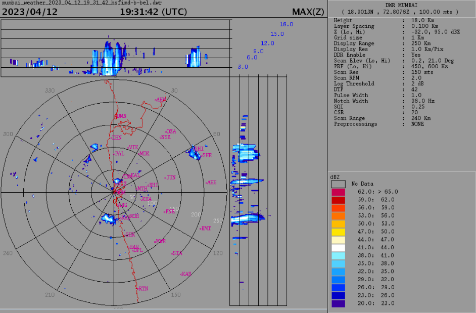
Rainfall areas of Mumbai on 12th night/13th early hours

Posted 12th night:
Mumbai region to see some rain/thunderstorms in some regions next 3 days and tonight!
Doppler Radar image showing some thundercloud development around western suburbs and parts of eastern suburbs.
Rains can be localized and not well distributed.
Some rainfall readings (in mm) for post-midnight Mumbai Rains:
Malwani 24.9
 (Data credits: MCGM)

Konkan region to see some thundery activity for next 3 days till 15th April.
Malwani 24.9
Goregaon 16.5
Borivali 18.8
Andheri E 16.7
Marol 13.9
Chincholi Fire stn 11.9
Kandivli 11.4
Versova 8.1
Malad W 8.3
Dahisar 5 mm
Most of the Mumbai rainfall concentrated over western suburbs!
Strong trough in 200 hPa jet stream over Arabian Sea will create upper-level divergence.
Low-level convergence from existing Line of Wind Discontinuity will be enhanced...so good conditions for towering clouds to develop along parts of konkan, Ghats and Madhya Maharashtra.
Model forecast for 250 hPa jet stream for 14th April shown below:
Konkan region to see some thundery activity for next 3 days till 15th April.


No comments:
Post a Comment