30th March Weather 👇
Weather outlook till Friday 31st March -
As we calculated in mid March after the Heat spell, remaining days of March stayed below 40c in India...And this may continue for another week..as
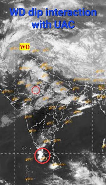
Another Strong Western Disturbance with trough dipping south on the way!
Effects of the new WD will start from today onwards.
Gujarat: Rain/thundershowers likely in Kutch and Saurashtra on today 29th and tomorrow 30th March.
Ahmedabad region may get some patchy rain on 30th.
Surat, Bharuch, Baroda may see some cloudiness, light showers may be possible in some areas on 30th and 31st.
Maharashtra: Some clouds and patchy drizzle/light showers for north konkan, possibly reaching Ghats.
Mumbai, Dahanu/Palghar, Thane regions may see some clouds with light showers (in some parts) around 31st March. Max temperature around 32-33C near coast, 34-35C in interior konkan, min around 22C.
Pune: Strong west breeze during 30th-31st, max/min around 35C/16C.
Westerly winds can be strong on 30th and 31st March for entire western Maharashtra.
Light showers possible in some areas of Nashik, Nandurbar, Dhule, Jalgaon districts around 31st March.
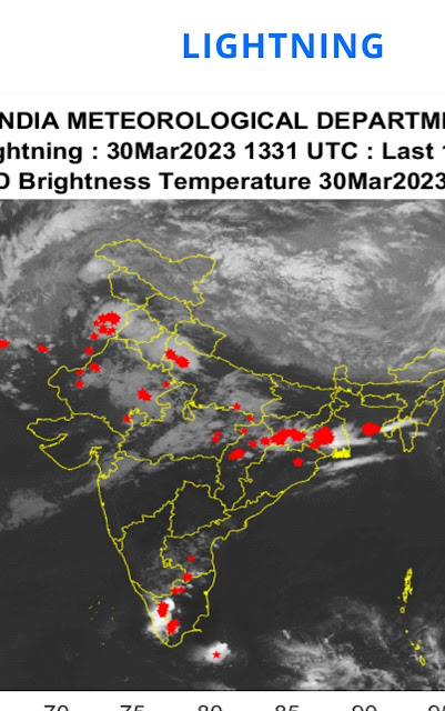
Rajasthan and Punjab may get some rain/thunderstorms from today 29th onwards. Heaviest precipitation for northern plains, including Uttar Pradesh during 30-31st.
Delhi NCR - Thunderstorms with chances of hail likely during 30th-31st March.
Rain/hail in low-mid ranges of Himalayas, snow in higher elevations from today 29th March - 1st April.
East coast - The pre-monsoon/summer thunderstorms - 'Kalbaisakhis' likely for Odisha, West Bengal, Jharkhand and Chhattisgarh regions. Parts of coastal Andhra Pradesh to get some rain/thundershowers.
Still analysis of SWM data is being done, and will give our views on SWM soon.


No comments:
Post a Comment