Posted 13th Evening....:
Thunder clouds developed and formed in the Eastern townships like Kalyan, Badlapur and Navi Mumbai on Monday afternoon.
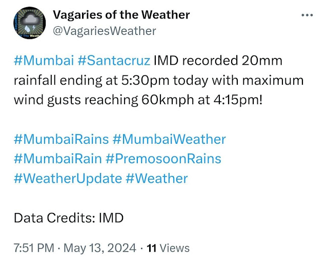
In a sudden development, the thundery clouds drifted towards Mumbai, and due to the fierce intensity of the cloud, a strong "downdraft" roared downwards into the city and suburbs. The winds in gusts touched 60-70 kmph, like cyclonic winds.
Many parts of city were covered with dust due to the gales.
Few places in North, Eastern and Central Mumbai got the pre monsoon showers as expected.
Prominent rains till 5 pm : Badlapur 40 mms, Airoli 30 mms, Kopri IITM 28 mms, Marol 11 mms, Virle Parle 7 mms, Vagaries club 6 mms
Badlapur witnessed cyclonic winds at 106 kmph due thundery clouds at a height of 18kms..( 55000 feet)!
Mumbai rains in colour code as on 8.30 pm


3 comments:
Any rain reports in dhaisar phalghar belt
Credit Australian government Bureau of metereology
Issued Tuesday 14 May 2024
The latest Climate Driver Update and Climate Model Summary are now available on our website.
La Niña Watch—some signs of La Niña formation later in 2024
The El Niño–Southern Oscillation (ENSO) is currently neutral. There are some early signs that a La Niña might form in the Pacific Ocean later in 2024. As a result, the Bureau's ENSO Outlook has shifted to La Niña Watch. When La Niña Watch criteria have been met in the past, a La Niña event has subsequently developed around 50% of the time. There is about an equal chance of neutral ENSO conditions in the same outlook period.
Sea surface temperatures (SSTs) in the central Pacific have been steadily cooling since December 2023.
This surface cooling is supported by a significant amount of sub-surface cooling in the central and eastern Pacific. Recent cloud and surface pressure patterns are ENSO-neutral.
The Bureau's modelling suggests that ENSO will likely remain neutral until at least July 2024. It is important to emphasise that early signs of La Niña are most relevant to the climate of the tropical Pacific, and that the long-range forecast for Australian rainfall and temperature provides better guidance for local climate.
The Indian Ocean Dipole (IOD) is currently neutral. The most recent 2 weeks have seen the IOD index within neutral thresholds, and follow 7 weeks of the index being above the positive IOD threshold (+0.40 °C). The current SST observations suggest that recent development of a positive IOD may have stalled. If a positive IOD eventually develops, it would be earlier in the calendar year than is typical historically.
Global sea surface temperatures (SSTs) have been the warmest on record for each month between April 2023 and April 2024, with April 2024 SSTs warmer than April 2023. The global pattern of warmth is affecting the typical historical global pattern of sea surface temperatures associated with ENSO and IOD variability. As the current global ocean conditions have not been observed before, inferences of how ENSO or IOD may develop in 2024 that are based on past events may not be reliable.
The Southern Annular Mode (SAM) is currently neutral (as at 13 May). Forecasts indicate the index is mostly likely to remain neutral or become positive in the coming fortnight.
The Madden–Julian Oscillation (MJO) is currently weak. Most models forecast indicate that the MJO will remain weak before re-strengthening over the eastern Indian Ocean or Maritime Continent region from mid- to late-May.
Read the full report on our website. It includes the latest updates on climate drivers in the Pacific, Indian and Southern oceans, and the tropics.
More information
Media liaison (03) 9669 4057
Technical enquiries helpdesk.climate@bom.gov.au
Next update expected by 28 May 2024
hi Rajesh, how do we access that mumbai radar, the image you have displayed above..
Post a Comment