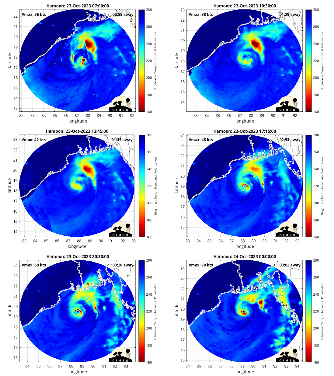
As per JTWC, Cyclone Hamoon rapidly intensified from 30knots to 70knots in last 24hrs (increase in windspeed of 40knots in 24hrs). This cyclone has undergone rapid intensification owing to strong poleward ouflow, upper level divergence due to presence of an upper level trough.
In early morning today, this cyclone has developed a strong eyewall.
This is only the 4th Bay of Bengal post-monsoon season cyclone in the recorded history (since 1982) to reach at least Category 1 intensity during an El Nino year. Data: JTWC
Based on IMD record, for the 1st time after 2018, a very severe cyclone (winds=65knots) formed in the Bay of Bengal in October.
As per IMD, this cyclone intensified rapidly from deep depression (30 knots) to Very severe cyclone (65 knots) in just 24hrs.


1 comment:
Credit Australian government Bureau of metereology
Issued Tuesday 24 October 2023
The latest Climate Driver Update and Climate Model Summary are now available on our website.
El Niño and positive Indian Ocean Dipole persist
Oceanic indicators continue to exhibit a clear El Niño state. Models indicate some further warming of the central to eastern Pacific is likely, with SSTs remaining above El Niño thresholds into the early southern hemisphere autumn 2024.
Broadscale pressure and cloudiness patterns over the Pacific reflect El Niño. Trade wind strength over the past fortnight has been weaker than average over most of the Pacific.
A positive Indian Ocean Dipole (IOD) is underway. All models indicate that this positive IOD will likely be sustained to at least December.
The Madden–Julian Oscillation (MJO) is currently weak. Most surveyed models indicate it will strengthen in the coming week. However, there is disagreement between models regarding the location of the pulse, which may move to the Western Pacific, eastern Pacific or tropical Americas regions.
The Southern Annular Mode (SAM) index is currently neutral with forecasts indicating it will remain mostly neutral over the coming fortnight.
The long-range forecast for Australia indicates warmer than average conditions are likely across most of Australia from November to January and below average rainfall across much of Australia excluding parts of the southeast.
More information
Media liaison (03) 9669 4057
Technical enquiries helpdesk.climate@bom.gov.au
Next update expected by 8 November 2023
Post a Comment