Monsoon Watch (MW) - 2... 2020...24th April 2020
These reports are the views, study and observations of Vagaries. Estimates and forecasts are also the calculation of Vagaries, and may/may not tally with any other estimates/nodels. This may not be used for commercial purposes. Vagaries of Weather is not responsible for any commercial loss from this article, or these series of articles.
The Monsoon developments, as they unfold, will be analysed , discussed and explained in Vagaries.
Vagaries follows the developments(parameters) that emerge during the summer (Apr/May) which lead to the monsoon.
Vagaries believes the expertise to predict the monsoon in it's entirety during early summer itself (early April) is not feasable. The parameters themselves develop in April and May.Quantum of rain forecasting in April for June right through September is an impossible task. Things get clearer by last week of April. Vagaries' (in MW) normally remains true to estimates around early May.
😎Otherwise the charm of chasing the monsoon parameters as they unfold during the summer , is lost.
As of 24th April, the South West Monsoon is just about 21 days away from its normal date of arrival from the shores of India ! Yes ! it's just 21 days from the First touch of shores...Southern most point of India on the South Andaman Islands, Indira Point, where the normal arrival date is 15th May.
➤Further Analysis of the parameters as discussed in MW-1...
In this initial stage, we will observe the basic root and foundation, the initial 5 parameters only, and the initial seed of the monsoon. From these parameters, later a few more develop.
1. Cross Equatorial Winds from Southern Hemisphere and Mascarene high.
2. Pre monsoon showers / LWD.
3. Seasonal low over Indian subcontinent.
Situation as on 23rd April 2020:
1. Cross Equatorial Winds and Mascarene high :

i)The cross equatorial wind flow, has deteriorated compared to MW-1 in the Western sector Southern Indian Ocean. SE Winds, now are not striking the East African Coast below the equator because of a low off the Madagascar coast . The Northward movement of the ITCZ will surely hasten and strengthen the winds.
ii) In the Eastern sector, in the Bay Branch, the Cross equatorial winds are not organised Westwards towards the Sumatra Coast. The winds hitting Sumatra coast are not Westerly (as required), and also need to gather strength soon.Thunder clouds(Cb) developments are seen near the equator in eastern Indian ocean.
And that is exactly where the start should be for the SWM to arrive at the Andamans.
We prefer the Bay Branch to be better organised, as the SW Monsoon is normally expected there in less than a month.
--Pressure chart--

Mascarene highs - Main high reading of 1023 mb and another high of 1021 mb is seen in the south Indian ocean between Madagascar and Australia.
This is considerable deterioration compared to the high reading of 1036 mb observed during MW-1.The power house of monsoon is behind schedule as of now.
The sea surface temps in the region of Mascarene High formation are lower than normal .This should help in strengthening the High.


Indicator as on 23 April 2020 : -ve


In 2017, Barmer had approached 46 c and recorded min temp above 30 c. April heat records had tumbled at many locations over the Indian subcontinent.
Temperatures of more than 45 c had already been recorded in many states of India . Even at Srinagar (Kashmir),Shimla (Himachal) temperatures approached around 29 c in April 2017 . Delhi AP was 44.9 c on 20th April 2017.
In 2017, Most of India was 4-7c above normal range.
Earlier than normal,the night temperatures had also crossed the 30c mark ! Barmer in Rajasthan recorded 30.4c as minimum on 15th April ,Kurnool (Andhra) saw a low of 31 c on 19th morning and Jhansi (UP) saw a low of 31.6 c on 21st morning.
Jaipur,Kota,Bundi,Alwar,Bikaner,Churu,Pilani (Rajasthan), Cuddapah(Andhra) saw lows of/above 30 c on 21st April 2017 morning.
Comparison with previous years shows the difference this year. In 2010, the first 45c touched on 10th April, and on the same day Nagpur was 44c, Delhi 42.8c. Soon on 15 th April 2010, Simla was 28.2c on 16th, Ganganagar, Akola and Hissar soared to 46c.
2015...Into the 3rd week of April , it had just topped 44.6c in Barmer on 19th April.
2016....touched 46c in Bankura on 16th April...and was constantly hot in Eastern region with almost daily ,a place touching 46c.. Bhubaneshwar and Titlagarh in India had touched 46c. Several large regions in Vidharbh, Telengana and MP were in the 44/43c range.
But, in 2011, 2012, 2013 and 2014, till date in 2020, temperatures were yet to reach 45c anywhere over the Indian Sub-Continent .
In 2018 and 2019 also , significant heat waves were not seen by this time in April.
23 April 2020- Max /Min temps in c of some cities/towns :


Indicator as on 23 April 2020 : Neutral ( as even in absence of heat wave , pressure over the Thar desert core seed area has fallen compared to MW-1 )


iv) The 30 day Southern Oscillation Index (SOI) is calculated using the pressure differences between Tahiti and Darwin.It is in neutral range currently.
(sustained values below -7 indicates El Nino and above +7 indicates La Nina)
v) IOD (Indian Ocean Dipole) is in neutral range currently.
Latest weekly value is -0.09.


These reports are the views, study and observations of Vagaries. Estimates and forecasts are also the calculation of Vagaries, and may/may not tally with any other estimates/nodels. This may not be used for commercial purposes. Vagaries of Weather is not responsible for any commercial loss from this article, or these series of articles.
The Monsoon developments, as they unfold, will be analysed , discussed and explained in Vagaries.
Vagaries follows the developments(parameters) that emerge during the summer (Apr/May) which lead to the monsoon.
Vagaries believes the expertise to predict the monsoon in it's entirety during early summer itself (early April) is not feasable. The parameters themselves develop in April and May.Quantum of rain forecasting in April for June right through September is an impossible task. Things get clearer by last week of April. Vagaries' (in MW) normally remains true to estimates around early May.
😎Otherwise the charm of chasing the monsoon parameters as they unfold during the summer , is lost.
As of 24th April, the South West Monsoon is just about 21 days away from its normal date of arrival from the shores of India ! Yes ! it's just 21 days from the First touch of shores...Southern most point of India on the South Andaman Islands, Indira Point, where the normal arrival date is 15th May.
➤Further Analysis of the parameters as discussed in MW-1...
In this initial stage, we will observe the basic root and foundation, the initial 5 parameters only, and the initial seed of the monsoon. From these parameters, later a few more develop.
1. Cross Equatorial Winds from Southern Hemisphere and Mascarene high.
2. Pre monsoon showers / LWD.
3. Seasonal low over Indian subcontinent.
4. ENSO Status.
5. April synoptic features.Situation as on 23rd April 2020:
1. Cross Equatorial Winds and Mascarene high :
--Wind flow chart of 23 April 2020--
i)The cross equatorial wind flow, has deteriorated compared to MW-1 in the Western sector Southern Indian Ocean. SE Winds, now are not striking the East African Coast below the equator because of a low off the Madagascar coast . The Northward movement of the ITCZ will surely hasten and strengthen the winds.
ii) In the Eastern sector, in the Bay Branch, the Cross equatorial winds are not organised Westwards towards the Sumatra Coast. The winds hitting Sumatra coast are not Westerly (as required), and also need to gather strength soon.Thunder clouds(Cb) developments are seen near the equator in eastern Indian ocean.
And that is exactly where the start should be for the SWM to arrive at the Andamans.
We prefer the Bay Branch to be better organised, as the SW Monsoon is normally expected there in less than a month.
--Pressure chart--
This is considerable deterioration compared to the high reading of 1036 mb observed during MW-1.The power house of monsoon is behind schedule as of now.
The sea surface temps in the region of Mascarene High formation are lower than normal .This should help in strengthening the High.
2. Pre-monsoon showers / LWD (Line of Wind Discontinuity) :
A LWD in the central peninsula region "looks after" the moisture content in the interior areas, and prepares the atmosphere with the humidity required. In reality, this LWD remains till June, in variable phases, and finally merges with the Monsoon trough (axis)/ITCZ when the ITCZ moves towards the Sub Continent. The seasonal low acts as a fulcrum to this Monsoon trough(axis) as it moves over the subcontinent .Also this trough helps to keep the seasonal low in place.
Good thunderstorms over the Indian peninsula and Kalbaishakis over East /North East India have been observed .
The rainfall has been excessive(blue colour) over most parts of the country during the first half of summer .
LWD observed over the Indian peninsula on 23 April 2020
Indicator as on 23 April 2020 : Positive
3. Seasonal low over Indian subcontinent :
This summer there have been no heat waves over the Indian subcontinent till now !!
No 45 c temps have been reported from India till now.Though min temp had touched 30 c only for a day at Barmer during mid April.
In fact temps have been significantly cooler over Northern / Eastern parts of the subcontinent during the past few days .
In 2017, Barmer had approached 46 c and recorded min temp above 30 c. April heat records had tumbled at many locations over the Indian subcontinent.
Temperatures of more than 45 c had already been recorded in many states of India . Even at Srinagar (Kashmir),Shimla (Himachal) temperatures approached around 29 c in April 2017 . Delhi AP was 44.9 c on 20th April 2017.
In 2017, Most of India was 4-7c above normal range.
Earlier than normal,the night temperatures had also crossed the 30c mark ! Barmer in Rajasthan recorded 30.4c as minimum on 15th April ,Kurnool (Andhra) saw a low of 31 c on 19th morning and Jhansi (UP) saw a low of 31.6 c on 21st morning.
Jaipur,Kota,Bundi,Alwar,Bikaner,Churu,Pilani (Rajasthan), Cuddapah(Andhra) saw lows of/above 30 c on 21st April 2017 morning.
Comparison with previous years shows the difference this year. In 2010, the first 45c touched on 10th April, and on the same day Nagpur was 44c, Delhi 42.8c. Soon on 15 th April 2010, Simla was 28.2c on 16th, Ganganagar, Akola and Hissar soared to 46c.
2015...Into the 3rd week of April , it had just topped 44.6c in Barmer on 19th April.
2016....touched 46c in Bankura on 16th April...and was constantly hot in Eastern region with almost daily ,a place touching 46c.. Bhubaneshwar and Titlagarh in India had touched 46c. Several large regions in Vidharbh, Telengana and MP were in the 44/43c range.
But, in 2011, 2012, 2013 and 2014, till date in 2020, temperatures were yet to reach 45c anywhere over the Indian Sub-Continent .
In 2018 and 2019 also , significant heat waves were not seen by this time in April.
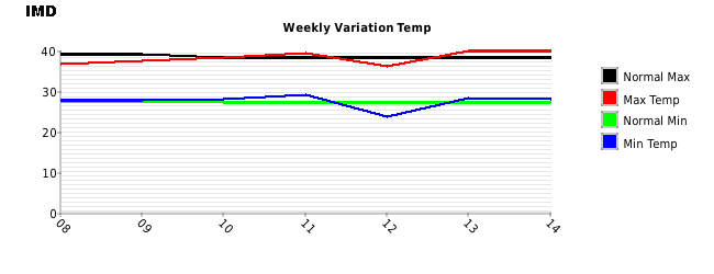
23 April 2020- Max /Min temps in c of some cities/towns :
Barmer.. 41 (0) / 27 (+2)
Jaisalmer.. 38 (-2) / 24 (0) ..7 mms
Nagpur.. 42 (0) / 24 (-1)
Delhi SFD.. 35 (-3) / 23 (0)
Angul (Odisha) .. 37 (-4) / 20 (-5)
The heating over the core region of Thar desert is below normal because of Western Disturbances .
Jaisalmer has reported below normal temps during the past week (18 to 24 April) .
The map below depicts the falling temps (blue areas increasing) over North India during the past few days because of western disturbance.
In spite of no significant heat, the seasonal low has shown a small core of lowest pressure at 1004 mb as compared to 1010 mb during MW-1.But no significant heat wave is expected over the Thar desert core seed region in the coming days of April. (The ultimate low in the core in June should be 994mb).

4. ENSO Status :
The tropical Pacific remains neutral with respect to the El Nino–Southern Oscillation (ENSO). Atmospheric and oceanic indicators of ENSO including the Southern Oscillation Index (SOI), trade winds, cloudiness near the Date Line, and sea surface and sub-surface temperatures in the tropical Pacific Ocean all continue to persist at levels consistent with neutral ENSO.
i) Multivariate ENSO Index (MEI) is in neutral range. Current value is 0.2.
The bi-monthly Multivariate El Nino/Southern Oscillation (ENSO) index (MEI) based on five different variables (sea level pressure (SLP), sea surface temperature (SST), zonal and meridional components of the surface wind, and outgoing longwave radiation (OLR)) over the tropical Pacific basin (30°S-30°N and 100°E-70°W).
ii) The Oceanic Nino Index (ONI) is based on SST departures from average in the Nino 3.4 region, and is a principal measure for monitoring, assessing, and predicting ENSO. The last 3 overlapping seasons show towards establishment of a neutral event. ONI latest is 0.5 ( 0.5 to -0.5 is neutral. Above 0.5 is El Nino, and below -0.5 is La Nina).
iii) Current NINO is in neutral range.
iv) The 30 day Southern Oscillation Index (SOI) is calculated using the pressure differences between Tahiti and Darwin.It is in neutral range currently.
(sustained values below -7 indicates El Nino and above +7 indicates La Nina)
| SOI values for 23 Apr, 2020 | ||
|---|---|---|
| Average SOI for last 30 days | -3.05 | |
| Average SOI for last 90 days | -2.86 | |
| Tahiti hpa - Darwin hpa (23 Apr 2020) | 1013.75 hpa - 1011.10 hpa | |
Latest weekly value is -0.09.
ENSO Indicator as on 23 April 2020 : Neutral
5. April synoptic features :
General April pressure and wind chart
Wind chart on 23 April 2020
The winds North of the Equator are revolving round a High in the Arabian Sea and around a high in the Bay of Bengal.These are normal synoptic features seen in April.
But as the second half of summer progresses , the high over the Bay of Bengal should collapse and give way to the formation of lows over the Bay of Bengal / Andaman sea.
But as the second half of summer progresses , the high over the Bay of Bengal should collapse and give way to the formation of lows over the Bay of Bengal / Andaman sea.
A strong MJO would hasten the favourable formations of lows, with enhanced precipitation. MJO will be in the Indian ocean basin for the next few days and it hopefully would help in the formation of a low within 7 days in the Bay of Bengal/Andaman sea.
Another factor, which helps the winds gain strength, and bring more moisture into the Indian landmass, is the sea temperatures (SST) on both sides of the Peninsula. Optimum (warm) temperatures will hasten and create more clouds, and help in faster forming of the lows from the Bay. Currently , the sea temperatures on both sides of the Indian Peninsula are more than 30 c (above normal) .
ITCZ (Inter Tropical Convergence Zone): This Seasonal trough passes from the South Arabian Sea to Andaman sea after the withdrawal of SWM in Oct. Shifts further south in Dec. Moves North during South West Monsoon.
Now south of the equator (5S) over western Indian ocean and near the equator over the eastern Indian ocean.
Now south of the equator (5S) over western Indian ocean and near the equator over the eastern Indian ocean.
Indicator as on 23 April 2020 : Normal
Summary as on 23 April 2020 :
Situations can change fast, and by the time we discuss the next MW, some factors can suddenly become +ve or -ve. So, MW discusses and follows the developments as they emerge, and discuss the parameters as is where is.
Please note There are more parameters to be considered, as and when they are developed and to be taken into consideration in the subsequent Monsoon Watch (MW) series.
Time schedule of arrival and strength/quantum is normally indicated in subsequent MW series in May.
Time schedule of arrival and strength/quantum is normally indicated in subsequent MW series in May.
To read MW-1 2020 article ,click on the link below :


2 comments:
Such a hard work and very informative as always...Thanks...
Great information sir.
Post a Comment