Posted 6th Evening:
The anticipated active off shore trough has resulted in good rainfall along the West Coast since Wednesday 5th.
Some of the heaviest rainfall last night in Konkan and Goa in cms:
Vaibhavwadi (dist Sindhudurg) 18,
Canacona (dist South Goa) 17,
Panjim – (dist North Goa) 16,
Sanguem (dist South Goa) 15,
Rajapur (dist Ratnagiri) 15,
Palghar_agri (dist Palghar) 15,
Gaganbawada (dist Kolhapur) 12
Mumbai got its share of rain from Wednesday Night, and had frequent showers on Thursday in the day.
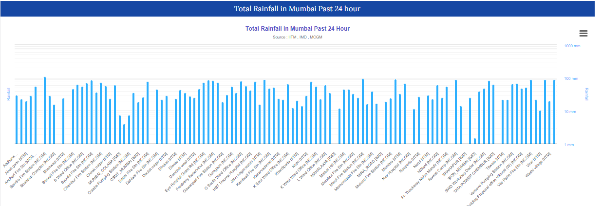
The rainfall for the Mumbai region from Wednesday evening (5.30 pm) to Thursday evening (5.30 ) :
TOP 10 BMC RAINFALL AMOUNTS (in millimeters)
24 HOURS (FROM 5.30 PM ON 5/7/23 -TO -5.30 PM ON 6/7/23)
BANDRA FIRE STATION 115
MAROL FIRE STATION 106
B-WARD OFFICE (SANDHURST ROAD) 104
BYCULLA FIRE STATION 94
CHEMBUR FIRE STATION 93
RAWALI CAMP 92
VILE PARLE FIRE STATION 91
M WEST WARD OFFICE (CHEMBUR) 91
F NORTH WARD OFFICE (KINGS CIRCLE) 90
WADALA FIRE STATION 89
(As vagaries' estimate, should be 150 mms+ by Thursday evening....South Mumbai received much lesser rainfall)
Print faded as original😕
The Lake Storage position has improved considerably in the last 2 days, and the total storage as on 6th is 18.29% ( 16% last year this date). That would amount to around 70 days of available water.
6th Night/Friday 7th: Orange Alert : Expected frequent showers, some heavy.
(When mid level vortex developing scenario is present...either it can rain very heavy or just get delayed / rain in sea and only when westerlies commence, it starts raining.)
But, with the Monsoon trough moving Northwards, Mumbai and Maharashtra can expect a decrease in rain intensity from Saturday.
But, we do not see much change in the Mumbai rainfall pattern next week.
However, due to the increased moisture content prevailing, the Ghat stations could get heavy rains this weekend.


No comments:
Post a Comment