Category 2-3 cyclone Gati (very severe cyclonic storm by IMD) now making an unprecedented landfall in Bari Region, #Somalia. This is solidly the strongest tropical cyclone to hit Somalia on JTWC, as well as IMD records (which goes back to 1891). Both show no typhoon-equivalent landfall in Somalia before.... From Vagarian Mitan (Bhubaneswar)
Posted Sunday 22nd Afternoon 1 pm:
Cyclone "Gati" forms and moves towards the West..away from the Indian coast...

BB-13 , is near the Indian Coast, as Depression and tracking as shown...becoming into Deep depression before crossing South of Chennai.
BB-13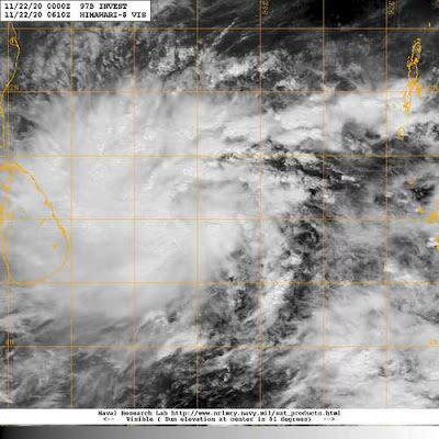

BB-3 Track and Rainfall

 |
| Add caption |
Mumbai & Pune : No rain, but night getting cooler from 25 th.. Pune dropping to 13c.
Delhi NCR: Temperatures around 25 - 11c next 4 days.


4 comments:
So finally rain in TN.
Thank you sir for your update for Mumbai
Parched TN requires at-least 1000mm of rain in 2 days
Thanks a lot rajesh for your coverage of this depression
Credit Australian Government B O M ... climate driver Update
Issued 24 November 2020
The latest Climate Driver Update and Climate Model Summary are now available on the Bureau's website.
La Niña continues; cooling in the tropical Pacific Ocean returns
La Niña continues in the tropical Pacific. International climate models suggest it is likely to continue to at least February 2021.
Central and eastern tropical Pacific Ocean sea surface temperatures (SSTs) are at La Niña levels. Models suggest the current La Niña will strengthen further, peaking in December 2020 or January 2021 at moderate to strong levels.
Most oceanic and atmospheric indicators reflect a mature La Niña. Recent variability in the Southern Oscillation Index has been related to the Madden–Julian Oscillation (MJO), rather than the state of La Niña.
The Southern Annular Mode (SAM) is neutral but is expected to increase to positive values over the coming week. This is driven in part by the La Niña influence, and in part by a stronger than average polar vortex over Antarctica. Positive values are expected at least into early 2021, and typically increase rainfall in south eastern Australia.
The Madden–Julian Oscillation (MJO) is at weak to moderate strength, having moved from the Atlantic to the eastern Indian Ocean in November. This pattern tends to be unfavorable for rain in Australia. The MJO is expected to weaken as it moves over Indonesian longitudes, though may bring increased rainfall over parts of northern Australia and be favourable for monsoon onset when it moves past the Top End.
Climate change is also influencing the Australian climate. Rainfall across northern Australia during its wet season (October–April) has increased since the late 1990s, with a greater proportion of high intensity short duration rainfall events.
Climate outlooks indicate December 2020 to February 2021 rainfall is likely to be above average for most of the country. Current La Niña conditions, though not as strong as 2010–12, warmer than average waters to the north of Australia, climate change and a positive SAM are contributing to the increased chances of rainfall over Australia. The state of the Indian Ocean is not as conducive to increased rainfall as it was during 2010–12.
Post a Comment