Posted 26th evening:
Monsoon has withdrawn from North Marathwada and Aurangabad Region...Cooler Nights in the region expected to be around 17-19c.
Monsoon further withdraws from North Konkan, North Madhya Maharashtra, Vidhrabh, Northern Marathwada and Chattisgarh..
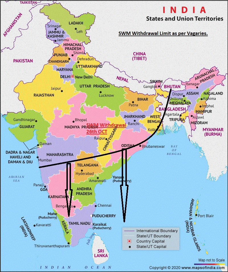
Mumbai: South West Monsoon has withdrawn from Mumbai. Equaling IMD record of Most delayed date ...26th October (2010).
(IMD Withdrawal criteria awaited this year.)
Rainfall:Scruz 3856 mms (151 inches) All time high.
Colaba : 3427 mms ( 135 inches)..Record 3482 mms 137 inches 1954
Pune: With the Monsoon having withdrawn now, the nights are expected to get cooler by 2/3c.
Next 3 Night temperatures in North Indian cities in Punjab, Haryana, Rajasthan and Delhi expected to see a drop...around 11-13.Srinagar expected to drop below freezing.


1 comment:
Credit Australian Government Bureau of metereology latest issued 27 10 2020 climate driver update
Issued 27 October 2020
The latest Climate Driver Update and Climate Model Summary are now available on the Bureau's website.
La Niña likely to continue until at least the end of summer 2020−21
La Niña continues in the tropical Pacific. Australian and international climate models suggest it is likely to continue at least into February 2021.
Central and eastern tropical Pacific Ocean sea surface temperatures remain at La Niña levels, as do most atmospheric indicators, including trade winds and cloudiness. The Southern Oscillation Index (SOI) has moved back into neutral values, most likely due to the influence of a passing MJO event. The SOI is expected to return to La Niña levels in the coming weeks.
La Niña typically increases the chance of above average rainfall across much of Australia during spring, and across eastern Australia during summer. Current climate outlooks indicate rainfall during November 2020 to January 2021 is likely to be above average for most of the country.
Most models suggest La Niña will peak in December, with around half the models anticipating a strong event. While there is some possibility that the peak strength could reach levels similar to 2010–12 there are some differences. La Niña became established much earlier in 2010, was long lived (over two years), and impacts were enhanced by a negative Indian Ocean Dipole and warm ocean temperatures around Australia.
In contrast, the Indian Ocean Dipole (IOD) is currently neutral, and most models suggest it will remain neutral for the rest of 2020.
The Southern Annular Mode (SAM) is expected to be positive for the remainder of October into early November. La Niña tends to favour positive SAM during spring and summer, further supporting the likelihood of above average rainfall in the east.
The Madden–Julian Oscillation (MJO) is currently in the western Pacific and is expected to remain moderately strong as it moves across the Pacific basin, then decrease in strength as it approaches Africa.
Climate change is also influencing the Australian climate. Australia's climate has warmed by around 1.4 °C since 1910, while southern Australia has seen a 10–20% reduction in cool season (April–October) rainfall in recent decades.
More information
Media enquiries: (03) 9669 4057 media@bom.gov.au
Next update expected on 10 November 2020
Post a Comment