Co Authors: GSB, Shreyas Dhavale, Pradeep John, Dr. Vineet Singh, Gokul

Sunday, August 28, 2022

Ganesh Chaturthi and Ganpati festival weather outlook: 30th August till 2nd September 

Weakening of Monsoon westerlies, and a NW deflection seen, will give rise to thunderstorms across interior parts of Maharashtra, Karnataka, Telangana, Tamil Nadu and Kerala. 


Surface winds ☝

Mumbai and Konkan: Hot and humid weather as westerlies weaken. More chance of some thundery development and patchy showers in interior konkan, eastern MMR and Thane districts, less chance for the city. 

Ghats and hill stations ( Lonavala/Mshwar) can receive thundershowers during afternoon/evening. 

Pune: Afternoon/evening thundershowers likely after warm and humid morning. Localized heavy rain possible. 

------------------------------

३० ऑगस्ट ते २ सप्टेंबर गणेशोत्सवानिमित्त हवामान अंदाज:

मुंबई व कोकण: नैऋत्य व पश्र्चिमेकडून येणाऱ्या मान्सूनच्या वार्‍यांचा वेग कमी होत असल्याने, गरम व दमट हवामान राहील. कोकणाच्या अंतर्गत भागात, व मुंबईच्या पूर्वेकडील भागात (ठाणे जिल्हा) गडगडाटासह पावसाची‌ शक्यता आहे. किनारपट्टी जवळपास (मुंबई शहर व उपनगरात) देखील काही भागात गडगडाटासह पाऊस पडू शकेल. 

पुणे: गरम व दमट दिवसानंतर, दुपारी/संध्याकाळी गडगडाटासह पाऊस पडण्याची शक्यता आहे. काही भागात जोरदार वादळी पाऊस पडू शकेल. 

मध्य महाराष्ट्रातील नाशिक, पुणे, सातारा, अहमदनगर, कोल्हापूर, सोलापूर, जळगांव, सांगली या सर्व जिल्ह्यात दुपारी/संध्याकाळी गडगडाटासह पावसाची शक्यता आहे.

--------------------------

Marathwada regions of Aurangabad, Jalna, Beed, Nanded can get light to moderate rain/thundershowers from 30th August. 

Farmers advised to not work in open fields/farms during rain as it could be accompanied by lightning. 

मराठवाडा: ३० ऑगस्ट ते २ सप्टेंबर दरम्यान औरंगाबाद, जालना, बीड, नांदेड जिल्ह्यातील काही भागात गडगडाटासह हलका ते मध्यम पाऊस पडू शकतो.

पाऊस विजांच्या कडकडाटात पडण्याची शक्यता असल्याने, शेतकर्यांनी पाऊस पडत असताना शेतात कामे करु नये.

Madhya Maharashtra region has the highest chance of seeing thundershowers with some heavy rain in parts. 

Districts such as Nashik, Pune, Satara, Ahmednagar, Kolhapur, Solapur, Jalgaon and Sangli can witness afternoon/evening thundery development from Tuesday 30th August till Friday 2nd September. 


Rainfall likely to be unevenly distributed, given the thundery and convective (heat and instability triggered) nature of the rain. 


Bangalore, Mysore, Belgaum, Dharwad and most parts of interior Karnataka likely to receive good thundershowers over next 3-4 days. 

Gujarat: Mainly dry weather across the state, warm and humid. 

East India to continue getting patchy thundershowers (some localized heavy), across east Madhya Pradesh, eastern Uttar Pradesh, Bihar, Jharkhand, Chhattisgarh, Odisha and West Bengal. 

Friday, August 26, 2022

 26th August 

FAQ on Kerala Weather for next 3 days 

No major Alert.But few heavy showers ( exceeding 50 mms) possible in Districts of Kottayam, Idduki, Ernakulam and Wayanad. 

IMD map

Thursday, August 25, 2022

 25th August..

Current  Trough at 850 level..👇 slightly South in the West Sector..UAC over Jharkhand 


The Jet Streams at Easterlies are normally placed..so SWM not in premature hurry to withdraw 👇


200 level👆


Wednesday, August 24, 2022


The vagaries of the monsoon:The unpredictability of the monsoon alongwith phenomena like monsoon troughs and depressions lead to uneven distribution of rainfall.

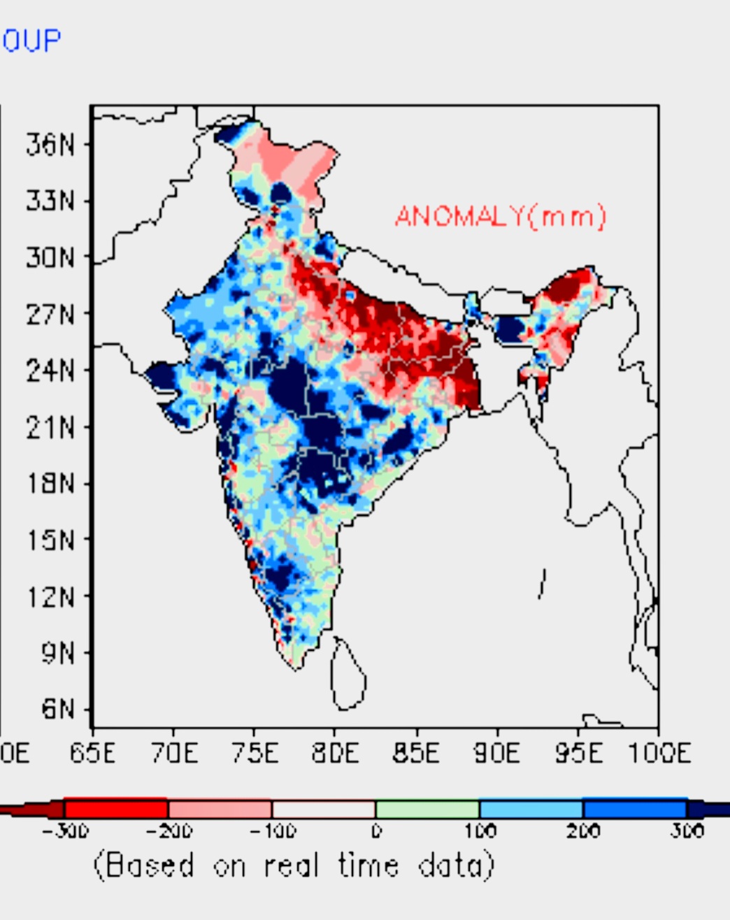
While the monsoon in India is currently at 9 % above normal.But,  the distribution is uneven across the country. and could lower this year's foodgrain production.

Rains have been geographically uneven, with concentration seen in central (+25%)and southern India (+24%), trailing in the northwest and a steep 19% below-normal in the east and the northeast.

But no cause for Alarm.  If proper systems track on the required route (U.P., Jharkhand), things can still improve. 

(We are hopeful of BB 11)


Monday, August 22, 2022

Weather Outlook from August 23rd to 25th - 

Parade of lows/depressions keeping the Monsoon active

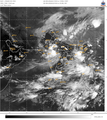
BB-10 lies as a depression over Madhya Pradesh, causing very heavy rainfall. 

BB-10 likely to move west, increasing rainfall over Gujarat region and southern, eastern and southwestern parts of Rajasthan, including Thar desert. 

Gujarat: 23rd-24th August - Moderate to heavy rainfall likely in Ahmedabad, Gandhinagar, Mahesana regions, moderate showers over Kutch and light to moderate in parts of Saurashtra. 

Bharuch region can receive light rain.

Udaipur and Mount Abu regions of Rajasthan likely to receive heavy rains on 23rd August, decreasing from 24th. 

[Mumbai, Konkan and Goa: Occasional passing showers to continue, some maybe moderate to heavy. No major change in current weather. So, Mumbai Colaba remains in 4% deficit though SantaCruz is in surplus. 

Rain likely to reduce after 25th August. 

But no worries..Mumbai Lakes @ 96% Storage have 1 year's availability. 

Pune: Pleasant weather with drizzles and light rain showers for next 2-3 days, reduction in rain and rise in day temperatures after 25th August. 

All Pune Dams are at 100% capacity...comfortable position. ]

Mainly dry weather likely for Marathwada region, which would be beneficial for the crops. 

Uttarakhand and Himachal Pradesh could see moderate rain/thundershowers in the low-mid Himalayan ranges. Upper reaches could get light snow. 

Avoid travel due to chances of landslides/mudslides. 


We await another low, BB-11, which could possibly form over north Bay and near West Bengal by 24th, but won't be as strong as BB-10. Rainfall could increase over West Bengal, Jharkhand and parts of north Chhattisgarh and east Uttar Pradesh. 

Most of Uttar Pradesh still faces big rainfall deficit,

with only marginal improvement likely in next 3-4 days. 

Weaker westerlies would result in increased chances of thundershowers over Bangalore region and parts of Tamil Nadu including Chennai and Pondicherry.


 22nd August...BB 10...Westward...

M.P....Bhopal 190 mms, Sagar 175 mms, Guna 174 mms, Jabalpur  160 mms.

In cms 👇


Kota (Rajasthan) recorded 224mm rain in the last 24hrs, this is the highest 24hrs rain recorded there in August in history breaking the record of 31 August 1978. Source: IMD

Meanwhile not a single day this August Delhi (Safdarjung) recorded double-digit rain. Huge rain deficiency

Input by Vag. Vineetkumar. 

  Vagaries Climate Change : Pros and Cons blog updated with Global Warming is Causing Cold Spells See Non Weather Matter Page Updated  Wing...