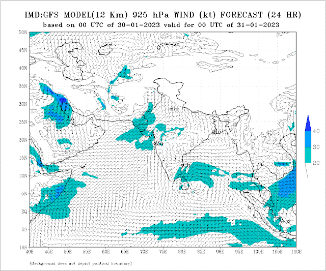
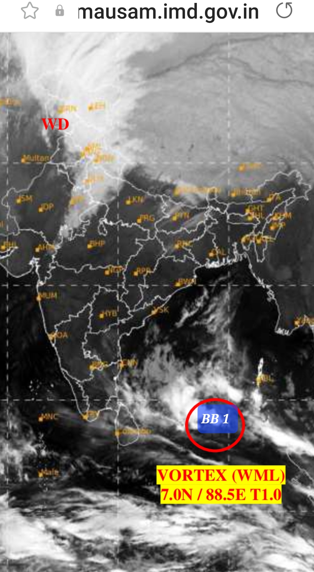
January System forms in the Bay. To Approach Sri Lankan Coast By February 1( Unusual )
Only six such January systems have formed in the Bay between 1980 and 2021, of which just one — a system that emerged on January 30, 1987 — managed to strengthen into a severe cyclonic storm.
An unusually rare January BB 1 appears to have formed in the Bay of Bengal, and it is expected to gain strength and track towards Sri Lanka & T.N. Coast.
To intensify into a depression over southwest Bay by Tuesday (January 31), and move to Sri Lankan coast around Wednesday (February 1).
Rains 🌧 and thundershowers expected in T.N. ( Southeast) and squally winds on Wednesday....


1 comment:
Credit Australian government Bureau of metereology
Issued Tuesday 31 January 2023
The latest Climate Driver Update and Climate Model Summary are now available on our website.
La Niña continues to ease
La Niña continues in the tropical Pacific, but oceanic indicators (sea surface temperatures, SSTs) have weakened since their peak during spring 2022. While ocean temperatures have eased from La Niña thresholds, the atmosphere has yet to respond, and remains La Niña-like. La Niña typically increases the chance of above-average rainfall for northern and eastern Australia during summer.
All models anticipate SSTs in the central Pacific will return to neutral ENSO levels during February, with neutral conditions (neither La Niña nor El Niño) anticipated until at least mid-autumn. As accuracy is generally lower for long-range ENSO forecasts made during summer, ENSO outlooks that extend past autumn should be viewed with caution.
The Southern Annular Mode (SAM) is currently strongly positive, but is anticipated to ease over the coming fortnight and then remain neutral over the remainder of February. During summer, positive SAM is typically associated with an increased chance of above average rainfall for eastern New South Wales, eastern Victoria, and north-east Tasmania, and below average rainfall for western Tasmania.
The Madden–Julian Oscillation (MJO) is currently moderate to strong and over the eastern Indian Ocean. Most models expect it to move across the Maritime Continent and towards the western Pacific in the coming week, with a possible decline in strength. While in the Maritime Continent, the MJO may increase the chance of an active monsoon period in northern Australia.
Sea surface temperatures are warmer than average to the south and south-east of Australia from the Eyre Peninsula to east of New Zealand, while generally weak warm anomalies persist across the west and north of the Maritime Continent. Warmer waters around Australia, especially in the tropics, can result in greater evaporation, humidity, cloudiness, and rainfall.
The Indian Ocean Dipole (IOD) is neutral and has little influence on Australian climate while the monsoon trough is in the southern hemisphere (typically December to April).
Climate change continues to influence Australian and global climates. Australia's climate has warmed by around 1.47 °C over the period 1910–2021. There has also been a trend towards a greater proportion of rainfall from high intensity short duration rainfall events, especially across northern Australia.
More information
Media liaison (03) 9669 4057
Technical enquiries helpdesk.climate@bom.gov.au
Next update expected by 14 February 2023
Post a Comment