Monsoon Watch - 2...2016
Further Analysis of the parameters as discussed in MW-1.
1. Seasonal Low:
As the average day/night temperatures in the Sub-Continent areas show a distinct heating up, the -ve indicator from the previous MW-1 discussion shows some improvement.
Heat waves are seen in the Northern, Central and Eastern regions now. Regions from Pakistan thru Rajasthan and Central India Southwards thru Maharashtra and Telengana have heated up to above normal temperatures.
The current temperature anomaly. Most of India in the 2-4c above normal range and pockets shooting to 4-6c above normal. ...

The night temperatures have also crossed the 30c mark ! Wardha in Vidharbh was 31.8c as minimum and Chandrapur saw a low of 31.6c on 20th morning.

However, comparison with previous years shows the difference this year. In 2010, the first 45c touched on 10th. April, and on the same day Nagpur was 44c, Delhi 42.8c. Soon on 15 th April 2010, Nawabshah (Pakistan) soared to 47c, Simla to 28.2c on 16th, Ganganagar, Akola and Hissar to to 46c.
But, in 2011, 2012, 2013 and 2014, till date, temperatures were yet to reach 45c anywhere in the Sub-Continent .
2015...Into the 3rd. week of April , we had seen 48c in Pakistan on 19th April in Larkana,and 46.5c in Moen Jo Daro. In India had just topped 44.6c in Barmer on 19th April.
2016....touched 46c in Bankura on 16th April...and is constatntly hot in Eastern region with almost daily a place touching 46c.. Bhunbaneshwar and Titlagarh in India and Dadu in Pakistan have touched 46c. Several large regions in Vidharbh, Telengana and MP are in the 44/43c range.The 16th April day maximum map..see the numerous places in the mid 40s...

The seasonal Low, as a result of good heating, is shaping up fast.
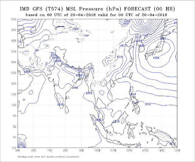
Last 2 days, the lowest pressure, in the Thar Desert region was at 1000/1002 mb. (though 2011/2014 was 1006 mb, 2010/2012 was at 1002 mb this time. 2015 it was at 1002 mb).
 Overall, even the 1002 mb Low is within the NW region of the India/Pakistan region.
Currently on 20th, the core pressure has increased to 1004 mb.
Lows over MP, Central India, should become less conspicuous because of the strengthening of the seasonal low over NW india.
As mentioned, it normally should reach a low nadir of 994 mb in June in the Thar Desert, and with 1008mb in the South Arabian Sea, a perfect gradient is created to attract the south -west winds towards the coast.
Seasonal Low should speed up now with extreme heat in the region.
Thunderstorm activity in Southern Tibet is also seen to be picking up.

The Line of Wind Discontinuity should normally stabilise around Central India perpendicular down into the Southern Peninsula by mid April.
This enhances the speed of the Seasonal Low formation. Normally is required to start taking shape for the monsoon by the second week of April.
Currently, LWD through Central Maharashtra down to Tamil Nadu is forming due to UAC is established over Marathwada.
In reality, this LWD remains till June, in variable phases, and finally merges with the Monsoon trough (axis)/ITCZ when the ICTZ moves towards the Sub Continent.
Indicator: +ve
2. ENSO: During January-mid March 2015, near to-above average SSTs were observed in the eastern Pacific. At the sea surface, temperatures have cooled by over 1 °C since their peak, but remain warmer than average and still at El Niño levels.
March values show the NINO3 region in the eastern Pacific cooled by 0.1 °C and the NINO3.4 region cooled by 0.4 °C over the past month.
to 20/3/2016 to 27/3/2016 to 3/4/2016 to 10/4/2016
NINO3 +1.5 °C +1.4 °C +1.5 °C +1.3 °C
NINO3.4 +1.4 °C +1.4 °C +1.2 °C +1.2 °C
NINO4 +1.2 °C +1.2 °C +1.0 °C +0.8 °C
NINO 3.4 is the predominant Region to see ..For our region.
The SOI is at a lowering level at but remains within values indicative of neutral ENSO conditions. The latest 30-day SOI value is -7. This is the threshold of El Nino levels, below -7 is considered El Nino.
The most recent ONI value
(January– March 2016) is 2.0c.
El Niño: characterized by a positive ONI greater than or equal to +0.5ºC.
La Niña: characterized by a negative ONI less than or equal to -0.5ºC.
By historical standards, to be classified as a full-fledged El Niño or La Niña episode, these thresholds must be exceeded for a period of at least 5 consecutive overlapping
3-month seasons.
Weak El Niño conditions are present.
3. Cross Equatorial Winds:
Let me explain, that the winds on crossing the equator break into 2 branches. 1) gushing into the Arabian Sea, and 2) moving into the Bay of Bengal.
Last week, the Monsoon winds, which originate from the Southern Indian Ocean as SE winds, and cross the equator to become South-West, were weak.
In the Western sector, now, we see the dis-organisation of the Southern Hemisphere SE winds, with Cyclone Fantala and a Low South of Sri Lanka. The regular SE flow towards East Africa is disturbed.Tropical cyclone Fantala, which reached category 5 intensity, is the strongest cyclone on record to form this late in the tropical cyclone season in the southwest Indian Ocean.
In the Western Sector, the Arabian Sea branch is still struggling to get organised. Here, sufficient wind speed off the Kenyan coast has yet to form the SE flow required. But should re-organise fast. The Northwards movement of the ITCZ will surely hasten and strengthen the winds.
But, it is a temporary upset, and things will get back to the normal cross equatorial flows within a few days.


In the eastern sector, and the Westerly flow in the Bay sector is also gone haywire.
And that is exactly where the start should be for the SWM to arrive at the Andamans. Upper winds at 100-400 hpa are vigorously aiding the lower winds to attain the required strength.
We prefer the Bay Branch to be better organised, as the S W Monsoon is expected there in 22-25 days…
Mascarene high pressure zones in the South Indian Ocean. Main High reading now 1023mb, and 2 more Highs (in the forming) have been observed, one at 1023mb and another at 1017 mb. between Madagascar and Australia.
 The "Power House" of the Monsoon winds is slightly behind schedule, for this time of the season. Last year in MW2 we had highs of 1031 mb already formed. A bit this year...(Cyclone effect).
Indicator: -ve
4. But the pre Monsoon Low in the Bay is still elusive.
As discussed, we should normally see a low sometime after the 15th. of April. The high pressure region in the Bay, at sea level, no longer prevails.
I do not see much happening soon, as the region does not have the support of a strong MJO. An strong MJO would hasten the favourable formations and lows, with enhanced precipitation. We see the MJO wave gradually approaching till 28th April. Might bring some rains in the Bay. But will a sort of "false alarm"...As the MJO, it Seems will remain weak another 10 days thence.
Another factor, which helps the winds gain strength, and bring more moisture into the Indian landmass, is the sea temperatures on both sides of the Peninsula. Optimum (warm) temperatures will hasten and create more clouds, and help in faster forming of the lows from the Bay.

Indicator: -ve
5. To bring the existing SE winds above the equator, the ITCZ should move northwards. Around 1st. of May, this should cross the equator. The ITCZ should now come back to its Northward position, as the effective "Lows" created by the Rossby Wave are reducing.
ITCZ around 5S currently.
Indicator: Normal
So, overall, we can summarise as:
Parameter: 1): +ve 2): El Nino (Weak). 3) -ve 4) -ve 5) Normal.
Two parameters are -ve as of today ( weak El Nino Taken as negative as yet). In today's situation, Monsoon arrival in Kerala could be a bit delayed in Kerala and the Bay Islands, and the NE states.
We will put up the estimated date of arrival in the MW-3.
But, situations can change fast, and by the time we discuss the next MW, some factors can suddenly become +ve or -ve. So, MW discusses and follows the developments as they emerge, and discuss the parameters as is where is.
No model can commit today when the Monsoon can arrive.
Quantum of rain forecasting in April for June right through September is an impossible task. Things get clearer by last week of April. Vagaries' (in MW) normally remains true to estimates around early May.
Next MW up on 2nd May with Dates of Monsoon Arrival.
Further Analysis of the parameters as discussed in MW-1.
1. Seasonal Low:
As the average day/night temperatures in the Sub-Continent areas show a distinct heating up, the -ve indicator from the previous MW-1 discussion shows some improvement.
Heat waves are seen in the Northern, Central and Eastern regions now. Regions from Pakistan thru Rajasthan and Central India Southwards thru Maharashtra and Telengana have heated up to above normal temperatures.
The current temperature anomaly. Most of India in the 2-4c above normal range and pockets shooting to 4-6c above normal. ...

The night temperatures have also crossed the 30c mark ! Wardha in Vidharbh was 31.8c as minimum and Chandrapur saw a low of 31.6c on 20th morning.

However, comparison with previous years shows the difference this year. In 2010, the first 45c touched on 10th. April, and on the same day Nagpur was 44c, Delhi 42.8c. Soon on 15 th April 2010, Nawabshah (Pakistan) soared to 47c, Simla to 28.2c on 16th, Ganganagar, Akola and Hissar to to 46c.
But, in 2011, 2012, 2013 and 2014, till date, temperatures were yet to reach 45c anywhere in the Sub-Continent .
2015...Into the 3rd. week of April , we had seen 48c in Pakistan on 19th April in Larkana,and 46.5c in Moen Jo Daro. In India had just topped 44.6c in Barmer on 19th April.
2016....touched 46c in Bankura on 16th April...and is constatntly hot in Eastern region with almost daily a place touching 46c.. Bhunbaneshwar and Titlagarh in India and Dadu in Pakistan have touched 46c. Several large regions in Vidharbh, Telengana and MP are in the 44/43c range.The 16th April day maximum map..see the numerous places in the mid 40s...

The seasonal Low, as a result of good heating, is shaping up fast.
Last 2 days, the lowest pressure, in the Thar Desert region was at 1000/1002 mb. (though 2011/2014 was 1006 mb, 2010/2012 was at 1002 mb this time. 2015 it was at 1002 mb).

Currently on 20th, the core pressure has increased to 1004 mb.

Lows over MP, Central India, should become less conspicuous because of the strengthening of the seasonal low over NW india.
As mentioned, it normally should reach a low nadir of 994 mb in June in the Thar Desert, and with 1008mb in the South Arabian Sea, a perfect gradient is created to attract the south -west winds towards the coast.
Seasonal Low should speed up now with extreme heat in the region.
Thunderstorm activity in Southern Tibet is also seen to be picking up.

The Line of Wind Discontinuity should normally stabilise around Central India perpendicular down into the Southern Peninsula by mid April.
This enhances the speed of the Seasonal Low formation. Normally is required to start taking shape for the monsoon by the second week of April.
Currently, LWD through Central Maharashtra down to Tamil Nadu is forming due to UAC is established over Marathwada.
In reality, this LWD remains till June, in variable phases, and finally merges with the Monsoon trough (axis)/ITCZ when the ICTZ moves towards the Sub Continent.
Indicator: +ve
2. ENSO: During January-mid March 2015, near to-above average SSTs were observed in the eastern Pacific. At the sea surface, temperatures have cooled by over 1 °C since their peak, but remain warmer than average and still at El Niño levels.
March values show the NINO3 region in the eastern Pacific cooled by 0.1 °C and the NINO3.4 region cooled by 0.4 °C over the past month.
to 20/3/2016 to 27/3/2016 to 3/4/2016 to 10/4/2016
NINO3 +1.5 °C +1.4 °C +1.5 °C +1.3 °C
NINO3.4 +1.4 °C +1.4 °C +1.2 °C +1.2 °C
NINO4 +1.2 °C +1.2 °C +1.0 °C +0.8 °C
NINO 3.4 is the predominant Region to see ..For our region.
The SOI is at a lowering level at but remains within values indicative of neutral ENSO conditions. The latest 30-day SOI value is -7. This is the threshold of El Nino levels, below -7 is considered El Nino.
The most recent ONI value
(January– March 2016) is 2.0c.
La Niña: characterized by a negative ONI less than or equal to -0.5ºC.
By historical standards, to be classified as a full-fledged El Niño or La Niña episode, these thresholds must be exceeded for a period of at least 5 consecutive overlapping
3-month seasons.
Weak El Niño conditions are present.
3. Cross Equatorial Winds:
Let me explain, that the winds on crossing the equator break into 2 branches. 1) gushing into the Arabian Sea, and 2) moving into the Bay of Bengal.
Last week, the Monsoon winds, which originate from the Southern Indian Ocean as SE winds, and cross the equator to become South-West, were weak.
In the Western sector, now, we see the dis-organisation of the Southern Hemisphere SE winds, with Cyclone Fantala and a Low South of Sri Lanka. The regular SE flow towards East Africa is disturbed.Tropical cyclone Fantala, which reached category 5 intensity, is the strongest cyclone on record to form this late in the tropical cyclone season in the southwest Indian Ocean.
In the Western Sector, the Arabian Sea branch is still struggling to get organised. Here, sufficient wind speed off the Kenyan coast has yet to form the SE flow required. But should re-organise fast. The Northwards movement of the ITCZ will surely hasten and strengthen the winds.


In the eastern sector, and the Westerly flow in the Bay sector is also gone haywire.
And that is exactly where the start should be for the SWM to arrive at the Andamans. Upper winds at 100-400 hpa are vigorously aiding the lower winds to attain the required strength.
We prefer the Bay Branch to be better organised, as the S W Monsoon is expected there in 22-25 days…
Mascarene high pressure zones in the South Indian Ocean. Main High reading now 1023mb, and 2 more Highs (in the forming) have been observed, one at 1023mb and another at 1017 mb. between Madagascar and Australia.

Indicator: -ve
4. But the pre Monsoon Low in the Bay is still elusive.
As discussed, we should normally see a low sometime after the 15th. of April. The high pressure region in the Bay, at sea level, no longer prevails.
I do not see much happening soon, as the region does not have the support of a strong MJO. An strong MJO would hasten the favourable formations and lows, with enhanced precipitation. We see the MJO wave gradually approaching till 28th April. Might bring some rains in the Bay. But will a sort of "false alarm"...As the MJO, it Seems will remain weak another 10 days thence.
Another factor, which helps the winds gain strength, and bring more moisture into the Indian landmass, is the sea temperatures on both sides of the Peninsula. Optimum (warm) temperatures will hasten and create more clouds, and help in faster forming of the lows from the Bay.

Indicator: -ve
5. To bring the existing SE winds above the equator, the ITCZ should move northwards. Around 1st. of May, this should cross the equator. The ITCZ should now come back to its Northward position, as the effective "Lows" created by the Rossby Wave are reducing.
ITCZ around 5S currently.
Indicator: Normal
So, overall, we can summarise as:
Parameter: 1): +ve 2): El Nino (Weak). 3) -ve 4) -ve 5) Normal.
Two parameters are -ve as of today ( weak El Nino Taken as negative as yet). In today's situation, Monsoon arrival in Kerala could be a bit delayed in Kerala and the Bay Islands, and the NE states.
We will put up the estimated date of arrival in the MW-3.
But, situations can change fast, and by the time we discuss the next MW, some factors can suddenly become +ve or -ve. So, MW discusses and follows the developments as they emerge, and discuss the parameters as is where is.
No model can commit today when the Monsoon can arrive.
Quantum of rain forecasting in April for June right through September is an impossible task. Things get clearer by last week of April. Vagaries' (in MW) normally remains true to estimates around early May.
Next MW up on 2nd May with Dates of Monsoon Arrival.


26 comments:
Sir
Is the first indicator -ve or +ve ?
Cos that would make 2 indicators -ve .
Sir,confusion on seasonal low parameter.....is it positive or negative???
Karan/Gaurav: Ist indicator is positive as given in main article....so we have 2 -ve. Thanks for pointing out.
Thank you Sir for a good recap of the current scenario.
Cyclone Fantala is expected to linger for another 5 - 7 days Sir, so till that time I think we cannot expect any movement towards Cross Equatorial winds strengthening for the next week or 10 days. Also Sir dont you think till Cyclone Fantala influence fades away ITCZ also may not move North towards Equator. The absence of Bay Low is a big worry and possibly going to influence the Bay Branch of SWM onset. I was for sometime suspecting we may not see a ontime onset or possibly a weak onset feels good that somebody like you is also possibly expecting a slow onset.
Excellent follow up...Eagerly awaiting the next in series. ...
Isn't the ElNino weakening rapidly ? NOAA is predicting enso neutral conditions by late spring and transition into LaNina by mid summer. Would this mean better monsoon rains during the second half of the season?
And , on another note, this year has been very hot in my area too. 33.6 , yesterday, 20th april, with similar temperatures expected today. Its quite hot for these parts.
neeraj: Hello. Its been a long time since we heard from you. Hope all ok.
Yes, el Nino has been mentioned as a wek event in our article, justified with figures of ONI, SOI and SST.
ENSO is one of the weighted parameters in calculating the quantum of rain. Hence a neutral event, or a quick development of a La Nina would mean better rains in the second half of the SWM. Could even mean prolonged rainy season.
srikanth: Yes, like i mentioned, Fantala is creating some dis order in the winds. We should expect it to fade away from our "reach".
Rajesh sir,if there's a delay in onset of monsoon over bay and kerela,then ot would result in a sluggish start,IMD is saying that monsoon will set over kerela by a delay of more than ten days,then won't it affect the quantum of rains in june all over the country and thevremaining three months have to make up for the deficient rains in june ?isn't it?
Bangalore Data:
I took sum of all the max in april. The sum reached 763 for 21 days. So the average is stunning 36.3.
For 21 days or 3 weeks the max at avg of 36.3.
That is unbelievable.
Its like a batsmen hitting 100+ in 10 back to back one dayers.
Rajesh sir,
it is confirm that the monsoon will delayed in kerela or andaman.
the IMD and all private forecaster forecast better monsoon this year.
why every time on onset of monsoon cyclone generate in bay and Arabian sea and its imapct on monsoon directly and what abt cyclone fantala its formimg in bay or arabian sea.
Cyclone fantala actually south indian ocean and monsoon arrival time in kerela very far.i dont think it will create imapct on onset..ur view on that..
abizer: A delayed start does not mean deficit rains. It may be a sluggish start, but overall we will give quantum estimate of SWM performance in later MWs.
Moshin: Cyclones generally form in the beginning of season (May/Jun) or in the end (Oct/Nov). So it may affect monsoon only if it interferes with the parameters we discuss.
Fantala has dis organised the southern equator winds as yet. But, like i mentioned, things can change fast.
Entry
Monsoon Watch - 2...2016
Apr 20, 2016, 12 comments
Pageviews: 3588..22nd April
Congrats sir it reflects the wide reader base of your blog....its like a newspaper you may order a copy but at home there are 6 other members reading it...means all may not be putting their comments here bit indeed a great number of people follows your work ....
http://www.bangaloremirror.com/news/state/Agumbe-Wettest-place-in-Ktaka-is-fast-going-dry/articleshow/51949479.cms
Agumbe going dry?
sir, what is outlook for May in Delhi and north india
Sir whats your forecast for mumbai and konkan in may ? Are pre monsoonal rains likely?
I THINK another CYCLONE developing IN INDIAN OCEAN!
actually it is season for cyclones in southern hemisphere - by month of MAY they all clear off
Bangalore touches 38c very soon it may beat 100 years record - simple reason again Rayalseema/Anatapur is boiling - Tirupathi 44.5c
Bangalore records 39.2 today. 100 year record broken. I am stunned :(
Please throw some light on why eastern India is bearing the brunt of terrible heat this summer and why there is no respite?
Entire eastern India except NE is under heat wave right from TN,AP,KAR...to Orissa,WB. Some very peculiar facts for this year (a) AP (Telangana/Rayalseema) is state with longest duration under heat wave from February on-wards which is of very concern (b) Bangalore likely to break all records of highest temperatures very soon > 38c (c)NE states continue to receive record breaking rains (d) Complete absence of pre-monsoon rains in entire south despite boiling temperatures - last year 2015 Khammam touched 48c (d) NW states GUJ / RAJ have are completely safe from heat waves! with generous WD...
Bangalore max temp 39.2°C today !! So with this break it's all time record of 85yrs old for April month which was 38.3c !!
Also highest ever temp in history which was 38.9c on 22nd May 1931 is also broken today.. Thanks for info Arjun LV & Srikanth..
Some rain news in this current record breaking heat wave !!
Cherrapunji recorded 421mm rainall ending 8.30am today which is also highest 24hrs rainfall in last 10yrs for April month !!
And seasonal rainfall stands at 2211mm from 1st March up to 24 Apr 2016..
several reasons attributed to heat wave in East and SE India: Briefly 1. Lack of pre monsoon rains, 2. Non formation of the trough (LWD) in the central peninsula region...3. formation of INLAND trough in interior of east coast...4. Continuous flow of upper air WDs preventing the formation...5. WDs keeping extreme heat away from NW india.
As mentioned in "Flash Snippet", heat waves in Bengal (Kolkata) and Odisha can lessen from Tuesday.
Post a Comment