Co Authors: GSB, Shreyas Dhavale, Pradeep John, Dr. Vineet Singh, Gokul

Monday, June 18, 2012


With the Monsoon advancing, Sunday, 17th June  Heavy Rainfall figures from Konkan till Monday Morning 8.30 am:

Dapoli  337 mms, Sanganeshwar  282 mms, Tala  274 mms, Devgad   235 mms, Ratnagiri  230 mms, Mahasala 209 mms, Mahad  201 mms, Chiplun  197 mms,  
Poladpur  170 mms, Karjat  110 mms, Panvel  85 mms. Thane 42 mms. 
Others: Pune city 13 mms, Mulshi  61 mms, Mahableshwar 125 mms.


Mumbai Figures on Mumbai Page..

Sunday, June 17, 2012


Mumbai Sunday Rainfall on Mumbai Page and " Vagaries Readings" Page


1. All perfect for the West Coast. As hoped for on Friday, an UAC "dutifully" forms embedded in the trough off the West Coast of India. And, this pulled up the SWM up the Mah coast upto 20N, and moved monsoon clouds into Western/Southern interior Mah.


Today, Sunday, 17th June, SWM has advanced into N.Konkan. Mumbai and upto 20N, Dahanu. See Map on Current Weather Page.
(Check MW6 & 7. Dated 20th and 26th May. Mumbai Monsoon dates were published as 13th/14th June )


2. This was also aided by the remnants of the UAC tracking inwards from the East coast. Now, with a vortex just North of Hyderabad, which is expected to linger in the region of North AP (Hyderabad), N.I.Karnataka (Gulbarga) and adjoining Marathwada, Heavy rain with thunder could be expected in the regions mentioned above thru the life expectancy of the UAC, 2 days, Monday18th and Tuesday 19th.


Hyderabad gets good rainfall till Tuesday, decreasing thereafter.


(sset)Bangalore may see the effect of clouds and some light rains on Monday. As there is no system thereafter, Bangalore will get no meaning full rains till Friday next.


Pune will see clouding and some rains upto 10 mms on Monday, and decreasing from Tuesday. Warming up to 34/35c after Tuesday.
Kolkata will see a slight decrease in rainfall from Tuesday, with very little rainfall till Thursday 21st at least.


SWM pushing into the Marathwada, N.I.Karnataka and S.Orissa and W.Bengal on Monday and  Hopefully moisture from the UAC will create persistent convective showers in a couple of days thereafter (in isolated pockets)with SWM moving into Vid by Tuesday or Wednesday.


No substantial push Northwards of the Monsoon from this point in the coming week.


Dry and hot in Pakistan this coming week. With no rainfall expected, places like Sukkur could cross 46c this week. Hot spots in Balochistan and Sindh could reach 48/49c this week.
Islamabad could be cloudy on Monday as a WD moves away. Dry and warming up later. 


The effect of The Mascarene high, described as the "power House" of the SWM in Vagaries' MW -1 , very aptly decsribed and illustrated by Kaneyen  here. in Indian Weatherman.


The UAC in the Western Arabian Sea has faded, and the off shore trough (west coast) gettting better organised. 


IMD's Meteorogical Criterea for SWM advance is considerable depth of W/SW winds along the coast. That's the reason I got a bit confused when "upper winds tended to veer away from SW directions yesterday.


Today's winds show full SW direction right upto 500 hpa height. 300 hpa and above do not concur, but that is normal. OLR yesterday was 200-230 and today shows 150 along North Konkan.


Other rainfall parameters also satisfy and justify an onset.


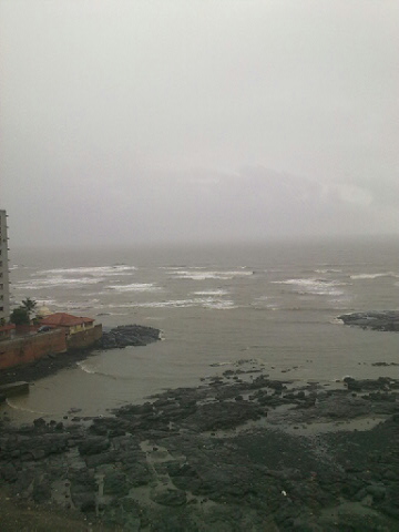
A thick covering of multi-layer clouds covered the Mumbai skies from afternoon on Sunday. Low strato cumulus clouds at 1500 feet are sailing past with gusty winds from 2 pm onwards heralding the SWM.


Pics taken from Mahalaxmi on Sunday Afternoon (on a lazy Sunday afternoon ..-:))


Vagaries' Daily Hits at 1031 on Saturday, 2nd Highest Daily Hit Reading....Thanks everyone for the Response and Faith..For details of area wise viewership, click on "view my stats" below counter.


Saturday, June 16, 2012


The UAC off the Orissa coast in the Bay persists, and may move inland by Sunday morning. Associated cloudings are seen in Orissa, and adjoining Chattisgarh.
Moving inland, precipitation could be expected in Orissa, Northern Coastal and Northern Interior AP, North of Vizag, and adjoining Vidarbha. Rapidly moving inland, rainfall in coastal regions will decrease by Monday, but the persistent UAC on Monday will bring rains to Northern Ap, and adjoining Vid on Monday and Tuesday. Hyderabad can expect rains on these days.
SWM could advance in Vid (Nagpur) and Northern interior and coastal AP by 19th June.
UAC fades away very fast within 2 days from Monday.

Along the west coast, the off shore trough is getting organised from Karnataka to Kerala. Expect some moderate rainfall moving into S.I.Karnataka on Sunday and Monday.
The trough will shift close to Konkan by Saturday night. 

North Konkan (Mumbai) can expect gusty winds and occasional showers on Sunday.
Mumbai rain amount (with gusty winds)for Sunday may be around 30-35 mms. 
Odd heavy shower in some parts expected, and SWM advance on Sunday into Mumbai.

Strong West winds will again raise the day temperatures in Chennai to over 40c on Sunday and Monday.


Noticing Upper Clouds in North Arabian Sea Streaming NW/SE direction ?? Puzzling ! Hope short its lived. Yes, otherwise this rain spell becomes short lived !


Re-Checking my readings with this cloud motion image...


Cloud Movement image from IMD

Friday, June 15, 2012

Mumbai Lakes Position on Mumbai Page.. Draw able Level ..@90 days stock..Mumbai weekend forecast on Mumbai Page

Observations as on Friday Morning:
Re-read MW-8 (below) and view map to get  easy reference of today's narration :

Developments seem to be almost "in Line" with  reference  to the Map put up on MW-8  and the narration " What Next" (of Wednesday's MW-8).

1. The UAC mentioned in the Arabian Sea has moved a bit towards the NW, and lay off the Dwarka coast. As a result, the off shore trough remains tilted west wards (away from the konkan) as on Friday.

UAC is expected to fizzle out by Saturday morning, returning the trough back towards the coast by 16th (see map). Later, by 17th, we wait for the "new" UAC to get embedded in the trough.
Rainfall will be heavy around the NW Saurastra coast till Friday night. 

Cloudy weather moving into Sindh coast and Karachi on Friday.

2. SWM is expected to pick up in the N.Konkan region from Saturday, once "normalcy" returns.
Saturday Night/Sunday would see the rains increasing, and Mumbai getting the forecasted rains and possibly the SWM advent.

Forecast for Mumbai remains the same as put up on Wednesday.(Had a few Queries regarding Mumbai) ;

3. The UAC in the Bay has formed, and IMD indicates that this may descend to form a low.
Even as a UAC, Vagaries has mentioned its brief inward movement into Eastern India. The path and life of the UAC is shown in the map ( Wed. MW-8).
Being in uniform with that predicted in MW-8, Monsoon progress will almost be on line as mentioned in the regions.

Wednesday, June 13, 2012


Mumbai Lake Levels on Mumbai Page....


Monsoon Watch -8  (Periodical Progress and Current Status). 


Much has happened after the last Monsoon Watch put up on Vagaries. MW-7 pushed the Monsoon into Maldives and Andamans. 


Current Position Explanation till 13th June:


All through this year's previous MWs articles, we have been mentioning, and explaining that the Arabian Sea sector of the Monsoon has been weak, and lagging. It was either a weak cross equtorial flow or a weak Somali effect or not enough momentumin the Arabian Sea due to low SSTs.
While, the Bay branch, has been normal and was always on schedule.


We saw the SWM advance into the Bay Islands almost on schedule by the 19th of May. Progressed well, though a little behind date into the Andaman Sea and had covered the Islands by the 25th of May. The Arabian Sea branch covered the Maldives around the 25th/26th of May.


The Bay current and momentum was kept active by strong cross flows from the South, and with a pulse from the Thai mainland, the SWM moved into the NE states by the 3rd of June. 
Cherrapunji announced the arrival with 400 mms of rain in a day !


The Arabian Branch had always been without proper support and energy. All the supporting factors here were lagging, and "letting down" the SWM. Still. a weak and lame SWM crept into Kerala, and the Indian mainland was hit on 5th June.
The off shore trough here along the west coast responded fast, and its formation led to the advance along the coast into coastal Karnatak and Goa by the 6th of June, and into South Konkan by the 10th.


Interior Karnataka and TN did not get the required benefits of Monsoon rains as the sole initator of the SWM advance along the west coast was a "lame" trough. 
But, all the other parameters for Monsoon advance like OLR, Upper Winds, UTH and 200 hp jet streams were favourable in S.I.Karnataka and TN, but without proper precipitation.
Vagaries had moved in the SWM in these regions on 10th due to these factors. IMD has moved the SWM in on the 13th.


For the Eastern sector, the sector which gets the SWM from the Bay, resistance came from 3 WDs, J1,J2 and now J3. The back to back WDs in June kept the pulses and any system from the Bay from forming in the Northern Bay areas, and prevented any form of Monsoon advance moving into the mainland all along from TN to the NE states. 


The Eastwards moving WDs pulled the seasonal low into an elongated low across the plains of N.India. In early June, the first 10/11 days of June, we see a long elongated region of 998 mb low stretching from around Delhi to Bihar. 


This is in effect a similar condition to a "break monsoon" situation. Though not actually a break monsoon scene, as the Monsoon has halted advance well South of the Peninsula.
The actual area under Monsoon as on 13th is very small and comparatively much less than normal coverage.


For Chennai, Strong Westerly winds prevented and blocked the East sea breeze from setting in last 2/3 days, and resulted in the days shooting up again to 40c and above.


Due to lack of cooler and moist air, prevented from flowing in land, Orissa, Chattisgarh and Coastal AP bore the brunt of a severe heat wave, which broke several all time records. In fact it was one of the longest lasting heat waves in terms of days in Orissa. 
Bhubaneshwar broke its all time high record. Vagaries has been mentioning these high temperatures in its daily blogs.


Meanwhile, a "brave' vortex maneged to creep into Coastal AP yesterday (Tuesday,12th June), and bring some relief rains along the coastal regions. Tuni and Vizag recieved 24 mms. Other hotspots like Vijaywada and Narsapur were lucky to get some soothing showers.


Between the 10th and the 13th of June, there was a favourable "chance" for the Monsoon to move into North Konkan due to the formation of a UAC in the off shore trough. An ideal influencing factor for monsoon advance. The UAC was critically located just off the Mumbai coast. 


But the clouding associated with the system was restricted to the SW of the system. By the 13th, the UAC, though still present, has moved NW, and tilted the Northern end of the trough away from the coast, westwards


Resultantly, instead of Konkan, we see heavy thundershowers in Saurastra, parts of Kutch and Eastern Gujarat on Wednesday. Heavy rainfall ranging from 15 mms - 70 mms are reported fom Gujarat. 
Askokbhai mentions Rajkot getting 44 mms in 90 minutes on Wednesday afternoon, with maximum rain rate around 3.30pm at 150 mms/hour ! 


Thundershowers will linger around for another day due to superb moisture incursion. Bharuch and Baroda regions to get maximum rains on Thursday.


What Next ?:


This UAC in the Arabian Sea is expected to persist for a day more, but more towards the west. On dissolving, we may have the off shore trough shifting back near the west coast again.


The revival of the monsoon gets another chance, if/when the trough moves towards the coast, and hosts another UAC within. 
Synoptic situation indicates formation of an embedded low by Saturday, 16th/Sunday, 17th. 
But current scenario shows shows sustaining and retention strength of the "to-be" UAC is poor, and may dissolve within 36 hrs. of forming. (Chances for Monsoon advance up the west coast is almost "touch and Go".)


But, even this factor is cosmetic. It will move up the SWM along the coast, but the interiors of Mah region will devoid of monsoon rains till a proper low emerges from the Bay. 

With the Bay clear of any resistance (from WDs), it should getting active from Sunday, 17th June, onwards. A pulse/UAC can travel into AP and move towards Vid and adjoining Mah areas. 
Possibility of Monsoon advance into Vid and Chattisgarh regions and East MP by the 20th of June. 
Simultaniously, monsoon rains will move westwards from the Bay into W Bengal (Kolkata) and remaining Bangladesh.


A weak MJO phase enters our seas from 15th June, and could prevail till 27th June at least. The 30 day SOI value is also not very favourable at -7.8.
Hence, Monsoon remains overall weak in June even after advance. 


Interior Peninsula, NW India may see a June deficit, alongwith some regions of East MP, Rajasthan and Southern Interior Peninsula.


Presently, the ENSO condition is neutral. Many international models forecast the El-Nino to develop by September. 


I would not currently worry about the El-Nino for our Monsoon. Let us be more concerned with the current weak MJO phase, which might push the SWM into a "break" phase immiedietly on setting in  !


Mumbai
June rainfall can still reach around 550 mms. 


Thursday 14th: Partly cloudy with Thunder heads in the evening sky. Chances of some rains in some parts Rain < 5 mms


Friday, 15th: Thunderclouds forming could precipitate rains in some parts of the city. expect the odd heavy shower somewhere. Rain amount 10 mms.


Saturday, 16th: Increasing cloudiness and a few showers and thunder shower by evening. Rain Amount 15-20 mms. 


Monsoon could advance into Mumbai by Sunday, 17th.
(Mumbai Wednesday ,13th, clear sky Sunset pic on Mumbai Page)

Tuesday, June 12, 2012


"The UAC will just shift a bit towards the coast on Tuesday, and bring some rains in North Konkan". This statement was put up yesterday (Monday, 11th June) on Vagaries.


A UAC off the West coast generally plays a very usefull part in influencing and activating the Monsoon current.


It was on this basis itself, that Vagaries forecasted a nominal increase in rainfall in N.Konkan and the Mumbai-Pune region for Tuesday, 12th June. And Vagaries waited for this "small" event to announce the SWM into Mumbai.


But...man proposes.......the events assembled systematically thru the day on Tuesday. The 700 mb and 850 mb Maps shown below indicate a "perfect "formation of the UAC. 


Also view it on this site:http://www.imd.gov.in/section/nhac/dynamic/nwp/00hgfs_700wind.htm


But, the UAC just "flirted" with the region.


It is apperant that the UAC will shift away from North Konkan Coast next few days...reluctantly keeping the given forecast on Tuesday's blog intact. 
The UAC is moving away from the coast.
J-3, another WD is moving across the Northern region of the sub-continent. Induced lows from J-3 could deter the Northward movement of the Monsoon. 


Has Mumbai and N.Konkan missed an opportunity ? 
Mumbai and Surat SWM pushed off till at least Sunday, 17th June.(One more chance if an off shore trough can re charge with an embedded UAC after Sunday).


Pune was cloudy in the afternoon, with thunder heads showing up in the eastern skies. In fact, there was a report of light drizzles from the outskirts (Sports city area) in the afternoon.
Next 2 days will see partly cloudy skies, but warming up in the day. Light drizzling in some parts.


Shitij just reports from Surat of a shower. (Vagaries had mentioned of a shower for Tuesday). Now, as mentioned, there will be a decrease in rainfall from Wednesay.


Central Interior regions of Saurashtra would get some rainfall, light to medium, in a few spread out pockets till Wednesday. 


Mumbai woke up to sunny skies, and the clouds gathered as per the assumption, and was almost overcast by afternoon. The high and medium clouds rolled in from the South, indicating a low area (aloft) due west of Mumbai threatening rain right thru the day. 
No area in the city recorded any rain.(Later,subsequent to publishing this, Vagaries recorded 0.9 mms in the night). 


Now, we stick to the given forecast. 
Wednesday/Thursday/Friday sees partly cloudy skies with light rain in some parts of Mumbai. Rain amounts < 5mms.


Vagaries' had already announced the advent of the SWM into S.Konkan (answer to a certain mail query) on Sunday (10th). Several stations in S.Konkan recieved good rainfall today:Kudal 110 mms, Sawantwadi 74 mms, Vengurla 71 mms and Devgad 46 mms to name a few.


Due to the WD effect, even Vortices expected (pulses) from the trough in the Eastern coast might get "pushed away" further Eastwards. This will prevent further rainfall in the peneinsula regions (East) and even deter the SWM from moving into Bengal and Kolkata till Sunday 17th June at least.


The anticipated vortex will form near Hyderabad as a pulse moves westwards, and bring showers to the city on Wednesday for a day.


Vagaries had mentioned 2 days ago of the prospects of strong west winds shooting up Chennai's day temperatures again to 40c. Meenambakam was 40.4c on Tuesday. We can expect the days to remain around 40c for another day, before slipping back into the late 30s.  


Kashmir had precipitation from J-3 today. Gulmarg, almost missed out on the snow as the low fell to 2.5c (-5c) with 24 mms of rains.


Several pockets in Pakistan's Balochistan and Northern Regions  had the WD precipitation. Hot spots in the Balochistan and Sindh suddenly saw a drop in temperatures. As per PMD site, Sibbi, a Balochistan hotspot, saw 19 mms of rain and a low of 14.2c !!Almost 15c below normal !! 


Lightning From A Space Station !  Must See Rare Pic on Space News Page...


  1st August...   .