Saturday, June 30, 2012


June 2012 Rainfall totals (in mms) for some Local Stations. 


Mumbai Centres: Colaba  177mms  Scruz  299 mms  vagaries 160 mms.  


Around Mumbai: Thane 385 mms   Panvel  311 mms  Vasai 158 mms  


Rest of Maharashtra: Malvan 1332 mms (Highest in State), M'shwar  581 mms, Aurangabad 77 mms,  Pune 36 mms. The stations like Shirgonda and Shirur mentioned are still at 0 mms.


South Stations: Bangalore 7 mms, Chennai AP 47 mms, Chennai 25 mms, Surat 85 mms. 


Rain for June in Mumbai Lake Areas: Tulsi 513 mms, Vihar 401 mms, Bhatsa 252, Vaitarna 162 mms


Maharashtra Dams and Reservoir levels and Storage in % as on 30th June: Konkan 28%, Marathwada 6%,  Amrawati 19%,  Nagpur 20%,  Nasik 7%, Pune 9%  
Others: 21%.  Avg for State: 13%


See Mumbai Page for Mumbai Lakes Storage.
Updating Some June rainfall and Overall Maharashtra Lakes/Reservoir levels by 10.30pm IST


Friday, June 29, 2012

Monsoon 2012

At last, an encouraging sign on the "spoiler" MJO front. Albeit to some extent, like "something is better than nothing" !
 
The MJO phase in our seas is expected to get gradually stronger, and come out of the weak phase  commencing from 5th July. But, it should be noted that it does NOT attain the full strength phase . It remains "out of the weak phase" into something like an "average phase" till 15th July. 
Thereafter, gaining marginally till 24th July, and weaken after that.

The SWM would now re-activate in the existing areas.
Tropical Storm is developing in the S.China sea, and is embedded in the Monsoon Trough.
 
Soon after 5th July, we may see immediate signs of a UAC/Low forming in the North Bay. And with a double effect of the west coast trough strengthening and re-organizing, the west coast will get a activated monsoon in the first week of July.

But, the SWM may take "advantage" of this marginal strengthening. As the MJO starts strengthening, and the pressure starts dropping, the SWM advance would commence into Saurashtra and Gujarat (7th/8th July), and in the North, Delhi may get its first Monsoon showers around 8th July.
SWM may move into Rajasthan and cover the entire country by the 10th of July.

 
We shall observe and follow the developments in all sectors as and when it happens.
Even if July rains are normal, It may be possible that the June deficit may remain, and may not be recovered.
 

 Progress of SWM into Pakistan possibly may be initially into Coastal Sindh around the 7th/8th July. 
After, that, along with is advance into NW India, it could move into Punjab(Pakistan ) around the 10th of July. as it advances into Rajasthan.

ENSO  continues in the neutral stage, though the SST warming has spread more in the last 15 days. Warm anomalies now extend across most of the eastern half of the equatorial Pacific Ocean and along the west coast of South America. The ocean is more than 1.0°C above average in some areas.
Latest SOI is -11.

 
Forecast For this Weekend (30th June-2nd July):
An UAC at 700 hpa is seen over interior Maharashtra as on Friday. The effect of this will be:
 
1. Saturday evening/night: Fairly good precipitation over western Vidharbha and adjoining Marathwada.
2. Sunday Evening/Night: Heavy thundershowers over West Vidharbha and adjoining North AP. Rainfall around Hydersabad expected.
3. Good precipitation in North AP ,including Hyderabad, and rainfall by evening in South Madhya Maharashtra and N.I. Karnataka.

City wise Week End Forecast:
 
Mumbai: Saturday/Sunday: Partly cloudy with sunny spells. Sunday may be warm and sunny. A shower or two in some parts. Rain Amounts: 5 mms/Day. 
Monday: Day getting cloudy and heavy thundershower by evening/night. Rain amount around 40-50 mms.

Pune: Saturday/Sunday: Partly Cloudy with light drizzles in some parts. 
Monday: Cloudy day with clouds forming and getting thicker. Heavy rains and thunder by afternoon/evening. Rain Amount around 40 mms.

Surat partly cloudy on Sat/Sun. Likely to get the heavy rains Monday night.

Delhi: Hot around 42c, with low temperatures around 32c. No Monsoon advance this weekend !

Bangalore: Not much rain.The weekend will be cloudy and light drizzles in some parts. Days will be around 29c.
 
TN rains will be restricted to the Western (Nilgiri) side. Chennai had decent rains last 2 days, but weekend could be dry with light clouding.


Major cities June rainfall v/s estimate will be put up tomorrow. Also July estimates for cities.

Monsoon 2012


The All India SWM Performance in June 2012:


1. The progress of the SWM itself is behind schedule, and as of end June, covers only about half of India. Normally, it should cover almost complete NW India by end June. The comparison with the normally required progress is shown on the map below.


Reasons have been discussed many a times throughout the month in vagaries blogs. Break Monsoon situation, even before the monsoon sets in, resulting in No Systems form either bay or Arabian Sea.


The actual performance has been disapointing over all. Very crucial for agriculture and economy, as almost 55% of the arable land does not have irrigation facilities and depends on direct rainfall.


The Water storage for the country as a whole is 16% of the live capacity storage. 
And for maharashtra it is 13% of the capacity. 


June end region wise map shows the deficit and scanty regions, mostly due to non arrival of Monsoon there. Comparison with Vagaries' June forecast put up in early June also shown.


The June end deficit this year is -23%.
Previous years June end performance was: 2011: +11%   2010: -16%    2009: -54%     2008: +11% 


Cities figures for June will be discussed and compared with Forecast tomorrow, after taking rainfall details on 30th Morning.


Now what for July ? MJO showing positive signs...?? drafting blog now and will publish by tonite 10.30pm (IST)

Thursday, June 28, 2012


Water Storage Position for Maharashtra and Mumbai put up on Mumbai Page.
Rainfall from 8.30am -5.30pm Thursday:
Mumbai Colaba 28 mms, S'Cruz 18.0 mms, Vagaries 18.0 mms, Alibag 14.0 mms, Mahableshwar 27 mms , Panjim 43 mms, Ratnagiri 40 mms
Next 6 hrs (valid till 1am Friday) for Mumbai : A few Passing Showers.


Latest on MJO and July outlook tomorrow 


Mumbai Special :


Well, its finally here ! After holding on to the hope of a Thursday revival, Mumbai got its heavy downpour from early morning.


As explained in Vagaries yesterday, there was some hope of the off shore trough strengthening off N.Konkan.
 Yesterday's MSLP chart put up (for Mumbai region) clearly showed the trough forming only off S. Konkan and below. Having the "capability" to form further North was envisaged in Vagaries yesterday. 


No, upper air charts do not indicate any UAC formation. Rains are purely a result of the much awaited (since Tuesday) off shore trough.(not localised). 


However, rainfall throughout Mumbai has been very very erratic. Check these figures:
In the 24 hrs till 8.30 am Thursday, Colaba measured 21 mms, S'Cruz  75 mms, Vagaries 4 mms, Thane 145 mms, Panvel 2 mms, Vasai 44 mms.


Since 8.30 am till 11.30am (Thursday), Dadar has received 50 mms, while Goregaon area it seems has measured 102 mms. and Malad 116 mms and Kandivali 130 mms. 
Colaba Weather Station has recorded 26 mms and S'Cruz 17 mms. vagaries measures 17 mms.


Expecting Rainfall to taper down after 3 pm.


Wednesday, June 27, 2012

As the West Coast Off shore trough persisit ( Quote:IMD), S.Konkan/Goa are Continuously lashed by rains. Goa too has achieved the 1000 mms mark for this Monsoon.
After Malvan in S.Konkan, it is Patgaon (1048 mms)  in Maharashtra and Pernem (1156 mms) and Quepem (1034 mms) in Goa.Gaganbavda (Kolhapur) is at 890mms, while Amboli was 812 mms ( till 25th June).

The strength of the trough is really showing its might in the region with heavy rains persisting. 5-11 cms in the last 24 hrs have added to the totals. Rains remain weak in North Konkan.
The reasons for the divided rains are clear from this IMD chart, showing a weak trough off N.Konkan.


Mumbai had 1.6 mms at Colaba and no rai at S'cruz or at Vagaries. The off shore trough will remain in position till at least Saturday. A further weakening of the monsoon trough can possibly strengthen the trough off  N.Konkan . It is resisted by lack of energy and momentum (weak MJO aided). Mumbai can still hold out hopes for some improved rainfall for Thursday.

But, seeing the current charts and synoptic scene, I see the Off shore trough getting stronger along the S.Konkan and Goa coast again on Sunday 1st July and Monday 2nd July. Very heavy rains expected in Goa    
 on 1st/2nd.July.

Meanwhile, much needed rains are lashing Chennai now, Wednesday evening/night.Rainfall measured upto 7 mms till night.
The rainfall from cross Kerala has crept in thru western TN.

Pradeep informs us of the heaviest rainfall ! 220 mms ended 27th June, 772 mms in 24 hrs ended 8.30 am 26th June, 461 mms ended 25th June. 1453 mms in 3 days !!
Yes ! Whereelse ? But Cherrapunji !! Undoubtedly the King !

Tuesday, June 26, 2012


On Tuesday, Meaningfull resurging of the off shore trough along the west coast was limited to S.Konkan and Coastal Karnataka. Precipitation along the Karnataka coast (Honavar 42 mms) penetrated inland resulting in much awaited rainfall in N.I.Karnataka on Tuesday evening. Bijapur, Bagalkot, Raichur (24 mms), and Bellary are receiving good rainfall while moderate rains are seen in Hubli, Gadag and surrounding regions.


Coastal rains from Kerala are also moving into the Nilgiri Districts of TN. West TN may see some rains next 2 days (mentioned in vagaries' forecast map of Monday, republished again below). 
Coastal AP forecast remains as per Map.


In South Konkan, Ratnagiri is currently getting moderate rains, while Panjim guaged up 19 mms till 5.30pm Tuesday.


But, N.Konkan got nominal and scattered rainfall. Though heavy in few pockets, overall the day (Tuesday) saw thundershowers in a few places inland, and showers ranging from 5-25 mms in the day. Was expecting better rains in N.Konkan, including Mumbai Region on Tuesday/Wednesday. 


Mumbai had some showers on Tuesday, with thunder heads towering in the Eastern sky. (Thunder is forecasted for Tuesday).Though the rainfall during the day was very less, SCruz getting 3.6 mms, Colaba 0.6 mms and vagaries station 4.0 mms till 8.30pm Tuesday. Thane town measured 8 mms in the period.
Mumbai still has another day or two, so the precipitation can improve.


With a weak MJO phase prevailing, it is difficult for any trough or vortex to get moisture and "feeding". The off shore trough stands and remains strengthened for the next 2 days, due to a "shrunk" monsoon axis. 
No chance of Monsoon advancing beyond the current line soon.


In Pakistan, the WD has precipitated som rains in the North, heat continues to sizzle Balochistan and Sindh. 46c was the highest in Sibbi and Jacobabad, with Sukkur a close 45c. 
Dry, Windy, and dusty for Sukkur on Wednesday.


Monday, June 25, 2012

 In Vagaries' Forecast, The Monsoon Trough in the North was to relent temporarily, and The Trough along the west Coast get a bit strong by today (Tuesday). 

The Northern trough HAS relented, and the West Coast off shore trough HAS become a bit more active. 
But, not in the region and areas estimated by Vagaries. The off shore trough, if you re read my forecast map of yesterday, was to have become activated and generate moderate rains in the S.Konkan/Goa region (see yesterday's Map). 
But, if we observe the Sat image, it has activated the coast  more towards the South, concentrating on the much needed coastal Karnataka and Goa is included. 
S.Konkan is getting what N.Konkan should be getting, while N.Konkan is left out. 


More in detail tonite by 10.30pm.....I have also to put up a Aurangabad District Page tonite..

Confused and anxious Farmers, from a few Talukas in Aurangabad district, have requested Vagaries to put up the Weather forecast and current weather situation for their Talukas. Wanting to know as to when they can start sowing seeds and expected quantum of rains. For them, I have set up a special Page, which they can refer to and update themselves..
Hope it helps them and eases their problems..

Latest Cloud development @ 11/30 am Tuesday around Mumbai from Dundee Sat.Image 


Thunder Heads are seen SE and East of Mumbai..Hoping to see them develop..


All India SWM Toppers from 1st June -24th June compiled by Pradeep put up on Inter Active Page...Must See, and be Surprised !!


Latest Mumbai Forecast Just put  up  On Mumbai Page..


Mumbai Page & Vagaries Readngs daily updated in the morning with rainfall..Panvel and Thane Updated.


The Monsoon trough along N.India seems "shrunk" in today's (Sunday) MSLP charts. However, the Eastern end seems active with an embedded UAC in Eastern UP region, and a trough runs from this UAC Southwards into W Bengal region. 


Charts indicate the Monsoon trough re-establishing position again from Wednesday. 
A WD passes thru North Pakistan and Kashmir, precipitating light rains on Monday.


No Further advance of SWM expected this week till Thursday at least.


A weakening of the Monsoon Trough across Northern India could result in the off shore trough along the West Coast strengthening to some extent from Monday thru Wednesday. 


But, this could result in increased rainfall along the west coast only. Interior Mah, Karnataka, AP and TN will be practically devoid of rainfall this week. No meaningfull rains. 


Forecast Monday thru Thursday: 


SWM rains increasing from Monday evening thru Wednesday along the West Coast. Central regions of heaviest rains (over 100 mms/day) will be South Konkan/Goa regions, followed by Coastal Karnataka with around 70-100mm/day, and North Konkan stations will vary from 30-60 mms/day.


Rainfall will be restricted along the West coast to the Monsoon upper limit, that is below 20N
Rest of interior Peninsula will not get any meaningfull increase in rains, almost dry. (5-10mms in pockets).
Decrease in rains in W Bengal from Monday thru Thursday. 
Coastal Gujarat can get some light rain, not much to cheer about in Saurashtra and Gujarat region.


Off shore trough can get weak again fom Wednesday 27th. 
MJO shows no signs of leaving weak phase in our seas till 1st July at least.


Mumbai Forecast for Monday 25th/Tuesday 26th/Wednesday 27th: Same as that put up on Mumbai Page Yesterday.


Pune: Monday 25th/Tuesday 26th/Wednesday 27th/Thursday 28th: Partly cloudy skies. Thundery developments on Tuesday. 50% chances of light rain 95-10 mms)on Tuesday. Other days light drizzles (less than 5 mms) in some parts of Pune. Days will be 32c and 23c at night.


Surat: Monday/Tuesday/Wednesday/Thursday: A nominal increase in rainfall in Surat on Tuesday, when around 5-10 mms is possible. Rest of the days will be cloudy with light rains in some parts. Thursday may see a rise in day temperature to 33c with 28c at night.


Delhi: where's the rain? No rain no Monsoon progress towards Delhi till Thursday at least. Hot and "loo" blowing in the night. Days could go to 45c on Wed/Thursday with a hot night at 32/33c.


Pakistan will also have to wait for the Monsoon. Vagaries had put up around 5th July in its forecast map (see on Current Weather Page). The Limit of the 
Monsoon is maintained as and when it moves (on Current Weather Page).


Due to the current WD passing over the Northern regions, some dust storms and rain were seen in Northern regions. 


Islamabad, which had no rain, but some clouding, gets some relief, from a sizzling 45c down to 42c ! 
The country high is also at 47c in Turbat. But for the WD, 49/50c was expected !
Sukkur however was very hot at 44c on Sunday, and no respite seen next few days, maybe 45c again. Chances of a dust storm on Monday.

Friday, June 22, 2012

Malvan (S.Konkan) First in Maharshtra to cross 1000 mms this year..1083 mms till Sunday Morning.


For Interested Readers, Thane and Panvel current rainfall put up on Vagaries' Readings Page (Bottom of Page)..those interested, try to observe the pressure movement on vagaries readings and the corresponding rainfall on that day...observe the pressure to judge the rainfall.


See Inter Active Page for Pradeep's Superb list of SWM Toppers...


In N.I.Karnataka, SWM rainfall is deficit (upto 23rd June) to the extent of -50%. Bellary District being the most deficit, at -80%. The District has received only 11 mms against a normal expected of 55 mms. Dharwad is showing a deficit of -69%. 
The lone District (N.I. Karnataka) in the positive is Bidar, at +28%.


Even the coastal region and Malnad regions are deficit, being -28% and -39% respectively.


The average deficit for the State of Karnataka till June 23rd works out to -41%.


The Moisture Adequacy Map speaks for itself. See Map here
Severe(Unfavourable) in entire Interior Karnataka region for agriculture.


Next Week (Monday) Brief Report on Interior Maharashtra.


Bangalore review:


SWM is still limping in Bangalore. Bangalore City has recieved just 4 mms from 1st June, against a normal of 73 mms,-95%. Air Port has, measured 15 mms against a normal of 65 mms -77%.


Bangalore comes under th S.I.Karnataka region, with Mysore, Davanagere, Tumkur and Kolar. 


In Ramanagara, rains are deficit to the extent of -86% !
The whole region is now facing deficit rains this season to the extent of -69%.
Diagram shows only 3 days of rain in June as yet.

Hotter days throughout the month..

Effective strong Easterly Winds North of the Monsoon Trough in the North,  Pushes the SWM into UP, Reaching upto Lucknow on Friday, 22nd June. 
It has also moved into most of Nepal, barring Extereme Western Parts .
See Current Weather Page.. 

Thursday, June 21, 2012


Today,Thursday 21st, the axis of the Monsoon is stuck to its Northern position along the UP plains and stretching from Punjab (Pakistan) thru Delhi and with its Eastern end over UP. As explained a few days back in Vagaries, the Easterly winds blow to the North of the axis and the westerlies to the south. Please refer to Monday axis map shown in Vagaries .


Today (Thursday), in the 700 hpa chart analysis, we see another UAC formed over the Bay off the W.Bengal/Orissa coast.


This UAC will track into the axis and bring heavy rainfall into Orissa and East MAP in the next 2 days, Friday and Saturday. By Saturday evening/Sunday, it will fizzle out as an embedded UAC in the trough somewhere in Central UP.


Now, as a result, from Friday, 22nd, the SWM will move "from the rear" deeper into west UP and along the axis, proceed Westwards. 
The Monsoon progress halts as the UAC weakens (Sunday).
Delhi may have to wait.


After the Monsoon trough in the North weakens, the rains will rainfall in Orissa and adjoining W Bengal will decrease to a greater extent from Tuesday 26th. 
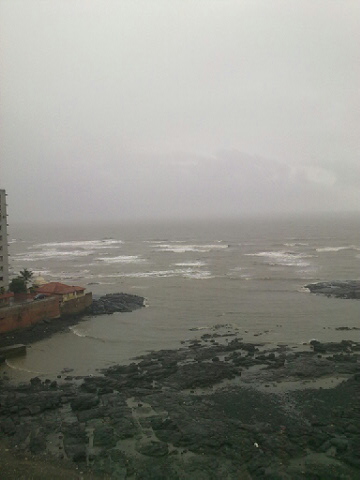
Resultatntly, a very windy Sunday with west winds for Kolkata. Rainfall in Kolkata will be negligible from Sunday. 


But, the Break Monsoon" status quo continues in the Peninsula and Western India. It will be negligible rains in West MP, Gujarat, Interior Maharashtra and the NW states till Monday, 25th.


Strong Dusty Westerly winds would sweep Gujarat, Rajasthan and parts of NW India Saturday thru Monday.


With the trough remaiming weak off the West coast, and the trough in the North in its Northern most position, this status quo for the region, and the west coast will continue to get meagre rainfall at least till Sunday/Monday, 24/25th. 
We could see the off shore trough in the west strengthening from Tuesday. 26th, to some extent. 


The Southern States of TN, interior Karnataka and complete AP, will see no meaningfull increase in rains till Tueday 25th (at least). 
Temperatures expected to rise to over 40c again from Sunday thru Monday in Coastal AP as the region gets strong West winds, blowing out in the Sea.


Pakistan: Karachi will get strong west winds, sweeping thru Lower Sindh regions Saturday thru Monday. Monsoon rains have still to cover many an area before reaching Pakistan. 
Vagaries had put 1st week of July in the last forecast.


With the Monsoon playing truant, Balochistan and Sindh will continue to heat up. As estimated, the region has heated up, with Larkana at 49c on Thursday. Another 50c is possible this weekend. 
Sukkur will continue to scale 46c, maybe touch 47c on the weekend. 


Mumbai Forecast:
Friday 22nd/Saturday 23rd/Sunday 24th: Hazy skies, Partly Cloudy, with hot days at 33/34c and nights at 27/28c. A light rain shower with a couple of passing rains in some parts. Rain amount : 5-10 mms.


Monday 25th: Partly cloudy with days at 31c and possibility of some showers in some parts in the evening. Rain amount upto 10 mms. 


Thundery developments on Tuesday. Tuesday forecast later.


Pune: Friday/Saturday/Sunday/Monday: Partly cloudy. Light drizzle in some parts. Days will be around 32c. Thundery developments on Monday evening (may not rain).


Surat: also will see no significant increase or change in rainfall till Monday. In fact nights could get stuffy at warm at 28c. Rain amount may not exceed 5 mms /day.
Nagpur may see some weekend showers due to the "fringe" effect of the UAC mentioned above. As the UAC fades, the rainfall decreases substantially from Monday in Nagpur.

Tuesday, June 19, 2012


Refer to the forecast map put up by vagaries yesterday, resisting the axis along the Northern Plains, we see the Eastern regions having moderate precipitation today ( purple coloured in the Map), and..
Today, 19th June, with the help of UAC system in the Bay a weakish Monsoon moves along the East Coast into Chattisgarh, Orissa, W Bengal, Bihar and also Northern Mah and Vidarbha.

Almost Break Monsoon Conditions prevailed over the Central, Western and Interior Southern regions.

Most cities in Vid had nominal rainfall from 20-30 mms on Tuesday. Though Nagpur proper was dry today. As a result of the advance the day temperature relief was felt in Vid, with the days not exceeding 33c in any city.
Bilaspur in Chattisgarh had the highest precipitation of 62 mms.

As per the map put up in Vagaries yesterday, Fairly good rainfall was recorded in Coastal AP and Telengana regions. Some of the higher rainfall figures for AP in cms :Mulug (dist Warangal) 12, Boath (dist Adilabad) 9, Venkatapuram (dist
Khammam) 9, Perur (dist Khammam) 7,
Prominent in the state were: Hyderabad city received 33 mms , Nizamambad 29 mms,  Khammam 26 mms, Hakimpet 24 mms and Bhadrachalam 26 mms.

Rainfall can decrease after Wednesday in the region. However, some isolated pockets along the East Coast North of Vizag can get some precipitation.
Southern Interior Peninsula will be almost dry and NW India remains dry too next 3/4 days.
West Coast Forecast remains valid as given on Monday.

Monday, June 18, 2012


On Monday. 18th June, the latest WD remains aloft over the North Pakistan and Kashmir region. Its weak precipitation is restricted to the extreme Northern regions of India and parts of N.Pakistan. 


Extreme heat prevails over the Himalayan state of HP. With Kullu recording 38c, Dharamsala 36c, Manali and Simla at 31c (+7c). Mussourie saw 31.6c (+8c) and Nainital was at 30c.  


But, as has happened last week, this WD has again elongated and pulled the Seasonal low eastwards, creating an axis run from Pakistan Punjab thru Delhi thru Upper UP upto Bihar. 
That translates into a sort of break monsoon conditions below the axis. The prominent reason why i had mentioned "No substantial push of the Monsoon" yesterday, and in the previous forecasts. 
Only a low from the Bay can "break " the axis. 


Meanwhile, as the East winds (north of the axis) interact with the westerlies (south of the axis), we see precipitation at many places along the line.
Delhi and the NCR received light rains today. As RK and others report, they have brought some relief from the heat of the past 3 days.


Continuing from Yesterday, the "life" of the current UAC crossing in from the Bay is limited till Tuesday, 19th. 


(*see Below for vagaries' nomenclature)


From Tuesday thru Friday, there will be some moderate* rains in Northern AP (SriKakulaum) and adjoining Orissa regions, and parts of Gangetic West Bengal. 
Southern Konkan and Coastal Karnataka will recieve 50% chances of medium* rains. 
Heavy rains in the sub-Himalayan regions of W Bengal will continue thru this week.


North Konkan will see a decrease in rains, and with interior Maharashtra, Interior Karnataka and Southern/Interior AP getting 40% chances of light* rains.


Heavy rainfall moving into Nepal  from Wednesday, with thundershowers in Kathmandu Wed/Thursday. 


Mumbai : Tuesday/Wednesday/Thursday: Partly cloudy with 50% chance of light rains (upto 5-20 mms/day). Days getting warmer to reach 32/33c. Nights a stuffy 27c.


Pune: Tuesday/Wednesday/Thursday: Partly cloudy with light drizzles in some parts. No meaningfull increase in rains.


Surat: Cloudy with passing light rain showers next 3/4 days. Again, no increase in rainfall due to explained situation.


Nagpur may also see a decrease in rains from Tuesday. Rest of the week may just about bring a convective thunder shower in some parts. Monsoon yet to set in.


{*Meaning of Rainfall Terms (in 24 hr Time period) given in Vagaries:
Extremely heavy: > 150 mms
Very Heavy: 100-150 mms
Heavy: 70-100mms
Medium: 40-70 mms
Moderate: 20-40 mms
Light: 5-20 mms
Drizzles: < 5mms.


On Some Occasions Vagaries may put up a % of rainfall Possibility,Meaning:
100%: Sure Shot
80%-100%: Almost Certain in all areas
60%-80%: Likely in many Parts of the region or City
40%-60%: Possible in some parts/areas
20%-40%: Possible in some time in the 24 hr Period in some nearby areas
0%-20%: An outside possibility in city or nearby areas}


With the Monsoon advancing, Sunday, 17th June  Heavy Rainfall figures from Konkan till Monday Morning 8.30 am:

Dapoli  337 mms, Sanganeshwar  282 mms, Tala  274 mms, Devgad   235 mms, Ratnagiri  230 mms, Mahasala 209 mms, Mahad  201 mms, Chiplun  197 mms,  
Poladpur  170 mms, Karjat  110 mms, Panvel  85 mms. Thane 42 mms. 
Others: Pune city 13 mms, Mulshi  61 mms, Mahableshwar 125 mms.


Mumbai Figures on Mumbai Page..

Sunday, June 17, 2012


Mumbai Sunday Rainfall on Mumbai Page and " Vagaries Readings" Page


1. All perfect for the West Coast. As hoped for on Friday, an UAC "dutifully" forms embedded in the trough off the West Coast of India. And, this pulled up the SWM up the Mah coast upto 20N, and moved monsoon clouds into Western/Southern interior Mah.


Today, Sunday, 17th June, SWM has advanced into N.Konkan. Mumbai and upto 20N, Dahanu. See Map on Current Weather Page.
(Check MW6 & 7. Dated 20th and 26th May. Mumbai Monsoon dates were published as 13th/14th June )


2. This was also aided by the remnants of the UAC tracking inwards from the East coast. Now, with a vortex just North of Hyderabad, which is expected to linger in the region of North AP (Hyderabad), N.I.Karnataka (Gulbarga) and adjoining Marathwada, Heavy rain with thunder could be expected in the regions mentioned above thru the life expectancy of the UAC, 2 days, Monday18th and Tuesday 19th.


Hyderabad gets good rainfall till Tuesday, decreasing thereafter.


(sset)Bangalore may see the effect of clouds and some light rains on Monday. As there is no system thereafter, Bangalore will get no meaning full rains till Friday next.


Pune will see clouding and some rains upto 10 mms on Monday, and decreasing from Tuesday. Warming up to 34/35c after Tuesday.
Kolkata will see a slight decrease in rainfall from Tuesday, with very little rainfall till Thursday 21st at least.


SWM pushing into the Marathwada, N.I.Karnataka and S.Orissa and W.Bengal on Monday and  Hopefully moisture from the UAC will create persistent convective showers in a couple of days thereafter (in isolated pockets)with SWM moving into Vid by Tuesday or Wednesday.


No substantial push Northwards of the Monsoon from this point in the coming week.


Dry and hot in Pakistan this coming week. With no rainfall expected, places like Sukkur could cross 46c this week. Hot spots in Balochistan and Sindh could reach 48/49c this week.
Islamabad could be cloudy on Monday as a WD moves away. Dry and warming up later. 


The effect of The Mascarene high, described as the "power House" of the SWM in Vagaries' MW -1 , very aptly decsribed and illustrated by Kaneyen  here. in Indian Weatherman.


The UAC in the Western Arabian Sea has faded, and the off shore trough (west coast) gettting better organised. 


IMD's Meteorogical Criterea for SWM advance is considerable depth of W/SW winds along the coast. That's the reason I got a bit confused when "upper winds tended to veer away from SW directions yesterday.


Today's winds show full SW direction right upto 500 hpa height. 300 hpa and above do not concur, but that is normal. OLR yesterday was 200-230 and today shows 150 along North Konkan.


Other rainfall parameters also satisfy and justify an onset.


A thick covering of multi-layer clouds covered the Mumbai skies from afternoon on Sunday. Low strato cumulus clouds at 1500 feet are sailing past with gusty winds from 2 pm onwards heralding the SWM.


Pics taken from Mahalaxmi on Sunday Afternoon (on a lazy Sunday afternoon ..-:))


Vagaries' Daily Hits at 1031 on Saturday, 2nd Highest Daily Hit Reading....Thanks everyone for the Response and Faith..For details of area wise viewership, click on "view my stats" below counter.


Saturday, June 16, 2012


The UAC off the Orissa coast in the Bay persists, and may move inland by Sunday morning. Associated cloudings are seen in Orissa, and adjoining Chattisgarh.
Moving inland, precipitation could be expected in Orissa, Northern Coastal and Northern Interior AP, North of Vizag, and adjoining Vidarbha. Rapidly moving inland, rainfall in coastal regions will decrease by Monday, but the persistent UAC on Monday will bring rains to Northern Ap, and adjoining Vid on Monday and Tuesday. Hyderabad can expect rains on these days.
SWM could advance in Vid (Nagpur) and Northern interior and coastal AP by 19th June.
UAC fades away very fast within 2 days from Monday.

Along the west coast, the off shore trough is getting organised from Karnataka to Kerala. Expect some moderate rainfall moving into S.I.Karnataka on Sunday and Monday.
The trough will shift close to Konkan by Saturday night. 

North Konkan (Mumbai) can expect gusty winds and occasional showers on Sunday.
Mumbai rain amount (with gusty winds)for Sunday may be around 30-35 mms. 
Odd heavy shower in some parts expected, and SWM advance on Sunday into Mumbai.

Strong West winds will again raise the day temperatures in Chennai to over 40c on Sunday and Monday.


Noticing Upper Clouds in North Arabian Sea Streaming NW/SE direction ?? Puzzling ! Hope short its lived. Yes, otherwise this rain spell becomes short lived !


Re-Checking my readings with this cloud motion image...


Cloud Movement image from IMD

Friday, June 15, 2012

Mumbai Lakes Position on Mumbai Page.. Draw able Level ..@90 days stock..Mumbai weekend forecast on Mumbai Page

Observations as on Friday Morning:
Re-read MW-8 (below) and view map to get  easy reference of today's narration :

Developments seem to be almost "in Line" with  reference  to the Map put up on MW-8  and the narration " What Next" (of Wednesday's MW-8).

1. The UAC mentioned in the Arabian Sea has moved a bit towards the NW, and lay off the Dwarka coast. As a result, the off shore trough remains tilted west wards (away from the konkan) as on Friday.

UAC is expected to fizzle out by Saturday morning, returning the trough back towards the coast by 16th (see map). Later, by 17th, we wait for the "new" UAC to get embedded in the trough.
Rainfall will be heavy around the NW Saurastra coast till Friday night. 

Cloudy weather moving into Sindh coast and Karachi on Friday.

2. SWM is expected to pick up in the N.Konkan region from Saturday, once "normalcy" returns.
Saturday Night/Sunday would see the rains increasing, and Mumbai getting the forecasted rains and possibly the SWM advent.

Forecast for Mumbai remains the same as put up on Wednesday.(Had a few Queries regarding Mumbai) ;

3. The UAC in the Bay has formed, and IMD indicates that this may descend to form a low.
Even as a UAC, Vagaries has mentioned its brief inward movement into Eastern India. The path and life of the UAC is shown in the map ( Wed. MW-8).
Being in uniform with that predicted in MW-8, Monsoon progress will almost be on line as mentioned in the regions.

Wednesday, June 13, 2012


Mumbai Lake Levels on Mumbai Page....


Monsoon Watch -8  (Periodical Progress and Current Status). 


Much has happened after the last Monsoon Watch put up on Vagaries. MW-7 pushed the Monsoon into Maldives and Andamans. 


Current Position Explanation till 13th June:


All through this year's previous MWs articles, we have been mentioning, and explaining that the Arabian Sea sector of the Monsoon has been weak, and lagging. It was either a weak cross equtorial flow or a weak Somali effect or not enough momentumin the Arabian Sea due to low SSTs.
While, the Bay branch, has been normal and was always on schedule.


We saw the SWM advance into the Bay Islands almost on schedule by the 19th of May. Progressed well, though a little behind date into the Andaman Sea and had covered the Islands by the 25th of May. The Arabian Sea branch covered the Maldives around the 25th/26th of May.


The Bay current and momentum was kept active by strong cross flows from the South, and with a pulse from the Thai mainland, the SWM moved into the NE states by the 3rd of June. 
Cherrapunji announced the arrival with 400 mms of rain in a day !


The Arabian Branch had always been without proper support and energy. All the supporting factors here were lagging, and "letting down" the SWM. Still. a weak and lame SWM crept into Kerala, and the Indian mainland was hit on 5th June.
The off shore trough here along the west coast responded fast, and its formation led to the advance along the coast into coastal Karnatak and Goa by the 6th of June, and into South Konkan by the 10th.


Interior Karnataka and TN did not get the required benefits of Monsoon rains as the sole initator of the SWM advance along the west coast was a "lame" trough. 
But, all the other parameters for Monsoon advance like OLR, Upper Winds, UTH and 200 hp jet streams were favourable in S.I.Karnataka and TN, but without proper precipitation.
Vagaries had moved in the SWM in these regions on 10th due to these factors. IMD has moved the SWM in on the 13th.


For the Eastern sector, the sector which gets the SWM from the Bay, resistance came from 3 WDs, J1,J2 and now J3. The back to back WDs in June kept the pulses and any system from the Bay from forming in the Northern Bay areas, and prevented any form of Monsoon advance moving into the mainland all along from TN to the NE states. 


The Eastwards moving WDs pulled the seasonal low into an elongated low across the plains of N.India. In early June, the first 10/11 days of June, we see a long elongated region of 998 mb low stretching from around Delhi to Bihar. 


This is in effect a similar condition to a "break monsoon" situation. Though not actually a break monsoon scene, as the Monsoon has halted advance well South of the Peninsula.
The actual area under Monsoon as on 13th is very small and comparatively much less than normal coverage.


For Chennai, Strong Westerly winds prevented and blocked the East sea breeze from setting in last 2/3 days, and resulted in the days shooting up again to 40c and above.


Due to lack of cooler and moist air, prevented from flowing in land, Orissa, Chattisgarh and Coastal AP bore the brunt of a severe heat wave, which broke several all time records. In fact it was one of the longest lasting heat waves in terms of days in Orissa. 
Bhubaneshwar broke its all time high record. Vagaries has been mentioning these high temperatures in its daily blogs.


Meanwhile, a "brave' vortex maneged to creep into Coastal AP yesterday (Tuesday,12th June), and bring some relief rains along the coastal regions. Tuni and Vizag recieved 24 mms. Other hotspots like Vijaywada and Narsapur were lucky to get some soothing showers.


Between the 10th and the 13th of June, there was a favourable "chance" for the Monsoon to move into North Konkan due to the formation of a UAC in the off shore trough. An ideal influencing factor for monsoon advance. The UAC was critically located just off the Mumbai coast. 


But the clouding associated with the system was restricted to the SW of the system. By the 13th, the UAC, though still present, has moved NW, and tilted the Northern end of the trough away from the coast, westwards


Resultantly, instead of Konkan, we see heavy thundershowers in Saurastra, parts of Kutch and Eastern Gujarat on Wednesday. Heavy rainfall ranging from 15 mms - 70 mms are reported fom Gujarat. 
Askokbhai mentions Rajkot getting 44 mms in 90 minutes on Wednesday afternoon, with maximum rain rate around 3.30pm at 150 mms/hour ! 


Thundershowers will linger around for another day due to superb moisture incursion. Bharuch and Baroda regions to get maximum rains on Thursday.


What Next ?:


This UAC in the Arabian Sea is expected to persist for a day more, but more towards the west. On dissolving, we may have the off shore trough shifting back near the west coast again.


The revival of the monsoon gets another chance, if/when the trough moves towards the coast, and hosts another UAC within. 
Synoptic situation indicates formation of an embedded low by Saturday, 16th/Sunday, 17th. 
But current scenario shows shows sustaining and retention strength of the "to-be" UAC is poor, and may dissolve within 36 hrs. of forming. (Chances for Monsoon advance up the west coast is almost "touch and Go".)


But, even this factor is cosmetic. It will move up the SWM along the coast, but the interiors of Mah region will devoid of monsoon rains till a proper low emerges from the Bay. 

With the Bay clear of any resistance (from WDs), it should getting active from Sunday, 17th June, onwards. A pulse/UAC can travel into AP and move towards Vid and adjoining Mah areas. 
Possibility of Monsoon advance into Vid and Chattisgarh regions and East MP by the 20th of June. 
Simultaniously, monsoon rains will move westwards from the Bay into W Bengal (Kolkata) and remaining Bangladesh.


A weak MJO phase enters our seas from 15th June, and could prevail till 27th June at least. The 30 day SOI value is also not very favourable at -7.8.
Hence, Monsoon remains overall weak in June even after advance. 


Interior Peninsula, NW India may see a June deficit, alongwith some regions of East MP, Rajasthan and Southern Interior Peninsula.


Presently, the ENSO condition is neutral. Many international models forecast the El-Nino to develop by September. 


I would not currently worry about the El-Nino for our Monsoon. Let us be more concerned with the current weak MJO phase, which might push the SWM into a "break" phase immiedietly on setting in  !


Mumbai
June rainfall can still reach around 550 mms. 


Thursday 14th: Partly cloudy with Thunder heads in the evening sky. Chances of some rains in some parts Rain < 5 mms


Friday, 15th: Thunderclouds forming could precipitate rains in some parts of the city. expect the odd heavy shower somewhere. Rain amount 10 mms.


Saturday, 16th: Increasing cloudiness and a few showers and thunder shower by evening. Rain Amount 15-20 mms. 


Monsoon could advance into Mumbai by Sunday, 17th.
(Mumbai Wednesday ,13th, clear sky Sunset pic on Mumbai Page)

Tuesday, June 12, 2012


"The UAC will just shift a bit towards the coast on Tuesday, and bring some rains in North Konkan". This statement was put up yesterday (Monday, 11th June) on Vagaries.


A UAC off the West coast generally plays a very usefull part in influencing and activating the Monsoon current.


It was on this basis itself, that Vagaries forecasted a nominal increase in rainfall in N.Konkan and the Mumbai-Pune region for Tuesday, 12th June. And Vagaries waited for this "small" event to announce the SWM into Mumbai.


But...man proposes.......the events assembled systematically thru the day on Tuesday. The 700 mb and 850 mb Maps shown below indicate a "perfect "formation of the UAC. 


Also view it on this site:http://www.imd.gov.in/section/nhac/dynamic/nwp/00hgfs_700wind.htm


But, the UAC just "flirted" with the region.


It is apperant that the UAC will shift away from North Konkan Coast next few days...reluctantly keeping the given forecast on Tuesday's blog intact. 
The UAC is moving away from the coast.
J-3, another WD is moving across the Northern region of the sub-continent. Induced lows from J-3 could deter the Northward movement of the Monsoon. 


Has Mumbai and N.Konkan missed an opportunity ? 
Mumbai and Surat SWM pushed off till at least Sunday, 17th June.(One more chance if an off shore trough can re charge with an embedded UAC after Sunday).


Pune was cloudy in the afternoon, with thunder heads showing up in the eastern skies. In fact, there was a report of light drizzles from the outskirts (Sports city area) in the afternoon.
Next 2 days will see partly cloudy skies, but warming up in the day. Light drizzling in some parts.


Shitij just reports from Surat of a shower. (Vagaries had mentioned of a shower for Tuesday). Now, as mentioned, there will be a decrease in rainfall from Wednesay.


Central Interior regions of Saurashtra would get some rainfall, light to medium, in a few spread out pockets till Wednesday. 


Mumbai woke up to sunny skies, and the clouds gathered as per the assumption, and was almost overcast by afternoon. The high and medium clouds rolled in from the South, indicating a low area (aloft) due west of Mumbai threatening rain right thru the day. 
No area in the city recorded any rain.(Later,subsequent to publishing this, Vagaries recorded 0.9 mms in the night). 


Now, we stick to the given forecast. 
Wednesday/Thursday/Friday sees partly cloudy skies with light rain in some parts of Mumbai. Rain amounts < 5mms.


Vagaries' had already announced the advent of the SWM into S.Konkan (answer to a certain mail query) on Sunday (10th). Several stations in S.Konkan recieved good rainfall today:Kudal 110 mms, Sawantwadi 74 mms, Vengurla 71 mms and Devgad 46 mms to name a few.


Due to the WD effect, even Vortices expected (pulses) from the trough in the Eastern coast might get "pushed away" further Eastwards. This will prevent further rainfall in the peneinsula regions (East) and even deter the SWM from moving into Bengal and Kolkata till Sunday 17th June at least.


The anticipated vortex will form near Hyderabad as a pulse moves westwards, and bring showers to the city on Wednesday for a day.


Vagaries had mentioned 2 days ago of the prospects of strong west winds shooting up Chennai's day temperatures again to 40c. Meenambakam was 40.4c on Tuesday. We can expect the days to remain around 40c for another day, before slipping back into the late 30s.  


Kashmir had precipitation from J-3 today. Gulmarg, almost missed out on the snow as the low fell to 2.5c (-5c) with 24 mms of rains.


Several pockets in Pakistan's Balochistan and Northern Regions  had the WD precipitation. Hot spots in the Balochistan and Sindh suddenly saw a drop in temperatures. As per PMD site, Sibbi, a Balochistan hotspot, saw 19 mms of rain and a low of 14.2c !!Almost 15c below normal !! 


Lightning From A Space Station !  Must See Rare Pic on Space News Page...


Forecasted East rough  Let's look into the 3rd week of March ( 17th - 21st). Mumbai : Hot weather likely for Mumbai region this week, ty...