Friday, January 29, 2010


Summing up of January Weather For the Indian Region:

Weather wise, It has been an odd and "different" January 2010 for the Indian region.


As a starter,to analyse the the average temperatures observed this winter,  we divide the region.
For the North, the average temperature, for most of the month, has been below normal. Picking up 2 cities from the region, Delhi and Amritsar, the daigram shows the major part of January in "blue". Now, this is basically due to the "super" cold days, and not cold nights ( as we would normally expect).

Fog, dense fog, prevailed over Haryana, Chandigarh & Delhi, Uttar Pradesh and Bihar on most days of the month.Thus keeping the days much below normal. Day temperatures were as much as 12c below normal on certain days in some cities. Delhi hovered around 12c and Amritsar around 10c on certain days.


Now, the anomaly temperature map, of the last week shows it all.


Contrary to this, the Western region of the country almost had a heat Wave!! In one blog, I had mentioned this, with Mumbai going up to 35c, in mid January ! (Mumbai diagram..RED all the way!!) Yes, its been really hot with temperatures still refusing to slide down, and averaging34/35c throughout this month. Goa was 35c today, 29th. Jan ! 


Typically pleasant cities like Pune, which would normally touch a low of 6c, has seen 9c on only 1 day, and has otherwise been averaging around 13/14c.
Mumbai has had a low of 19c on one day,(14c in the suburbs). While, on a good winter's night, we can easily read 15c in the city amd 10c in the suburbs.
Same story along the Southern regions, and the temperatures never really dropped this winter in the Southern and Central parts of India. One can say the states barring the Northern states, had just about an average winter.

And, with hardly any W.D, worth its name, the normally rainy regions (North) remained practically dry. Only one good snowfall during January in the hills.


IMD rain map shows the entire North as deficient.


And this is the region that actually requires, and recieves good rains/snow in winter.

Mark has put up a beautiful forecast for February..for his region in Scotland..and believe me..his estimates are too good !!

kapadias@gmail.com


Tuesday, January 26, 2010


Global warming claims melt faster than Himalayan glaciers

For the Global Warming, alias Climate Change, alarmists, when the weather is hot, it’s due to Global Warming. When the weather is cold, it’s due to Climate Change


I often hear, and agree that an occasional cold snap doesn’t disprove Anthropogenic Global Warming. However, anyone can download the data from GISS, HadCRUT, NOAA land & ocean, UAH, or RSS and see for themselves that there has been a cooling trend that started sometime before.


By displaying different start date, it is possible to cover up any short term trend by averaging the data over 20/30/40 years. In fact, this is what is being done.


But why hide it? And is trying to hide it honest and genuine?
I think, weather and meterological facts are forgotten and get "out of mind" very fast, as they, at that moment are only of general interest to the majority of the people.


A meteorologist should remind the people about how hot is was in the 30’s and 40’s. In reality the warm spike in the 20’s, 30’s and 40’s warmed more than the one we have just left behind.


Then remember the ice age scare in the 50’s, 60’s and 70’s?
Then it warmed a bit in the 90’s, stayed the same for almost a decade, and now it has been cooling again for the last 3 years. Where does C02 induced warming fit into that?

I beg you not to believe me…just check it out…its on the net…you’ll see.
Honestly I don't buy these kinds of predictions. I accept that the data shows the earth temperature is variable, and these variations may change every 3 years, or every decade. Season to season changes are short term, and are not reason for alarm. The climate is the very definition of a chaotic system
I do not accept that climatological science has reached a degree of accuracy where they can accurately predict what will the climate be in the next few decades, much less centuries in advance.


But let's not conjecture predictions that we have 20/30 years or so. We just don't know. If we spend trillions trying to fix what is a natural occurrence our fixes may just contribute to making the problem worse.

kapadias@gmail.com


Monday, January 25, 2010

Every other day the media comes up with a new "false claim" regarding the Global Warming report !! And this new falsehood claim is even more amusing, it reads :"UN wrongly linked Global Warming to natural disasters".
Took some time for them to realise this truth, but, better late then never !!
Nothing new, since I have always been "against the stream" in this matter, and have been putting up, and stressing on this point thru my views against "Global Warming" on regular basis last few months.

My 4 part series on this has actually highlighted many of these points (available at  http://rajesh26.blogspot.com/2009_12_01_archive.html ) last month. read through the December blogs of 8th,15th,18th and 24th. for the complete write up written earliar.


Shall put up a new blog tomorrow. With common sense meteorological knowledge, and practicle viewing, its easy to understand exactly whats (not) harming the earth.

Saturday, January 23, 2010

Changes in Weather next week for India:

Day temperatures in the northern region of India have risen a bit today. After almost 8/10 days of bitter foggy cold, and days below normal by 9-11c, it was higher today, though: The map still shows a north-south divide in the day temperature range all over the country.


Highest day temperature in India today was Ratnagiri at 34c. Mumbai was 33c today.

Southern regions are still warmish in the day, and continue to have above normal days. The cooler nights have started creeping southwards, to some extent, with the below normal region extending towards the central/southern areas (IMDmap).


Lowest in the country today was -30c, in the Ladhak region, and -1c at Amritsar in the plains of the country.


The weather is set to change for the sub-continent from Tuesday, 26th. A system, W.D, and that too a moderately good one, is aproaching the Indian region, and is exected to preciitate good rains from Wednessday, 27th. (see upper air map above ). And with good rains in the Punjab, Haryana, Delhi and north Rajasthan regions, I see the fog disappearing from Northern India from Monday onwards. Maybe a clearer Republic day.

Days will get cloudier from next week for northern India, and the hill states can get good snowfall from Tuesday. The major hillstations of North India can expect snow next week on Wenessday/Thursday, 27th./28th.

Clearer weather behind this "front" will bring down the night temperatures substantially in the north from Thursday 28th.

Cold dry winds can be expected to sweep the central areas of Rajasthan, Gujarat, M.P. ad Maharashtra next week after the assing of the W.D.


Mumbai, exect relief from early next week. Days will be around 29c and nights at 18c in the initial part of the week, and dropping after Thursday.

kapadias@gmail.com

Friday, January 22, 2010


Himalayan Blunder on "so called" Climate Change"


Time and again, and in an exhaustive 4 part series last month, I have written the "improbilites" of the so called Global Warming, or Climate Change, or whatever they want to name it as. Quite a few reputable environmental scientists from around the world do not buy into the hysteria of global warming. The earth has a natural history of warming and cooling on which man has negligible impact. Climatic changes are more likely due to the sun’s energy output, variations in the earth’s rotation around the sun, volcanic activity and many other factors that we do not understand.


The association between CO2 levels and temperature is debatable. The famous CO2 hockey hook graph is arguably “created” from false data as revealed by the recent climate-gate scandal involving the revelation of global warming scientists destroying, hiding and altering data to support their man-created global warming argument.


My views against the GW theory has always been firm and, now has been further substantiated with fresh ammo. But, I urge readers to not blindly believe alarmists,or me. But, form your opinion by reading ahead.


The IPCC was set up precisely to ensure that world leaders had the best possible scientific advice on climate change.


Two years ago, the Intergovernmental Panel on Climate Change (IPCC) issued a report on the latest and most detailed research into the impact of global warming.
A central claim was that the world's glaciers were melting so fast that those in the Himalayas could vanish by 2035.


The report in question is the second of four issued by the IPCC in 2007 on global warming. This 838-page document had chapters on each continent.
The paragraph starts, “Glaciers in the Himalayas are receding faster than in any other part of the world.”


*It says that if the Earth continues to warm, the “likelihood of them disappearing by the 2035 and perhaps sooner is very high".


*The paragraph says: “Its total area will likely shrink from the present 500,000 to 100,000 square kilometers by the year 2035.”
(Cogley said there are only 33,000 square kilometers of glaciers in the Himalayas).
A table says that between 1845 and 1965, the Pindari Glacier shrank by 2,840 metres. Then comes a math mistake: It says that’s a rate of 135.2 metres a year, when it really is only 23.5 metres a year.


Now, the errors were in a half-page section of the Asia chapter.
The section got it wrong as to how fast the thousands of glaciers in the Himalayas are melting.
All the mistakes appear in a subsection that suggests glaciers in the Himalayas could melt away by the year 2035—hundreds of years earlier than the data actually indicates. The year 2350 apparently was transposed as 2035,” the Associated Press reported.


How did this happen?


A letter being published online later today in Science Magazine says the IPCC picked up the date from a report by the World Wildlife Fund, which has since corrected its error. WWF picked up the date from a quote in the popular science magazine, New Scientist.


But the final clue to the mystery may lie in an obscure study that discussed the global fate of glaciers in the year 2350. Flip around a few of those digits and....


This error translated a scare, and meant that in a mere 25 years, large parts of Asia would lose the rivers that sustain the farms and lives of half a billion people.


It's the latest news to hit the headlines and throws yet more negative light on the IPCC who are still feeling the effects of the Climategate emails that were leaked to the public last year. (Mentioned in my series on GW last month).


Like economics and the financial markets,Climate science is prone to many variables and fluctuations, and it is impossible to predict, with any degree of precision, what will result and when.


For instance, despite all the dire warnings about global warming, the last 10 years have been cooler than the year that went before—mostly because 1998 was a particularly hot year. Such facts make us cautius when making firm predictions as to when exactly the earth will have warmed by 2 degrees Celsius, or whether it will actually happen at all !


Even though this is a quite different issue from the hyped up GW hysteria that now stands exposed, on the issue of when the Himalayan glaciers will melt, it is worth keeping in mind that even bogus science becomes mainstream fact. Modus Operandi: They would find some "scientists" to back it up, be little any one else who claims otherwise, hammer it home, and eventually, it would become fact


In that sense, the world may now be ready for a more careful debate that focuses on reliable probabilities than on dubious certainties.


By the way, the good news is that there will still be glaciers in the Himalayas in 2035.


Good news for the Yeti. We should not be seeing be seeing TV images like in the polar bear, (where one is stranded on a chuck of ice because of global warming). Nor should we be subject to viewing an image of a Yeti family huddled around a cooler full of ice trying to stay cool in the unrelenting super-heated CO2 polluted atmosphere.


There's another old axiom: "the little boy that cried wolf"


Which will sink first? The climate change scam or the earth? My money is on climate change which has hull down to bridge level. The earth will not warm and will outlast our species.


We do not need to throw our money on solutions that won’t work. No one is absolutely sure a problem exists regarding global warming generally or whether we’re the ones causing the problem.


Its for the media to turn off the heat now, from this GW topic and "typo" errors.

kapadias@gmail.com


Sunday, January 17, 2010


Mumbai 2nd. Warmest City:


For many, in the cold and frozen Northern Hemisphere, this heading, and the blog may be a "warm greeting" from me.

I put forward a blog of a "Heat Wave". Yes, a "Heat Wave" with tempearutures 6c above normal in Mumbai Colaba. In fact, all along the west coast of India on 16th, we see, in the map attached, a series of day temperatures in the 34/35c range, with a top of 35.5c at Ratnagiri.


The IMD colour map shows the west coast getting warmed up.

Incidently, 35.5c at Ratnagiri befits the "heat Wave" title, as it turned out to be the highest day temperature in the entire Norhtern Hemisphere yesterday, 16th. jan.

And Mumbai turned up being the second warmest city in the Hemisphere on the16th. !! Beating all traditional "hot spots".

It is too unusual for Mumbai (Colaba) though. Last year, 2009, too recorded a high of 36.3 on 24th. January. And, it was 36.2 on 31st. Jan in 2007 also.

Mumbai is a contrasting and Topsy Turvy city, temperature wise. The normal high for the peak summer, in May is 33c. And here we record a day warmer than a normal summer day. On Jan 16th, in peak winter, the thermometer reads 35c!!
But, in May, with the temperature at 33c, and a strong westerly breeze, the humidity would be 80-85%. Making it extremely uncomfortable. While now, in January, with dry easterlies blowing the high to 35c, the humidity is 30-35%.

The highest ever for Mumbai (Colaba) for Jan was 37.0 in 1991, and for Mumbai Santa Cruz it was 37.4 on 16th. Jan 2006.

Will it touch the all time high this year ?? Well, with 1.5c behind, seems a bit difficult. But, if the easterlies which are the reason behind the coastal heat, do continue for a couple of days more, it can touch 36c, at the most.
And, I do not see the winds veering back to the northerly direction till Tuesday.

Mumbai has not seen much of its normal temperatures this year. As the diagram of the previous 30 days shows, much of the period is in the "red". And only on a few days it has gone into the :blue".


Now in comparison, the North India belt for the period, is another extreme.The region has been reeling under cold day conditions the last 25 days. Take a similar diagram for Delhi, and in sharp contrast, we see a major portion in blue, mainly due to the below normal days, below by as much as 11c in places.

kapadias@gmail.com


Tuesday, January 12, 2010


North India Fog to Retreat:
The maximum day temperatures, these last 4 days, were below normal by a whopping 11c in some cities of Punjab, Haryana, Delhi and Uttar Pradesh and by 4 to 6c in some regions of north Rajasthan, Bihar and some parts of northwest Madhya Pradesh.

Some low day maximums, recorded in the plains of North India between 8th. Jan and 12th. Jan were: Chandigarh, Ambala & Amritsar 9c (-12c), Bikaner (Rajasthan) also 9c, Lucknow 11c (-11c), and Delhi 12c (-9c).
Lows at night were somewhat slightly below normal , as the dense fog kept the day temperature low, and prevented the minimum temperatures from dropping. However, Amritsar and Adampur, alongwith Abu maintained the 0c level in the plains. A sudden one day dip saw Jaipur drop to 2c on the 10th. In Pakistan, Islamabad records a low of 0c.


Now, a W.D. is fast appraoching the Northern regions of India, and currently today, the system is over Pakistan. As a result, firstly we will find an immiediate relief from the dense seasonal fog over the plains, as the region comes under the influence of a westerly trough.


Then, from Wednessday 13th. and into Thursday 14th,, the prevailing cold north to northwesterlies would get replaced by moderate westerlies to southwesterlies as the W.D. moves into the Indian region, and precipitates rain in the plains and snow in the hilly states.
Now, this rain system will generally effect the night temperatures as well, and result in the minimum temperatures to increase by 2/4c during the next 2/3 nights, and to abatement of cold wave conditions.
Rains could occur in The Punjab, Haryana, Delhi, and western U.P., while we will see snow in H.P.and Kashmir on Wednessday/Thursday. Some of the lower hill stations of Uttaranchal may recieve this winter's first snow flurries.


There is a posibility of a secondary low forming in the Rajasthan area on Thursday. What that this lead to ? It means westerlies from the W.D. will meet the easterlies from the bay somewhere in the central India regions. Resultantly, producing precipitation in M.P.and south Maharashtra, on Wednessday/Thursday.
In the aftermath, say from Friday, cold northwesterlies would again sweep the North and Northwest areas, and once again lower the night temperatures there.
Cold winds may also sweep the Rajasthan, Gujarat, M.P.and Maharashtra regions from Thursday. I would expect the temperatures to drop substantially in these regions from Thursday/Friday.


If the movement of the W.D.is according to this estimate, I see temperatures in Gujarat and M.P. dropping to 4/5c below normal and Gujarat and M.P. cities reaching below 10c, and Maharashtra cities going down to 8/10c by Friday.


Mumbai will continue with its "warm" trend of 24c minimum for another 2 days. Clouds will be the main culprits these next 2 days.
Expect a drop to 18c on Friday, and a weekend temperature range of readings between 28c and 16c.

kapadias@gmail.com


Friday, January 08, 2010


A FROZEN WORLD!! A review of the Winter of 2009-2010 thus far:


"Arctic air and record snow falls gripped the northern hemisphere yesterday, inflicting hardship and havoc from China, across Russia to Western Europe and over the US plains," The Times (London).

U.S.:
Florida heading for record Cold...maybe snow !!
-37 at International Falls, Minnesota brings 3 straight morning to start the new year, coldest opening to a new year in their history...
-37 at Spencer, Iowa, coldest in 20 years...Details of the North American cold have been put up by me previously, with around 1000 cold temperature records broken till now in the U.S.

Asia:
Heavy snows and biting cold hit parts of Asia, with unusually harsh winter weather across China, South Korea and Northern India. The Korean peninsula were also hit by heavy snow, and the airport in Seoul (heaviest snow in 70 years), cancelled all domestic flights. Beijing has become used to milder, largely snow-free winters in recent decades. The snow over the weekend was the capital's biggest since 1951, with falls of up to 20cm in the city's far north near the Great Wall. Beijing is likely to shiver at about - 10c in daytime and -13c at night, touching decades-old records.

A heavy blanket of fog in North India and specaially New Delhi, over the last few days forced cancellations or delay of dozens of flights from the capital. Train services were also disrupted. Heavy snow was recorded in the Northern states of Kashmir and H.P. While populated centres like Leh touched -19c, it was biting cold in the upper reaches at -30c.

In the plains of India, Amritsar and Adampur reached -1c.

Europe:

Longest cold spell in the UK in 25 years and coldest December since 1996...Modern Cities such as Glasgow, Edinbugh and London may look and feel more like Moscow.

Lows of -10 c have been recorded throughout the central regions of the U.K, and now Scotland is heading towards -20c. Manchester at -13c is one cold urban centre. Altnaharra, today recorded alow of -22c.

THE RIVER CLYDE WHERE IT RUNS THROUGH GLASGOW CITY CENTER IS SHOWING ICE FORMATION NOW.
(Excellent daily details from Mark's blog).
                 Pic from Scotland &  Sat. Image of Snow covered U.K


An arctic outbreak chilled Finland, Scandinavia and the Russian heartland. In late December, Helsinki, Finland, was cold at -22C, 17C below normal. A low of -16C at Stockholm was touched,and Gardermoen, near Oslo, Norway, came in at -20C on the coldest day. And in 2010, in Norway, temperatures plummeted to -40C in some areas

In Russia, Moscow had its harshest cold - down to at least -26C in the month of December. In the first week of 2010, for Hemavan, in the far north of Sweden, a new winter low of -40.8C (-41.4F) was recorded overnight, Radio Sweden reports
France had -19C at Dijon. Poland saw -20C, and recordings of below -15C were reached into Netherlands and eastern Belgium last week.

And, as per forecasts, extreme cold will continue, for the U.S. and Europe well into mid January.

Continental lows today (8th. Jan): Europe: -42c Roras (Norway),  Asia: -53c Omjmakon(Russia), N.America: -40c Hallbeach Airport (Nunavat),  U.K. -33c Benbecula (could be an all time record for U.K.)

Such weather doesn't seem to fit with warnings that the Earth is warming because of greenhouse gases.

                                 Snow Cover of the Northern Hemisphere today


                                              kapadias@gmail.com

Thursday, January 07, 2010


Indian Region back to Normal:


Be it in the North,West, East or South, most of us in the Sub-continent look forward to a good, long "cold" winter. A pleasant forerunner to the coming summer months. For that, we have to keep a continuous watch for those W.Ds and rain bearing systems fromthe west. But, for now, its a no-no, its waiting time.

The weather in the Indian Sub-Continent region seems to be heading back to the normal levels. that is, from the recent cold waves and cold foggy days, sems to be heading towards normal winter range temperatures.

Reason: the W.D, the rare one this season, has come, precipitated good snow in the hills, some rain in the plains, upto Rajasthan, and gone away. A meek "cold Wave" followed, if I can call it a cold wave. The co;d wave has moved east, and may not be very "effective" in the east.

Now, I foresee just about normalcy in the entire northern region, ( Delhi, U.P.,Rajasthan, Gujarat and M.P.) with no W.D. in sight, till the 12th. at least. Till the 12th. normal temperatures in the Northern states, with pleasant nights and , not very severe or intense fogging. And of-course, dry. The hilly states should also remain dry till then, with near normal temperatures.

But, for the south, I see a bout of rain approaching from the east. T.N.and Southern Kerala are in for some rain till the weekend.

Karnataka and Southern Maharashtra has some rain creeping in subsequently on Monday/Tuesday, i.e. 11th./12th. The precipitation may linger into Pune on Monday.

Hence, for all of Maharashtra, and the south, its warm and above above normal from this weekend.

But now, for Mumbai, the party's over, for its a temporary "wait again" for the winter, as we see some clouding at the weekend, and a rise in temperatures, with the nights going up to 22-23c.


For Mumbai, I would categories a normal winter when the nights would be around the 18-21c range. Below 18c, I would say a good winter for Mumbai. So with the expected 22-23c, its going to be cause to grumble !

While its a "winter break" for the time being here in the sub-continent, tomorrow I'll put up how the Northern Hemisphere is in the grip of an "artic" cold.

kapadias@gmail.com


Monday, January 04, 2010


I hav'nt the Foggiest why ??

Ok, so winter's setting in, and there is fog all over the Northern plains of the sub-continent. So what ?? Is it something unusual? Something new for this part of the world ?? Fog is a yearly phenomena, and occurs year -in -year -out. In fact if there is no fog, it would become a "Global Warming "winter !!


And why all these mishaps and delays ?? Fog is an age old occurance, not only for Northern India, but all over the world. Planes/trains operate in zero visibility in most of the major airports and cities of the world. All important internatinal airports have special landing instruments, now working automatically to aid smooth landings and take offs. In fact, many airports in Europe and the US have a zero visibility factor from a height of 3000ft. right down to ground level. That is, there is absolutely zero visibility, yes zero, for the pilot from 3000ft high (when inside a cloud), right upto the ground touch down, thru a ground hugging fog (only felt with a mild "thud.)". In simple terms, a passenger inside the aircraft sees nothing, maybe not even the tip of the wings, outside, from ,say, 30 minutes prior to landing, till he physically emerges outside the plane.


So,our airports and railways are not "major" or "important" enough to be operational in severe situations, weatherwise. I do not believe we Indians are not capable of overcoming this fog phenomena. I am no expert on aviation and navigation science, but I don't think its that difficult to handle this situation today.


What's the point of issueing "Fog Bulletins" ?? We do not have the basics to overcome this annual occurance.


What we have is "Advection Fog", which is normally predictable. Advection fog is a type of fog caused by the horizontal movement of moist air over a cold surface and the cooling of that air to below its dew point. now, this, any meteorologist could foresee, as conditions were gradually building up from mid December. With a steady fall in night temperatures,and moisture feeding from W.D.s and the recent inflow of moisture from the Arabian Sea had helped the fogging conditions.


Two generations ago, a mishap or chaos would have been excused. Fog in the north was a challenging phenomena then. But, the challenge is still on after 50 years. And not one, not a single winter passes without fog. Every year there was chance to experiment and to finding solutions and improve upon and overcome the situation gradually, year by year.


Forget it. Lets not moan about this fogging. Its going to come year after year, and its going to chill and freeze the north too.


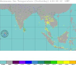
Like today, the days in Punjab, Haryana, Delhi and parts of Rajasthan and UP were around 13-15c. Almost 7-9c below normal. The image from Cologne Univ. gives a clear picture of the cold.


We here are trying to cope with the foggy conditions, as the plains of the Northern regions are "blue" with temperatures around 0-3c.


But whats happening elsewhere. Is it Global Warming all around ?? With major cities facing severe freezing at -10c to -17c, like Moscow and Chicago were -18c on Sunday, New York -8c, and London touched -6c, its a harsh winter.


Read a good write about this up on Mark's blog here.

kapadias@gmail.com


Friday, January 01, 2010


                                  Happy New Year
India Weather :2009

2009 will be remembered, weather wise, for the bad Monsoon. Deficit had been assessed at 23 % for the southwest Monsoon, making it the second worst Monsoon in the last 37 years.

The deficit climbed up close to the 23.9 % recorded in recent memory (1972). The next worst is the 24.9 % recorded way back in 1918. And 1899 was -26%. Lowest ever was 1877 at -29%.
Even then, weak rains in the peninsula continued well after the official Monsoon season into October and November. So much so, that it made it the 2nd. wettest November in many cities of Maharashtra (due to Phyan).


The warming up for the Monsoon (summer), had started well in the year, with a heat wave in mid-April, gearing up the atmosphere for a "healthy and early Monsoon". But Cyclone "Bijli", and the subsequent rains in the Central Peninsula, disrupted the normal summer pattern, and the sub-continent saw no "major" heat wave in rest April and May. Resultantly, the Monsoon too arrived late.


It was a late December arrival of Winter for the Indian Sub-continent. The temperatures dropped, somewhat to below normal levels, only in the last week. End December saw the season's lows at: Leh/Kargil -19c, Srinagar -5c, Delhi's low at 5c, Amritsar -0.6c.
But, effectively, we have not seen the cold waves, with nights going more than 3c below normal. In fact, the cold conditions have not penetrated southwards below Punjab/Haryana.
For the Central/Western regions, not much, except some pockets of "good" cooling in Maharashtra,with seasonal lows of: Pune/Nasik at 8c, Ahmednagar at 6c.

South has still to get the feel of its winter.


Western Disturbances, are low presuure systems, or cold fronts, that form and originate somewhere near the Caspian Sea region, or the Mediterranean Sea. The system then moves eastwards precipitating along its route, along the central Asia- middle east route into the sub-continent.
On an average, Northern regions can get at least 1/2 really effective W.D's in November, and 2/3 in December. But this year, as yet, a real strong W.D.has remained absent, and a couple of weak and feeble W.D's have moved along the upper regions of the Northern sub-continent. They being mild, have been unable to actually bring any precipitation to the plains of the region.
Hence our regions are still to get the effects of a strong W.D. Our winter rains, for the Northern regions have been deficient, as seen in the rainfall map.


Hopefully,lets not see a dry winter, like the summer monsoon.


For the south, the North-East Monsoon has been fairly on the average level, maybe a bit excess in pockets.
But, though prolonged beyond date it has again lacked the heavy precipitation and downpours in the coastal regions. The Nilgiri Mountains did have an initial very heavy burst of torrential downpours, with 30-50 cms in a day, with a record 80 cms. Though Tamil Nadu was normal at +12%, Nilgiri district had surplus of more than 250 %.


North Interior Karnataka was surplus at +110%, while the rest of the state's above average at +50% was comforting.


Kerala was just about normal at +6%, and A.P. was along the normal lines at +15%.
kapadias@gmail.com


Forecasted East rough  Let's look into the 3rd week of March ( 17th - 21st). Mumbai : Hot weather likely for Mumbai region this week, ty...